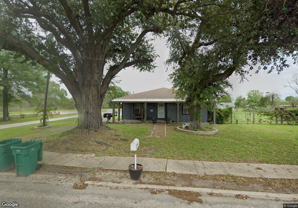
1219 Dupont Dr Orange, TX 77630
East Orange NeighborhoodEstimated Value: $121,000 - $171,852
--
Bed
--
Bath
1,960
Sq Ft
$74/Sq Ft
Est. Value
About This Home
This home is located at 1219 Dupont Dr, Orange, TX 77630 and is currently estimated at $145,963, approximately $74 per square foot. 1219 Dupont Dr is a home located in Orange County with nearby schools including West Orange-Stark Elementary School, West Orange-Stark Middle School, and West Orange-Stark High School.
Ownership History
Date
Name
Owned For
Owner Type
Purchase Details
Closed on
Apr 11, 2012
Sold by
Brown Cathy A and Estate Of Gilton L Brown
Bought by
Henderson Raymond W and Henderson April A
Current Estimated Value
Purchase Details
Closed on
Nov 17, 2005
Sold by
Davis Oscar R
Bought by
Henderson Raymond W
Purchase Details
Closed on
Oct 20, 2005
Sold by
Buzbee Bryan J
Bought by
Henderson Raymond W
Purchase Details
Closed on
Nov 21, 2003
Sold by
Lyons Donald Paul
Bought by
Brown Gil and Brown Cathy
Create a Home Valuation Report for This Property
The Home Valuation Report is an in-depth analysis detailing your home's value as well as a comparison with similar homes in the area
Home Values in the Area
Average Home Value in this Area
Purchase History
| Date | Buyer | Sale Price | Title Company |
|---|---|---|---|
| Henderson Raymond W | -- | James R Dunaway Pc | |
| Henderson Raymond W | -- | -- | |
| Henderson Raymond W | -- | -- | |
| Brown Gil | -- | None Available |
Source: Public Records
Tax History Compared to Growth
Tax History
| Year | Tax Paid | Tax Assessment Tax Assessment Total Assessment is a certain percentage of the fair market value that is determined by local assessors to be the total taxable value of land and additions on the property. | Land | Improvement |
|---|---|---|---|---|
| 2024 | $2,170 | $123,441 | $14,101 | $109,340 |
| 2023 | $1,952 | $100,715 | $14,101 | $86,614 |
| 2022 | $1,054 | $73,641 | $14,101 | $59,540 |
| 2021 | $1,824 | $65,128 | $14,101 | $52,740 |
| 2020 | $1,627 | $57,871 | $14,101 | $43,770 |
| 2019 | $1,685 | $57,891 | $14,101 | $43,790 |
| 2018 | $1,628 | $58,071 | $14,101 | $43,970 |
| 2017 | $946 | $58,071 | $14,101 | $43,970 |
| 2016 | $1,479 | $52,875 | $14,101 | $38,774 |
| 2015 | $962 | $53,730 | $14,101 | $39,629 |
| 2014 | $962 | $53,116 | $14,101 | $39,015 |
Source: Public Records
Map
Nearby Homes
- 1008 Dupont Dr
- 1601 Georgia Ave
- 607 Dupont Dr
- 710 Levingston St
- 802 Border St
- 906 W Scott St
- 602 Border St
- 412 Market St
- 1621 Western Ave
- 803 Chester St
- 1100 & 1106 Flint St
- 2308 Travis St
- 2404 Smith St
- 208 College St
- 811 Flint St
- 2112 Houston St Unit 2114
- 2112 & 2114 Houston
- 701 Sherrill St
- 2120 Houston St
- 1212 Irving St
- 1225 Dupont Dr
- 1227 Dupont Dr
- 1301 Dupont Dr
- 1207 Dupont Dr
- 1208 Dupont Dr
- 1117 Dupont Dr
- 1306 Dupont Dr
- 1115 Dupont Dr
- 1215 Texas Ave
- 104 W Bland St
- 1308 Dupont Dr
- 1201 Texas Ave
- 1311 Dupont Dr
- 1114 Dupont Dr
- 1105 Dupont Dr
- 1312 Dupont Dr
- 1103 Dupont Dr
- 1110 Dupont Dr
- 1101 Dupont Dr
- 1009 Louisiana St