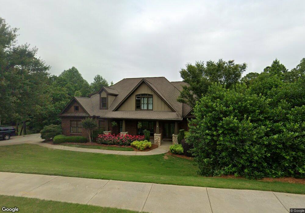
122 Grove Dr Dallas, GA 30132
Estimated Value: $746,000 - $836,000
4
Beds
5
Baths
3,682
Sq Ft
$212/Sq Ft
Est. Value
About This Home
This home is located at 122 Grove Dr, Dallas, GA 30132 and is currently estimated at $779,213, approximately $211 per square foot. 122 Grove Dr is a home located in Paulding County with nearby schools including Burnt Hickory Elementary School, Sammy Mcclure Sr. Middle School, and North Paulding High School.
Ownership History
Date
Name
Owned For
Owner Type
Purchase Details
Closed on
Aug 6, 2021
Sold by
Hagood Tracee
Bought by
Rotti Clifford M and Rotti Lora
Current Estimated Value
Home Financials for this Owner
Home Financials are based on the most recent Mortgage that was taken out on this home.
Original Mortgage
$548,250
Outstanding Balance
$498,529
Interest Rate
2.9%
Mortgage Type
VA
Estimated Equity
$280,684
Purchase Details
Closed on
Jan 29, 2010
Sold by
Jonah Dev Llc
Bought by
Hagood Tracee
Home Financials for this Owner
Home Financials are based on the most recent Mortgage that was taken out on this home.
Original Mortgage
$297,511
Interest Rate
5.37%
Mortgage Type
FHA
Purchase Details
Closed on
Jul 18, 2007
Sold by
Nick Fields Properties Inc
Bought by
Jonah Dev Llc
Home Financials for this Owner
Home Financials are based on the most recent Mortgage that was taken out on this home.
Original Mortgage
$419,923
Interest Rate
6.52%
Create a Home Valuation Report for This Property
The Home Valuation Report is an in-depth analysis detailing your home's value as well as a comparison with similar homes in the area
Home Values in the Area
Average Home Value in this Area
Purchase History
| Date | Buyer | Sale Price | Title Company |
|---|---|---|---|
| Rotti Clifford M | $561,000 | -- | |
| Hagood Tracee | $303,000 | -- | |
| Jonah Dev Llc | $290,000 | -- |
Source: Public Records
Mortgage History
| Date | Status | Borrower | Loan Amount |
|---|---|---|---|
| Open | Rotti Clifford M | $548,250 | |
| Previous Owner | Hagood Tracee | $297,511 | |
| Previous Owner | Jonah Dev Llc | $419,923 |
Source: Public Records
Tax History Compared to Growth
Tax History
| Year | Tax Paid | Tax Assessment Tax Assessment Total Assessment is a certain percentage of the fair market value that is determined by local assessors to be the total taxable value of land and additions on the property. | Land | Improvement |
|---|---|---|---|---|
| 2024 | $4,747 | $305,372 | $30,000 | $275,372 |
| 2023 | $4,940 | $295,376 | $30,000 | $265,376 |
| 2022 | $5,801 | $234,132 | $30,000 | $204,132 |
| 2021 | $6,669 | $231,340 | $30,000 | $201,340 |
| 2020 | $6,160 | $209,260 | $30,000 | $179,260 |
| 2019 | $6,104 | $204,460 | $30,000 | $174,460 |
| 2018 | $5,863 | $194,616 | $24,000 | $170,616 |
| 2016 | $5,076 | $169,740 | $24,000 | $145,740 |
| 2015 | $5,816 | $190,836 | $24,000 | $166,836 |
| 2014 | $5,377 | $172,196 | $24,000 | $148,196 |
| 2013 | -- | $141,640 | $24,000 | $117,640 |
Source: Public Records
Map
Nearby Homes
- 122 Grove Dr
- 142 Grove Dr
- 125 Grove Dr
- 81 Grove Dr
- 54 Grove Dr
- 0 Grove Dr Unit LOT 12 3248118
- 0 Grove Dr Unit LOT 8 3248116
- 0 Grove Dr Unit 7413526
- 0 Grove Dr Unit 12 7413252
- 0 Grove Dr Unit 15 7613675
- 0 Grove Dr Unit 12 7613674
- 0 Grove Dr Unit 8 7613670
- 0 Grove Dr Unit 6 7613668
- 0 Grove Dr Unit 4 7613667
- 0 Grove Dr Unit 1 7613662
- 0 Grove Dr Unit 11 7613673
- 0 Grove Dr Unit 9 7613672
- 0 Grove Dr Unit 7 7613669
- 0 Grove Dr Unit 3 7613664
- 15 Grove Dr