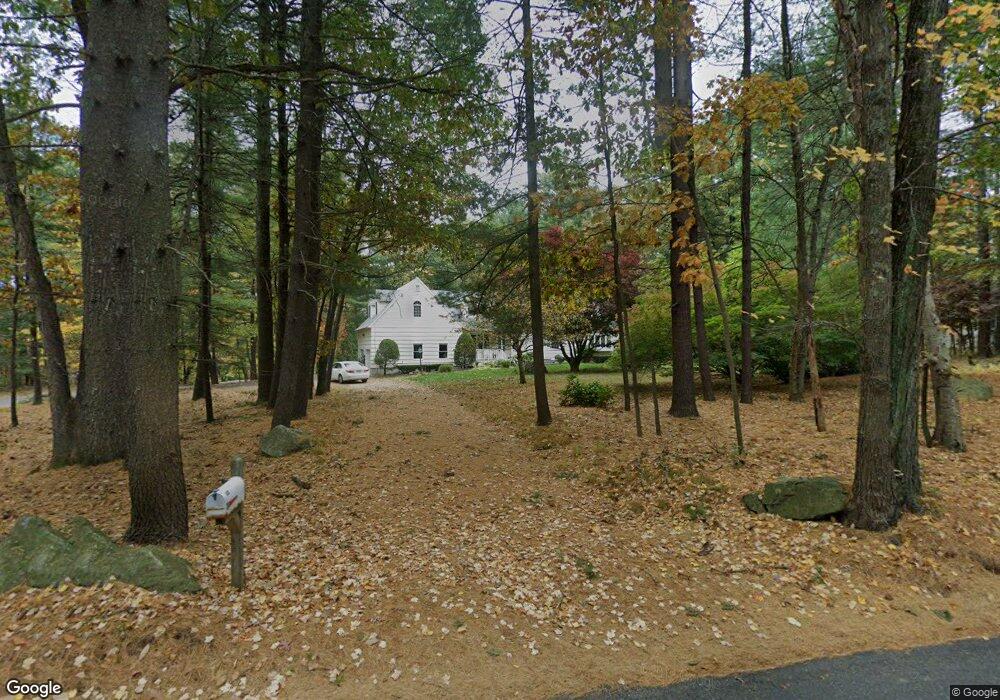
122 Morse Rd Sudbury, MA 01776
Estimated Value: $1,022,625 - $1,128,000
4
Beds
4
Baths
2,749
Sq Ft
$388/Sq Ft
Est. Value
About This Home
This home is located at 122 Morse Rd, Sudbury, MA 01776 and is currently estimated at $1,065,406, approximately $387 per square foot. 122 Morse Rd is a home located in Middlesex County with nearby schools including General John Nixon Elementary School, Ephraim Curtis Middle School, and Lincoln-Sudbury Regional High School.
Ownership History
Date
Name
Owned For
Owner Type
Purchase Details
Closed on
Jul 3, 1985
Bought by
Ravesi Alan T and Ravesi Linda M
Current Estimated Value
Create a Home Valuation Report for This Property
The Home Valuation Report is an in-depth analysis detailing your home's value as well as a comparison with similar homes in the area
Home Values in the Area
Average Home Value in this Area
Purchase History
| Date | Buyer | Sale Price | Title Company |
|---|---|---|---|
| Ravesi Alan T | $180,000 | -- |
Source: Public Records
Mortgage History
| Date | Status | Borrower | Loan Amount |
|---|---|---|---|
| Open | Ravesi Alan T | $200,000 | |
| Closed | Ravesi Alan T | $66,000 | |
| Closed | Ravesi Alan T | $224,500 |
Source: Public Records
Tax History Compared to Growth
Tax History
| Year | Tax Paid | Tax Assessment Tax Assessment Total Assessment is a certain percentage of the fair market value that is determined by local assessors to be the total taxable value of land and additions on the property. | Land | Improvement |
|---|---|---|---|---|
| 2025 | $12,820 | $875,700 | $461,300 | $414,400 |
| 2024 | $12,369 | $846,600 | $447,700 | $398,900 |
| 2023 | $12,660 | $802,800 | $414,500 | $388,300 |
| 2022 | $12,189 | $675,300 | $380,100 | $295,200 |
| 2021 | $11,752 | $624,100 | $380,100 | $244,000 |
| 2020 | $11,515 | $624,100 | $380,100 | $244,000 |
| 2019 | $11,178 | $624,100 | $380,100 | $244,000 |
| 2018 | $11,256 | $627,800 | $400,100 | $227,700 |
| 2017 | $11,160 | $629,100 | $395,300 | $233,800 |
| 2016 | $10,744 | $603,600 | $380,100 | $223,500 |
| 2015 | $10,319 | $586,300 | $365,300 | $221,000 |
| 2014 | $10,284 | $570,400 | $354,500 | $215,900 |
Source: Public Records
Map
Nearby Homes
- 63 Canterbury Dr
- 427 Concord Rd
- 24 Goodnow Rd
- 14 Frost Ln
- 55 Widow Rites Ln
- 45 Widow Rites Ln
- 36 Old Forge Ln
- 54 Phillips Rd
- 4 Elderberry Cir
- 270 Old Lancaster Rd
- 47 Fairbank Rd
- 941 Concord Rd
- 5 Taintor Dr
- Lot 5 Sailaway Ln
- 45 N Crescent Cir
- Lot 4 Sailaway Ln
- 2 Betts Way
- 8 Mina Way
- 0 Elm Unit 73282184
- Lot 9 Sailaway Ln