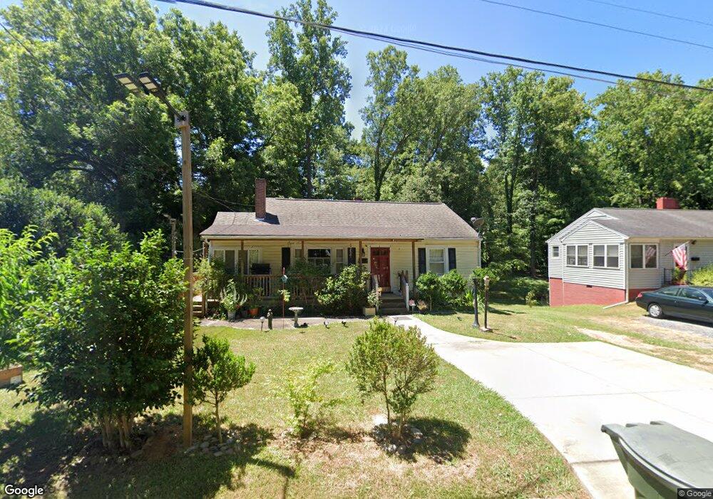
1221 Westwood Dr Asheboro, NC 27205
Estimated Value: $129,000 - $187,000
--
Bed
1
Bath
884
Sq Ft
$175/Sq Ft
Est. Value
About This Home
This home is located at 1221 Westwood Dr, Asheboro, NC 27205 and is currently estimated at $154,369, approximately $174 per square foot. 1221 Westwood Dr is a home located in Randolph County with nearby schools including Donna L. Loflin Elementary School, North Asheboro Middle School, and Asheboro High School.
Ownership History
Date
Name
Owned For
Owner Type
Purchase Details
Closed on
Nov 21, 2011
Sold by
Liles T Allen and Liles Robin G
Bought by
Mora Maria A
Current Estimated Value
Home Financials for this Owner
Home Financials are based on the most recent Mortgage that was taken out on this home.
Original Mortgage
$70,000
Outstanding Balance
$6,585
Interest Rate
4.02%
Mortgage Type
Seller Take Back
Estimated Equity
$147,784
Purchase Details
Closed on
Mar 7, 1994
Bought by
Mora Maria A
Purchase Details
Closed on
Feb 28, 1991
Bought by
Mora Maria A
Create a Home Valuation Report for This Property
The Home Valuation Report is an in-depth analysis detailing your home's value as well as a comparison with similar homes in the area
Home Values in the Area
Average Home Value in this Area
Purchase History
| Date | Buyer | Sale Price | Title Company |
|---|---|---|---|
| Mora Maria A | $80,000 | None Available | |
| Mora Maria A | $47,500 | -- | |
| Mora Maria A | $35,000 | -- |
Source: Public Records
Mortgage History
| Date | Status | Borrower | Loan Amount |
|---|---|---|---|
| Open | Mora Maria A | $70,000 |
Source: Public Records
Tax History Compared to Growth
Tax History
| Year | Tax Paid | Tax Assessment Tax Assessment Total Assessment is a certain percentage of the fair market value that is determined by local assessors to be the total taxable value of land and additions on the property. | Land | Improvement |
|---|---|---|---|---|
| 2025 | $1,521 | $114,800 | $20,920 | $93,880 |
| 2024 | $1,521 | $114,800 | $20,920 | $93,880 |
| 2023 | $1,521 | $114,800 | $20,920 | $93,880 |
| 2022 | $1,229 | $85,220 | $20,920 | $64,300 |
| 2021 | $1,229 | $85,220 | $20,920 | $64,300 |
| 2020 | $1,229 | $85,220 | $20,920 | $64,300 |
| 2019 | $1,171 | $81,230 | $20,920 | $60,310 |
| 2018 | $922 | $62,810 | $19,210 | $43,600 |
| 2016 | $922 | $62,812 | $19,210 | $43,602 |
| 2015 | $923 | $62,812 | $19,210 | $43,602 |
| 2014 | -- | $62,812 | $19,210 | $43,602 |
Source: Public Records
Map
Nearby Homes
- 1263 Winslow Ave Unit A, B & C
- 135 West St
- 923 Arnold St
- 830 Sunset Ave
- 627 Oakmont Dr
- 711 Sunset Ave Unit E
- 435 Peachtree St
- 612 Sunset Ave Unit 6
- 516 and 518 Peachtree St
- 401 Uwharrie St
- 135 Dixon St
- 866 Mountain Rd
- 1110 Park Dr
- 617 Uwharrie St Unit N
- TBD Oakland Ave
- 0000 Little Gate Dr
- 631 W Kivett St
- 0 Highwood Dr
- 1011 Westmont Dr
- 1582 Westmont Dr
- 1229 Westwood Dr
- 1215 Westwood Dr
- 1235 Westwood Dr
- 1238 Sunset Dr
- 1230 Sunset Dr
- 1248 Sunset Dr
- 227 Lexington Rd
- 1243 Westwood Dr
- 1254 Sunset Dr
- 1224 Sunset Dr
- 319 Lexington Rd
- 1303 Westwood Dr
- 1304 Sunset Dr
- 1241 Sunset Dr
- 1214 Sunset Dr
- 1247 Sunset Dr
- 1237 Sunset Dr
- 1255 Sunset Dr
- 1231 Sunset Dr
- 305 Cannon Ct