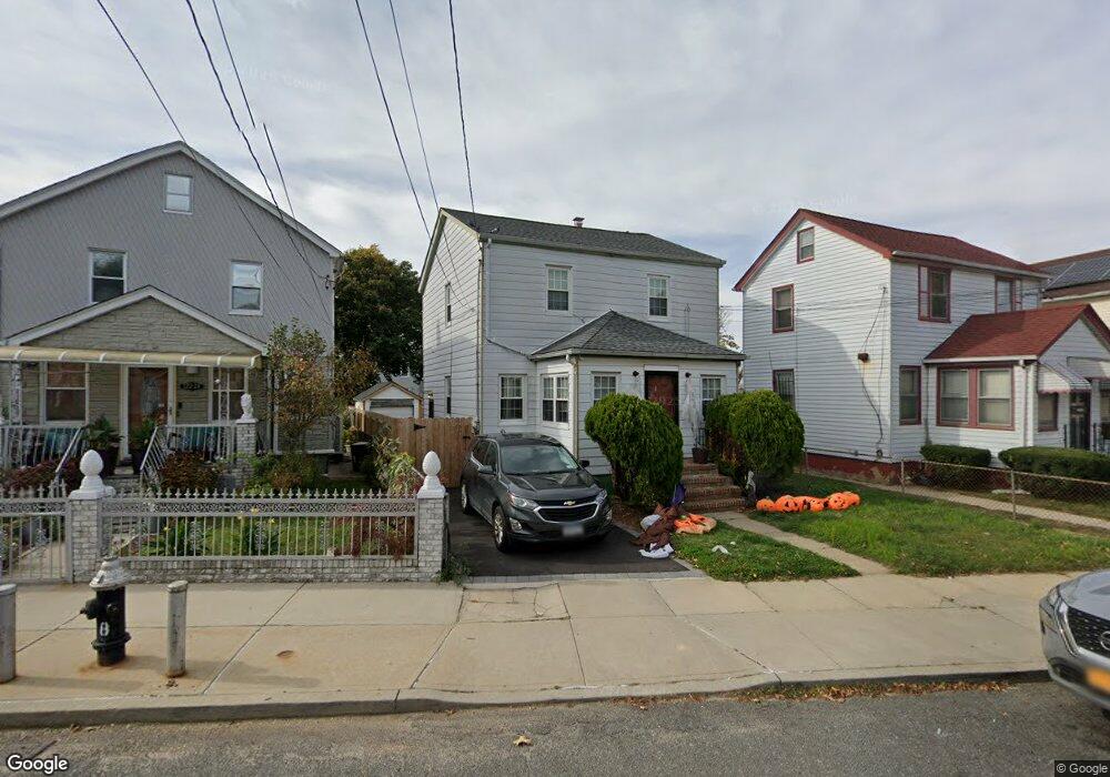
12222 Milburn St Springfield Gardens, NY 11413
Saint Albans NeighborhoodEstimated Value: $600,000 - $742,000
--
Bed
--
Bath
1,028
Sq Ft
$678/Sq Ft
Est. Value
About This Home
This home is located at 12222 Milburn St, Springfield Gardens, NY 11413 and is currently estimated at $696,870, approximately $677 per square foot. 12222 Milburn St is a home located in Queens County with nearby schools including P.S. 15 Jackie Robinson, Is 59 Springfield Gardens, and Success Academy Springfield Gardens.
Ownership History
Date
Name
Owned For
Owner Type
Purchase Details
Closed on
Jan 12, 2015
Sold by
Carroll Mary and % Leslie Nizen Esq
Bought by
Jamieson Giovanni and Ottley Andria
Current Estimated Value
Home Financials for this Owner
Home Financials are based on the most recent Mortgage that was taken out on this home.
Original Mortgage
$424,297
Interest Rate
3.97%
Mortgage Type
New Conventional
Purchase Details
Closed on
Nov 28, 2007
Sold by
Carroll Mary and Grant Julia Mae
Bought by
Carroll Mary and Grant Julia Mae
Purchase Details
Closed on
Dec 31, 1996
Sold by
Nesbitt Dorothy and Nesbitt Kevin
Bought by
Nesbitt Dorothy
Create a Home Valuation Report for This Property
The Home Valuation Report is an in-depth analysis detailing your home's value as well as a comparison with similar homes in the area
Home Values in the Area
Average Home Value in this Area
Purchase History
| Date | Buyer | Sale Price | Title Company |
|---|---|---|---|
| Jamieson Giovanni | $350,000 | -- | |
| Jamieson Giovanni | $350,000 | -- | |
| Carroll Mary | -- | -- | |
| Carroll Mary | -- | -- | |
| Nesbitt Dorothy | -- | First American Title Ins Co | |
| Nesbitt Dorothy | -- | First American Title Ins Co |
Source: Public Records
Mortgage History
| Date | Status | Borrower | Loan Amount |
|---|---|---|---|
| Previous Owner | Jamieson Giovanni | $424,297 |
Source: Public Records
Tax History Compared to Growth
Tax History
| Year | Tax Paid | Tax Assessment Tax Assessment Total Assessment is a certain percentage of the fair market value that is determined by local assessors to be the total taxable value of land and additions on the property. | Land | Improvement |
|---|---|---|---|---|
| 2025 | $6,728 | $34,579 | $10,965 | $23,614 |
| 2024 | $6,728 | $33,498 | $12,145 | $21,353 |
| 2023 | $6,347 | $31,602 | $9,748 | $21,854 |
| 2022 | $5,952 | $35,340 | $12,900 | $22,440 |
| 2021 | $6,162 | $29,280 | $12,900 | $16,380 |
| 2020 | $6,099 | $31,560 | $12,900 | $18,660 |
| 2019 | $5,889 | $34,740 | $12,900 | $21,840 |
| 2018 | $5,485 | $26,909 | $10,834 | $16,075 |
| 2017 | $4,227 | $20,736 | $9,465 | $11,271 |
| 2016 | $4,145 | $20,736 | $9,465 | $11,271 |
| 2015 | $2,359 | $19,905 | $10,690 | $9,215 |
| 2014 | $2,359 | $19,353 | $11,281 | $8,072 |
Source: Public Records
Map
Nearby Homes
- 122-22 Nellis St
- 12244 Nellis St
- 12253 Milburn St
- 122-66 Nellis St
- 12133 Grayson St
- 12251 Grayson St
- 12248 Benton St
- 179-47 Zoller Rd
- 17915 Eveleth Rd
- 17911 Eveleth Rd
- 18806 Nashville Blvd
- 179-50 Anderson Rd
- 12811 Harry Douglass Way
- 17955 Anderson Rd
- 17836 Eveleth Rd
- 19009 122nd Ave
- 191-01 122nd Ave
- 188-51 120th Rd
- 187-16 Williamson Ave
- 178-26 Zoller Rd
- 12218 Milburn St
- 12224 Milburn St
- 12222 Milburn St
- 12216 Milburn St
- 12226 Milburn St
- 12228 Milburn St
- 12228 Milburn St
- 122-12 Milburn St
- 12212 Milburn St
- 12229 Nellis St
- 12225 Nellis St
- 12229 Nellis St
- 12221 Nellis St
- 12231 Nellis St
- 122-21 Nellis St
- 12230 Milburn St
- 12219 Nellis St
- 12235 Nellis St
- 12219 Nellis St
- 12223 Milburn St