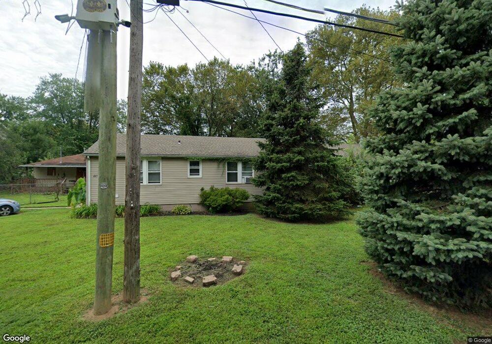
1223 Marie Lowe Dr Bristol, PA 19007
Estimated Value: $244,000 - $340,000
--
Bed
2
Baths
1,800
Sq Ft
$167/Sq Ft
Est. Value
About This Home
This home is located at 1223 Marie Lowe Dr, Bristol, PA 19007 and is currently estimated at $300,128, approximately $166 per square foot. 1223 Marie Lowe Dr is a home located in Bucks County with nearby schools including Truman Senior High School, St. Mark Elementary School, and Isabet Academy.
Ownership History
Date
Name
Owned For
Owner Type
Purchase Details
Closed on
May 31, 2007
Sold by
Nesbitt Joanne
Bought by
Walsh Matthew
Current Estimated Value
Home Financials for this Owner
Home Financials are based on the most recent Mortgage that was taken out on this home.
Original Mortgage
$159,900
Interest Rate
6.17%
Mortgage Type
Purchase Money Mortgage
Purchase Details
Closed on
Dec 7, 1987
Bought by
Nesbitt Dale and Nesbitt Joanne
Create a Home Valuation Report for This Property
The Home Valuation Report is an in-depth analysis detailing your home's value as well as a comparison with similar homes in the area
Home Values in the Area
Average Home Value in this Area
Purchase History
| Date | Buyer | Sale Price | Title Company |
|---|---|---|---|
| Walsh Matthew | $100,000 | None Available | |
| Nesbitt Dale | $15,000 | -- |
Source: Public Records
Mortgage History
| Date | Status | Borrower | Loan Amount |
|---|---|---|---|
| Closed | Walsh Matthew | $159,900 |
Source: Public Records
Tax History Compared to Growth
Tax History
| Year | Tax Paid | Tax Assessment Tax Assessment Total Assessment is a certain percentage of the fair market value that is determined by local assessors to be the total taxable value of land and additions on the property. | Land | Improvement |
|---|---|---|---|---|
| 2025 | $4,128 | $15,200 | $4,320 | $10,880 |
| 2024 | $4,128 | $15,200 | $4,320 | $10,880 |
| 2023 | $4,097 | $15,200 | $4,320 | $10,880 |
| 2022 | $4,097 | $15,200 | $4,320 | $10,880 |
| 2021 | $4,097 | $15,200 | $4,320 | $10,880 |
| 2020 | $4,097 | $15,200 | $4,320 | $10,880 |
| 2019 | $6,713 | $15,200 | $4,320 | $10,880 |
| 2018 | $4,017 | $15,200 | $4,320 | $10,880 |
| 2017 | $3,956 | $15,200 | $4,320 | $10,880 |
| 2016 | $3,956 | $15,200 | $4,320 | $10,880 |
| 2015 | $3,067 | $15,200 | $4,320 | $10,880 |
| 2014 | $3,067 | $15,200 | $4,320 | $10,880 |
Source: Public Records
Map
Nearby Homes
- 5517 Schumacher Dr
- 5605 Toga St
- 5617 Beaver Dam Rd
- 1515 Lakeland Ave
- 5 Green Ln
- 1201 Pacific Ave
- 5604 Fleetwing Dr
- 314 Railroad Ave
- 905 Garden St
- 2205 Liberator St
- 5711 Mustang St
- 221 Cleveland St
- 61 Green Ln
- 903 New Chestnut St
- 243 Monroe St
- 194 Delhaas Cir
- 192 Delhaas Cir
- 190 Delhaas Cir
- 186 Delhaas Cir
- 184 Delhaas Cir
- 1227 Marie Lowe Dr
- 1215 Marie Lowe Dr
- 1308 Ashby Ave
- 1206 Marie Lowe Dr
- 1306 Ashby Ave
- 1312 Ashby Ave
- 5509 Schumacher Dr
- 1229 Marie Lowe Dr
- 5505 Schumacher Dr
- 1324 Ashby Ave
- 5507 Schumacher Dr
- 5515 Schumacher Dr
- 5001 Beaver Dam Rd
- 1231 Marie Lowe Dr
- 1328 Ashby Ave
- 5521 Schumacher Dr
- 5519 Schumacher Dr
- 1235 Marie Lowe Dr
- 0 Ashby Ave
- 5498 Schumacher Dr