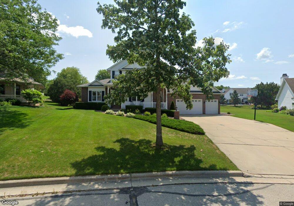
1225 Livingston St Green Bay, WI 54311
Wilder Park NeighborhoodEstimated Value: $471,106 - $522,000
3
Beds
3
Baths
2,597
Sq Ft
$190/Sq Ft
Est. Value
About This Home
This home is located at 1225 Livingston St, Green Bay, WI 54311 and is currently estimated at $493,777, approximately $190 per square foot. 1225 Livingston St is a home located in Brown County with nearby schools including Wilder Elementary School, Edison Middle School, and Preble High School.
Ownership History
Date
Name
Owned For
Owner Type
Purchase Details
Closed on
Oct 6, 2006
Sold by
Graan Jeffrey T and Graan Sandra A
Bought by
Taylor Cliff A and Taylor Lori Ann
Current Estimated Value
Home Financials for this Owner
Home Financials are based on the most recent Mortgage that was taken out on this home.
Original Mortgage
$192,800
Interest Rate
6.19%
Mortgage Type
Purchase Money Mortgage
Create a Home Valuation Report for This Property
The Home Valuation Report is an in-depth analysis detailing your home's value as well as a comparison with similar homes in the area
Home Values in the Area
Average Home Value in this Area
Purchase History
| Date | Buyer | Sale Price | Title Company |
|---|---|---|---|
| Taylor Cliff A | $245,000 | None Available |
Source: Public Records
Mortgage History
| Date | Status | Borrower | Loan Amount |
|---|---|---|---|
| Previous Owner | Taylor Cliff A | $192,800 |
Source: Public Records
Tax History Compared to Growth
Tax History
| Year | Tax Paid | Tax Assessment Tax Assessment Total Assessment is a certain percentage of the fair market value that is determined by local assessors to be the total taxable value of land and additions on the property. | Land | Improvement |
|---|---|---|---|---|
| 2024 | $6,914 | $361,800 | $47,800 | $314,000 |
| 2023 | $7,506 | $406,300 | $47,900 | $358,400 |
| 2022 | $7,299 | $406,300 | $47,900 | $358,400 |
| 2021 | $5,660 | $237,400 | $38,600 | $198,800 |
| 2020 | $5,606 | $237,400 | $38,600 | $198,800 |
| 2019 | $5,448 | $237,400 | $38,600 | $198,800 |
| 2018 | $5,311 | $237,400 | $38,600 | $198,800 |
| 2017 | $5,220 | $237,400 | $38,600 | $198,800 |
| 2016 | $5,143 | $237,400 | $38,600 | $198,800 |
| 2015 | $5,225 | $237,400 | $38,600 | $198,800 |
| 2014 | $5,430 | $237,400 | $38,600 | $198,800 |
| 2013 | $5,430 | $237,400 | $38,600 | $198,800 |
Source: Public Records
Map
Nearby Homes
- 953 Hilly Haven Ct
- 1015 Aphrodite Rd
- 856 Alpine Dr
- 2856 Sleepy Hollow Dr
- 2722 Finger Rd
- 2615 Finger Rd Unit 2617
- 2400 Ruffed Ct
- 537 Alpine Dr
- 0 Lowell Dr
- 1563 Diamond Ct
- 2756 Continental Dr
- 2570 Edgewood Ln
- 1732 Keehan Ln
- 448 Harvest Rd
- 3110 Lazy Oak Ct
- 530 Pinehurst Ave
- 3114 Lazy Oak Ct
- 1883 Mac Ln
- 2174 Nellie Ln
- 3154 Lazy Oak Ct
- 1211 Livingston St
- 2680 Pecan St
- 1244 Gail Dr
- 1234 Gail Dr
- 1248 Gail Dr
- 1228 Gail Dr
- 1205 Livingston St
- 1218 Livingston St
- 1235 Benjamin Ct
- 1216 Gail Dr
- 0 Gail Dr
- 1256 Gail Dr
- 1245 Benjamin Ct
- 1204 Livingston St
- 1210 Gail Dr
- 1163 Livingston St
- 2665 Pecan St
- 1253 Benjamin Ct
- 1160 Livingston St
- 1276 Gail Dr