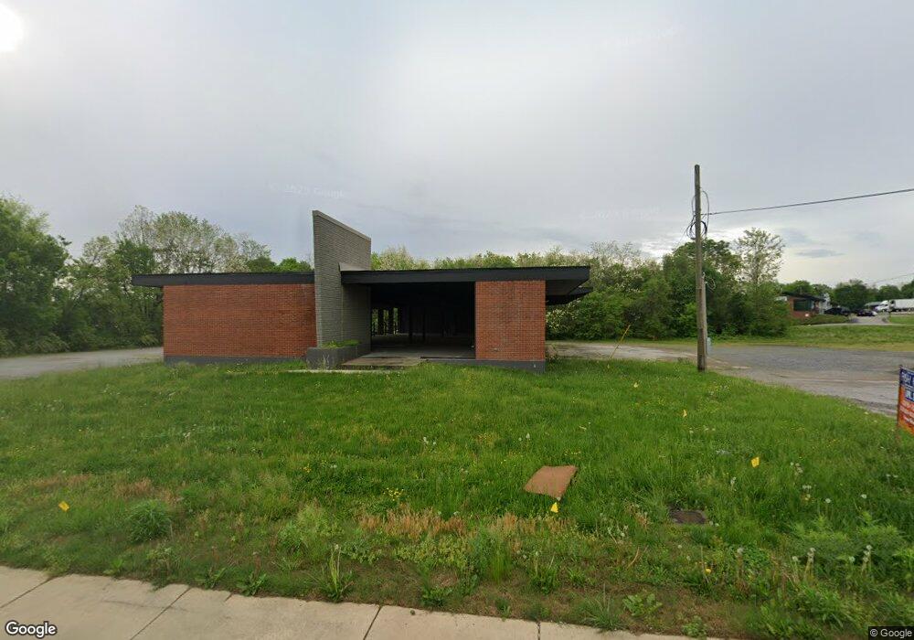
1225 W Morris Blvd Morristown, TN 37813
Estimated Value: $695,690
--
Bed
3
Baths
2,650
Sq Ft
$263/Sq Ft
Est. Value
About This Home
This home is located at 1225 W Morris Blvd, Morristown, TN 37813 and is currently estimated at $695,690, approximately $262 per square foot. 1225 W Morris Blvd is a home located in Hamblen County with nearby schools including Lincoln Heights Elementary School, Lincoln Heights Middle School, and Morristown West High School.
Ownership History
Date
Name
Owned For
Owner Type
Purchase Details
Closed on
Apr 15, 2025
Sold by
Davenport Mark
Bought by
Cgs Stores Llc
Current Estimated Value
Purchase Details
Closed on
Apr 1, 2022
Sold by
Mclemore Imelda P
Bought by
Davenport Mark
Purchase Details
Closed on
Sep 15, 2000
Sold by
Keyman Limited Partnership
Bought by
Mclemore Wayne L
Purchase Details
Closed on
Apr 24, 1998
Bought by
Keyman Limited Partnership #5
Purchase Details
Closed on
May 26, 1970
Bought by
Consolidated Freightways Corp
Create a Home Valuation Report for This Property
The Home Valuation Report is an in-depth analysis detailing your home's value as well as a comparison with similar homes in the area
Home Values in the Area
Average Home Value in this Area
Purchase History
| Date | Buyer | Sale Price | Title Company |
|---|---|---|---|
| Cgs Stores Llc | $680,000 | 7 Title | |
| Davenport Mark | $300,000 | None Listed On Document | |
| Mclemore Wayne L | $321,500 | -- | |
| Keyman Limited Partnership #5 | $325,000 | -- | |
| Consolidated Freightways Corp | -- | -- |
Source: Public Records
Tax History Compared to Growth
Tax History
| Year | Tax Paid | Tax Assessment Tax Assessment Total Assessment is a certain percentage of the fair market value that is determined by local assessors to be the total taxable value of land and additions on the property. | Land | Improvement |
|---|---|---|---|---|
| 2024 | $2,643 | $150,160 | $116,320 | $33,840 |
| 2023 | $2,643 | $150,160 | $0 | $0 |
| 2022 | $4,745 | $150,160 | $116,320 | $33,840 |
| 2021 | $4,745 | $150,160 | $116,320 | $33,840 |
| 2020 | $4,739 | $150,160 | $116,320 | $33,840 |
| 2019 | $5,508 | $162,000 | $116,320 | $45,680 |
| 2018 | $5,103 | $162,000 | $116,320 | $45,680 |
| 2017 | $5,022 | $162,000 | $116,320 | $45,680 |
| 2016 | $4,795 | $162,000 | $116,320 | $45,680 |
| 2015 | $4,461 | $162,000 | $116,320 | $45,680 |
| 2014 | -- | $162,000 | $116,320 | $45,680 |
| 2013 | -- | $236,760 | $0 | $0 |
Source: Public Records
Map
Nearby Homes
- 440 S Fairmont Ave
- 837 Pauline Ave
- 1530 Rayburn Dr
- 816 W 2nd St N
- 1211 W 6th St N
- 1002 Watercrest St
- 722 W 2nd St N
- 1476 Darbee Dr
- 731 Lennie Ave
- 900 Baird Ave
- 203 Lincoln Ave
- 529 N Jackson St
- 1442 Darbee Dr
- 0 Mcfarland St
- 323 Pauline Ave
- 2078 Edgewater Sound Rd
- 811 Crescent St
- 912 N Church St
- 707 Walters Dr
- 941 Heykoop Dr
- 1238 Urban Dr
- 1302 Urban Dr
- 1306 Urban Dr
- 1234 Urban Dr
- 1230 Urban Dr
- 231 S Fairmont Ave
- 0 Urban Dr
- 1241 Urban Dr
- 1227 Urban Dr
- 1225 Urban Dr
- 1135 W Morris Blvd
- 1215 Urban Dr
- 309 S Fairmont Ave
- 304 Valley St
- 1218 Rosedale Ave
- 310 Valley St
- 302 Valley St
- 1423 W Morris Blvd
- 1202 Rosedale Ave
- 315 S Fairmont Ave