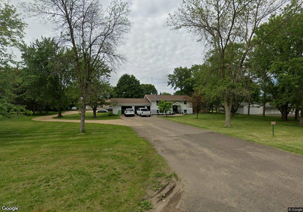
1226 172nd Ave New Richmond, WI 54017
Estimated Value: $306,000 - $419,000
3
Beds
2
Baths
2,184
Sq Ft
$169/Sq Ft
Est. Value
About This Home
This home is located at 1226 172nd Ave, New Richmond, WI 54017 and is currently estimated at $369,520, approximately $169 per square foot. 1226 172nd Ave is a home located in St. Croix County with nearby schools including New Richmond High School and St. Mary School.
Ownership History
Date
Name
Owned For
Owner Type
Purchase Details
Closed on
Jan 6, 2022
Sold by
Fern Victor and Fern Megan
Bought by
Haglund Alisha M and Slicer Michael A
Current Estimated Value
Home Financials for this Owner
Home Financials are based on the most recent Mortgage that was taken out on this home.
Original Mortgage
$230,000
Outstanding Balance
$212,001
Interest Rate
3.12%
Mortgage Type
New Conventional
Estimated Equity
$157,519
Purchase Details
Closed on
Oct 1, 2014
Sold by
Brathall Megan and Fern Megan
Bought by
Fern Victor
Purchase Details
Closed on
May 2, 2011
Sold by
Bird Shaun
Bought by
Brathall Megan
Home Financials for this Owner
Home Financials are based on the most recent Mortgage that was taken out on this home.
Original Mortgage
$118,804
Interest Rate
4.86%
Mortgage Type
New Conventional
Purchase Details
Closed on
Aug 17, 2010
Sold by
Borst Darcy R and Borst Suzette L
Bought by
Anchorbank Fsb and S&C Bank
Create a Home Valuation Report for This Property
The Home Valuation Report is an in-depth analysis detailing your home's value as well as a comparison with similar homes in the area
Home Values in the Area
Average Home Value in this Area
Purchase History
| Date | Buyer | Sale Price | Title Company |
|---|---|---|---|
| Haglund Alisha M | $350,000 | St Croix County Abstract & T | |
| Fern Victor | $130,200 | -- | |
| Brathall Megan | $115,000 | None Available | |
| Anchorbank Fsb | $120,000 | None Available |
Source: Public Records
Mortgage History
| Date | Status | Borrower | Loan Amount |
|---|---|---|---|
| Open | Haglund Alisha M | $230,000 | |
| Previous Owner | Brathall Megan | $118,804 |
Source: Public Records
Tax History Compared to Growth
Tax History
| Year | Tax Paid | Tax Assessment Tax Assessment Total Assessment is a certain percentage of the fair market value that is determined by local assessors to be the total taxable value of land and additions on the property. | Land | Improvement |
|---|---|---|---|---|
| 2024 | $26 | $218,300 | $40,100 | $178,200 |
| 2023 | $2,385 | $218,300 | $40,100 | $178,200 |
| 2022 | $2,061 | $218,300 | $40,100 | $178,200 |
| 2021 | $2,021 | $218,300 | $40,100 | $178,200 |
| 2020 | $2,209 | $135,000 | $16,600 | $118,400 |
| 2019 | $1,419 | $135,000 | $16,600 | $118,400 |
| 2018 | $2,106 | $135,000 | $16,600 | $118,400 |
| 2017 | $2,041 | $135,000 | $16,600 | $118,400 |
| 2016 | $2,041 | $135,000 | $16,600 | $118,400 |
| 2015 | $2,136 | $135,000 | $16,600 | $118,400 |
| 2014 | $2,053 | $135,000 | $16,600 | $118,400 |
| 2013 | $1,964 | $135,000 | $16,600 | $118,400 |
Source: Public Records
Map
Nearby Homes
- 1050 Pheasant Run
- 1141 Pinewood Trail
- 1016 W Ridge Ct
- 1142 W Edge Place
- 941 W Edge Place Unit 14
- 1272 Pheasant Run
- 1343 Creekwood Dr
- 1337 Eagle Ct
- 637 Maple Ct
- 619 Chestnut Dr
- 1422 Creekwood Dr
- 1430 Creekwood Dr
- 1549 Creekwood Dr
- TBD County Road A
- 1517 Creekwood Dr
- 1513 Creekwood Dr
- Kenny Plan at The Creek at Gloverdale
- Nora Plan at The Creek at Gloverdale
- Hudson Plan at The Creek at Gloverdale
- Aspen Plan at The Creek at Gloverdale
- 1230 172nd Ave
- 1222 172nd Ave
- 1133 Sharptail Run
- 1043 W Ridge Ct
- 1041 W Ridge Ct
- 1045 W Ridge Ct
- 1129 Sharptail Run
- 1225 172nd Ave
- 1037 W Ridge Ct
- 1037 W Ridge Ct Unit 22
- 1051 W Ridge Ct Unit 27
- 1125 Sharptail Run
- 1229 172nd Ave
- 1221 172nd Ave
- 1033 W Ridge Ct
- 1033 W Ridge Ct Unit 21
- Lot 123 Quail Run
- 1038 Pheasant Run
- 1053 W Ridge Ct
- 1218 172nd Ave