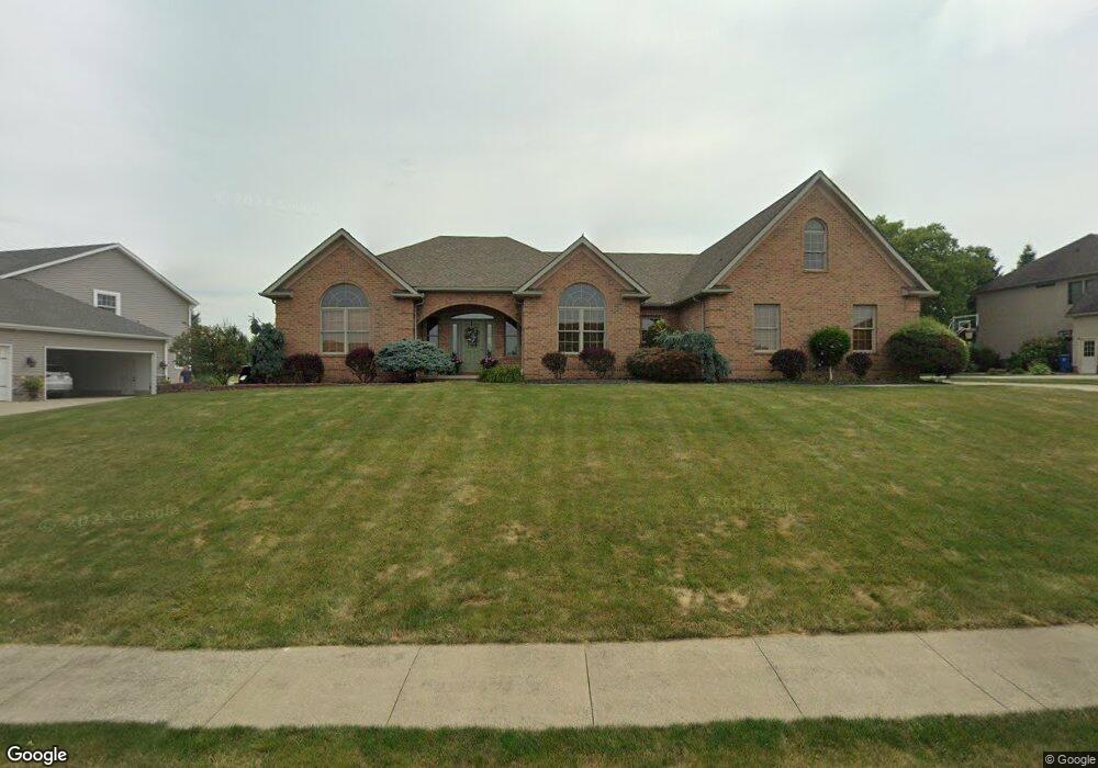
1228 S Marion Ave Louisville, OH 44641
Estimated Value: $384,000 - $511,000
3
Beds
3
Baths
3,196
Sq Ft
$146/Sq Ft
Est. Value
About This Home
This home is located at 1228 S Marion Ave, Louisville, OH 44641 and is currently estimated at $467,421, approximately $146 per square foot. 1228 S Marion Ave is a home located in Stark County with nearby schools including Louisville High School and St. Thomas Aquinas High School & Middle School.
Ownership History
Date
Name
Owned For
Owner Type
Purchase Details
Closed on
Mar 30, 2015
Sold by
Kettlewell Cynthia K
Bought by
Chiefs Irrevocable Trust
Current Estimated Value
Purchase Details
Closed on
May 26, 2006
Sold by
Wilbourne Gary V
Bought by
Kettlewell Cynthia K
Purchase Details
Closed on
Dec 2, 2002
Sold by
Miranoma Inc
Bought by
Wilbourne Gary V
Create a Home Valuation Report for This Property
The Home Valuation Report is an in-depth analysis detailing your home's value as well as a comparison with similar homes in the area
Home Values in the Area
Average Home Value in this Area
Purchase History
| Date | Buyer | Sale Price | Title Company |
|---|---|---|---|
| Chiefs Irrevocable Trust | -- | None Available | |
| Kettlewell Cynthia K | $35,000 | None Available | |
| Wilbourne Gary V | $42,000 | -- |
Source: Public Records
Tax History Compared to Growth
Tax History
| Year | Tax Paid | Tax Assessment Tax Assessment Total Assessment is a certain percentage of the fair market value that is determined by local assessors to be the total taxable value of land and additions on the property. | Land | Improvement |
|---|---|---|---|---|
| 2025 | -- | $171,790 | $20,130 | $151,660 |
| 2024 | -- | $171,790 | $20,130 | $151,660 |
| 2023 | $5,312 | $132,830 | $18,970 | $113,860 |
| 2022 | $5,338 | $132,830 | $18,970 | $113,860 |
| 2021 | $5,353 | $132,830 | $18,970 | $113,860 |
| 2020 | $4,284 | $116,630 | $17,120 | $99,510 |
| 2019 | $4,091 | $111,340 | $20,510 | $90,830 |
| 2018 | $4,076 | $111,340 | $20,510 | $90,830 |
| 2017 | $3,891 | $103,260 | $18,030 | $85,230 |
| 2016 | $3,971 | $103,260 | $18,030 | $85,230 |
| 2015 | $3,982 | $103,260 | $18,030 | $85,230 |
| 2014 | $1,649 | $89,260 | $15,580 | $73,680 |
| 2013 | $1,829 | $89,260 | $15,580 | $73,680 |
Source: Public Records
Map
Nearby Homes
- 2110 Edmar St
- 1715 High St
- 1812 E Broad St
- 3390 Meese Rd NE
- 641 S Nickelplate St
- 908 Sand Lot Cir
- 520 S Silver St
- 308 Superior St
- 728 E Broad St
- 2015 E Main St
- 0 Michigan Blvd
- 8225 Georgetown St
- 510 S Bauman Ct
- 204 E Broad St
- 107 E Broad St
- 1702 View Pointe Ave
- 325 Lincoln Ave
- 1639 Horizon Dr
- 1170 Winding Ridge Ave
- 910 Crosswyck Cir
- 1244 S Marion Ave
- 1218 S Marion Ave
- 1819 Hillocke St
- 1804 Edmar St
- 1816 Edmar St
- 1227 S Marion Ave
- 1237 S Marion Ave
- 1247 S Marion Ave
- 1217 S Marion Ave
- 1728 Edmar St
- 1301 S Marion Ave
- 1833 Hillocke St
- 1836 Edmar St
- 1718 Edmar St
- 1818 Hillocke St
- 1805 Edmar St
- 1817 Edmar St
- 1845 Hillocke St
- 1315 S Marion Ave
- 1846 Edmar St