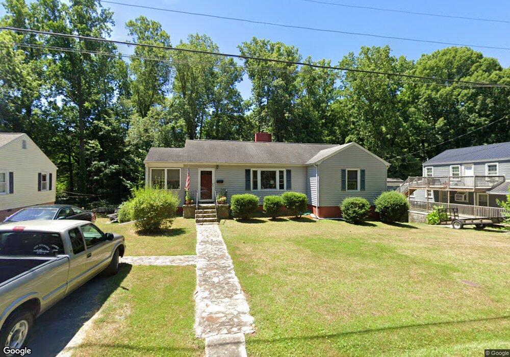
1229 Westwood Dr Asheboro, NC 27205
Estimated Value: $177,778 - $227,000
--
Bed
1
Bath
1,334
Sq Ft
$152/Sq Ft
Est. Value
About This Home
This home is located at 1229 Westwood Dr, Asheboro, NC 27205 and is currently estimated at $202,195, approximately $151 per square foot. 1229 Westwood Dr is a home located in Randolph County with nearby schools including Donna L. Loflin Elementary School, North Asheboro Middle School, and Asheboro High School.
Ownership History
Date
Name
Owned For
Owner Type
Purchase Details
Closed on
May 1, 2020
Sold by
Mcglohon Robert A
Bought by
Mcglohon John S
Current Estimated Value
Purchase Details
Closed on
Oct 4, 2010
Sold by
Mcglohon John A
Bought by
Mcglohon Robert A and Mcglohon John S
Purchase Details
Closed on
Oct 17, 2006
Sold by
Mcglohon John A and Mcglohon Jane G
Bought by
Mcglohon John A and Mcglohon Jane G
Create a Home Valuation Report for This Property
The Home Valuation Report is an in-depth analysis detailing your home's value as well as a comparison with similar homes in the area
Home Values in the Area
Average Home Value in this Area
Purchase History
| Date | Buyer | Sale Price | Title Company |
|---|---|---|---|
| Mcglohon John S | -- | None Available | |
| Mcglohon Robert A | -- | None Available | |
| Mcglohon John A | -- | None Available |
Source: Public Records
Tax History Compared to Growth
Tax History
| Year | Tax Paid | Tax Assessment Tax Assessment Total Assessment is a certain percentage of the fair market value that is determined by local assessors to be the total taxable value of land and additions on the property. | Land | Improvement |
|---|---|---|---|---|
| 2025 | $1,853 | $139,840 | $22,150 | $117,690 |
| 2024 | $1,853 | $139,840 | $22,150 | $117,690 |
| 2023 | $1,853 | $139,840 | $22,150 | $117,690 |
| 2022 | $1,486 | $103,070 | $22,150 | $80,920 |
| 2021 | $1,486 | $103,070 | $22,150 | $80,920 |
| 2020 | $1,486 | $103,070 | $22,150 | $80,920 |
| 2019 | $1,486 | $103,070 | $22,150 | $80,920 |
| 2018 | $1,275 | $86,910 | $22,560 | $64,350 |
| 2016 | $1,275 | $86,909 | $22,560 | $64,349 |
| 2015 | $1,278 | $86,909 | $22,560 | $64,349 |
| 2014 | -- | $86,909 | $22,560 | $64,349 |
Source: Public Records
Map
Nearby Homes
- 1263 Winslow Ave Unit A, B & C
- 135 West St
- 923 Arnold St
- 830 Sunset Ave
- 627 Oakmont Dr
- 711 Sunset Ave Unit E
- 435 Peachtree St
- 612 Sunset Ave Unit 6
- 401 Uwharrie St
- 516 and 518 Peachtree St
- 135 Dixon St
- 866 Mountain Rd
- 617 Uwharrie St Unit N
- 1110 Park Dr
- 631 W Kivett St
- TBD Oakland Ave
- 806 Windermere Ct
- 0000 Little Gate Dr
- 1582 Westmont Dr
- 0 Highwood Dr
- 1221 Westwood Dr
- 1235 Westwood Dr
- 1243 Westwood Dr
- 1215 Westwood Dr
- 1248 Sunset Dr
- 1238 Sunset Dr
- 1254 Sunset Dr
- 1230 Sunset Dr
- 1303 Westwood Dr
- 319 Lexington Rd
- 1304 Sunset Dr
- 227 Lexington Rd
- 1224 Sunset Dr
- 1247 Sunset Dr
- 1308 Sunset Dr
- 1255 Sunset Dr
- 1241 Sunset Dr
- 1315 Westwood Dr
- 1237 Sunset Dr
- 1301 Sunset Dr