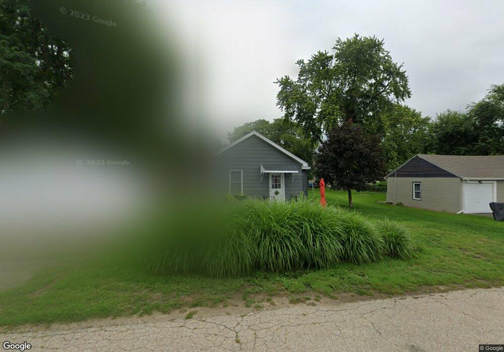
123 Catherine St East Peoria, IL 61611
Estimated Value: $71,000 - $125,000
3
Beds
1
Bath
1,026
Sq Ft
$100/Sq Ft
Est. Value
About This Home
This home is located at 123 Catherine St, East Peoria, IL 61611 and is currently estimated at $102,676, approximately $100 per square foot. 123 Catherine St is a home located in Tazewell County with nearby schools including Woodrow Wilson Elementary School, Glendale Elementary School, and Central Junior High School.
Ownership History
Date
Name
Owned For
Owner Type
Purchase Details
Closed on
Mar 25, 2020
Sold by
Peters Raymond W
Bought by
Dion Karl M and Dion Susan D
Current Estimated Value
Purchase Details
Closed on
Sep 25, 2019
Sold by
Peters Jeffrey N
Bought by
Peters Raymond
Purchase Details
Closed on
Feb 15, 2019
Sold by
Peters Raymond W and Chamberlain Kelly C
Bought by
Peters Jeffrey W
Purchase Details
Closed on
May 27, 2011
Sold by
Peters Jeffery W
Bought by
Peters Raymond W and Chamberlain Kelly C
Create a Home Valuation Report for This Property
The Home Valuation Report is an in-depth analysis detailing your home's value as well as a comparison with similar homes in the area
Home Values in the Area
Average Home Value in this Area
Purchase History
| Date | Buyer | Sale Price | Title Company |
|---|---|---|---|
| Dion Karl M | $35,000 | Attorney | |
| Peters Raymond | -- | None Available | |
| Peters Jeffrey W | -- | None Available | |
| Peters Raymond W | $46,500 | None Available |
Source: Public Records
Tax History Compared to Growth
Tax History
| Year | Tax Paid | Tax Assessment Tax Assessment Total Assessment is a certain percentage of the fair market value that is determined by local assessors to be the total taxable value of land and additions on the property. | Land | Improvement |
|---|---|---|---|---|
| 2024 | $2,300 | $25,810 | $3,380 | $22,430 |
| 2023 | $2,300 | $23,760 | $3,110 | $20,650 |
| 2022 | $2,199 | $22,080 | $2,890 | $19,190 |
| 2021 | $2,108 | $21,230 | $2,780 | $18,450 |
| 2020 | $2,002 | $20,610 | $2,700 | $17,910 |
| 2019 | $1,410 | $20,610 | $2,700 | $17,910 |
| 2018 | $1,371 | $20,610 | $2,700 | $17,910 |
| 2017 | $1,173 | $20,400 | $2,670 | $17,730 |
| 2016 | $1,139 | $20,400 | $2,670 | $17,730 |
| 2015 | $1,837 | $0 | $0 | $0 |
| 2013 | $1,849 | $20,400 | $2,670 | $17,730 |
Source: Public Records
Map
Nearby Homes
- 615 Meadow Ave
- Lot 7 Sundance Ln
- 717 Bloomington Rd
- 1513 Bloomington Rd
- 208 Montrose Ave
- 123 Terrace Ln
- 223 Kerfoot St
- 950 N Main St
- 117 Greenlawn Ct
- 700 N Main St
- 0000 Highway 24
- 322 Schulzki Ln
- 125 Canterbury Ct
- 210 Stewart St
- 1004 Springfield Rd
- 104 N Inglewood Dr
- 331 Oakwood Ave
- 508 Highview Rd
- 202 Castle Ln
- 0 High Point Ln
- 129 Catherine St
- 121 Catherine St
- 133 Catherine St
- 113 Catherine St
- 109 Catherine St
- 135 Catherine St
- 141 Catherine St
- 103 Catherine St
- 120 Catherine St
- 118 Catherine St
- 126 Catherine St
- 130 Catherine St
- 109 N East Ln
- 110 Catherine St
- 132 Catherine St
- 134 Catherine St
- 111 N East Ln
- 125 Kenwood St
- 121 Kenwood St
- 127 Kenwood St