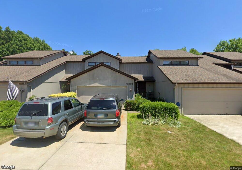
12305 Woodside Ct Unit B6 Strongsville, OH 44136
Estimated Value: $259,000 - $282,117
3
Beds
3
Baths
1,552
Sq Ft
$176/Sq Ft
Est. Value
About This Home
This home is located at 12305 Woodside Ct Unit B6, Strongsville, OH 44136 and is currently estimated at $273,029, approximately $175 per square foot. 12305 Woodside Ct Unit B6 is a home located in Cuyahoga County with nearby schools including Strongsville High School and Sts Joseph & John Interparochial School.
Ownership History
Date
Name
Owned For
Owner Type
Purchase Details
Closed on
Aug 30, 2002
Sold by
Liang Anita D
Bought by
Ragozzino Carol
Current Estimated Value
Home Financials for this Owner
Home Financials are based on the most recent Mortgage that was taken out on this home.
Original Mortgage
$128,600
Outstanding Balance
$54,387
Interest Rate
6.41%
Estimated Equity
$218,642
Purchase Details
Closed on
Jun 23, 1992
Sold by
Pratt Kathleen M
Bought by
Liang Anita D
Purchase Details
Closed on
Jan 1, 1987
Bought by
Pratt Kathleen M
Create a Home Valuation Report for This Property
The Home Valuation Report is an in-depth analysis detailing your home's value as well as a comparison with similar homes in the area
Home Values in the Area
Average Home Value in this Area
Purchase History
| Date | Buyer | Sale Price | Title Company |
|---|---|---|---|
| Ragozzino Carol | $160,800 | Lawyers Title Ins Corp | |
| Liang Anita D | $128,000 | -- | |
| Pratt Kathleen M | -- | -- |
Source: Public Records
Mortgage History
| Date | Status | Borrower | Loan Amount |
|---|---|---|---|
| Open | Ragozzino Carol | $128,600 | |
| Closed | Ragozzino Carol | $9,400 |
Source: Public Records
Tax History Compared to Growth
Tax History
| Year | Tax Paid | Tax Assessment Tax Assessment Total Assessment is a certain percentage of the fair market value that is determined by local assessors to be the total taxable value of land and additions on the property. | Land | Improvement |
|---|---|---|---|---|
| 2024 | $3,863 | $82,285 | $8,225 | $74,060 |
| 2023 | $4,298 | $68,640 | $6,900 | $61,740 |
| 2022 | $4,267 | $68,640 | $6,900 | $61,740 |
| 2021 | $4,233 | $68,640 | $6,900 | $61,740 |
| 2020 | $3,624 | $51,980 | $5,220 | $46,760 |
| 2019 | $3,517 | $148,500 | $14,900 | $133,600 |
| 2018 | $3,120 | $51,980 | $5,220 | $46,760 |
| 2017 | $3,105 | $46,800 | $4,660 | $42,140 |
| 2016 | $3,079 | $46,800 | $4,660 | $42,140 |
| 2015 | $3,359 | $46,800 | $4,660 | $42,140 |
| 2014 | $3,359 | $50,340 | $5,010 | $45,330 |
Source: Public Records
Map
Nearby Homes
- 18336 Falling Water Rd
- 18248 Meadow Ln
- 17945 Cliffside Dr
- 17809 Cliffside Dr Unit 4926
- 11499 Pearl Rd Unit A106
- 12539 Olympus Way
- 11432 Pearl Rd
- 13099 Olympus Way
- 13066 Olympus Way
- 13156 Olympus Way
- 11650 River Moss Rd
- 12385 Corinth Ct
- 19240 Briarwood Ln
- 12694 Ionia Ct
- 12101 The Bluffs
- 12647 Edgepark Cir
- 11179 Fawn Meadow Ln
- 19982 Westwood Dr
- 17289 Akita Ct Unit 4508
- 19160 Wheelers Ln
- 12293 Woodside Ct
- 12293 Woodside Ct Unit B5
- 12329 Woodside Ct Unit B8
- 12243 Woodside Ct
- 12255 Woodside Ct Unit 2A
- 12255 Woodside Ct Unit 2
- 12351 Woodside Ct
- 12279 Woodside Ct Unit A4
- 12267 Woodside Ct Unit A3
- 12317 Woodside Ct
- 12317 Woodside Ct Unit B7
- 12288 Woodside Ct Unit E17
- 12393 Woodside Ct
- 12393 Woodside Ct Unit D12
- 12300 Woodside Ct Unit 16
- 12316 Woodside Ct Unit E15
- 12363 Woodside Ct Unit C10
- 12272 Woodside Ct
- 12260 Woodside Ct Unit F19
- 12375 Woodside Ct Unit C11