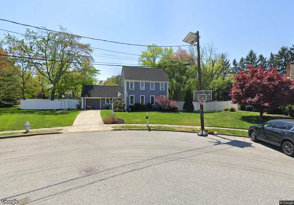
1232 Barnesdale Ct West Deptford, NJ 08096
West Deptford Township NeighborhoodEstimated Value: $448,565 - $521,000
--
Bed
--
Bath
2,209
Sq Ft
$216/Sq Ft
Est. Value
About This Home
This home is located at 1232 Barnesdale Ct, West Deptford, NJ 08096 and is currently estimated at $477,641, approximately $216 per square foot. 1232 Barnesdale Ct is a home located in Gloucester County with nearby schools including Green-Fields Elementary School, Oakview Elementary School, and Red Bank Elementary School.
Ownership History
Date
Name
Owned For
Owner Type
Purchase Details
Closed on
Sep 23, 2003
Sold by
Pollock Pollock Michael Michael and Pollock Baratta Michele
Bought by
Mcmahon Paul E and Mcmahon Cori E Mcfadden
Current Estimated Value
Home Financials for this Owner
Home Financials are based on the most recent Mortgage that was taken out on this home.
Original Mortgage
$168,000
Interest Rate
6.29%
Mortgage Type
Purchase Money Mortgage
Create a Home Valuation Report for This Property
The Home Valuation Report is an in-depth analysis detailing your home's value as well as a comparison with similar homes in the area
Home Values in the Area
Average Home Value in this Area
Purchase History
| Date | Buyer | Sale Price | Title Company |
|---|---|---|---|
| Mcmahon Paul E | $210,000 | Congress |
Source: Public Records
Mortgage History
| Date | Status | Borrower | Loan Amount |
|---|---|---|---|
| Closed | Mcmahon Paul E | $168,000 |
Source: Public Records
Tax History Compared to Growth
Tax History
| Year | Tax Paid | Tax Assessment Tax Assessment Total Assessment is a certain percentage of the fair market value that is determined by local assessors to be the total taxable value of land and additions on the property. | Land | Improvement |
|---|---|---|---|---|
| 2025 | $9,606 | $275,100 | $82,200 | $192,900 |
| 2024 | $9,483 | $275,100 | $82,200 | $192,900 |
| 2023 | $9,483 | $275,100 | $82,200 | $192,900 |
| 2022 | $9,439 | $275,100 | $82,200 | $192,900 |
| 2021 | $8,186 | $275,100 | $82,200 | $192,900 |
| 2020 | $9,384 | $275,100 | $82,200 | $192,900 |
| 2019 | $9,122 | $275,100 | $82,200 | $192,900 |
| 2018 | $8,875 | $275,100 | $82,200 | $192,900 |
| 2017 | $8,668 | $275,100 | $82,200 | $192,900 |
| 2016 | $8,426 | $275,100 | $82,200 | $192,900 |
| 2015 | $8,027 | $275,100 | $82,200 | $192,900 |
| 2014 | $7,629 | $275,100 | $82,200 | $192,900 |
Source: Public Records
Map
Nearby Homes
- 1220 Royal Ln
- 1102 Barnesdale Rd
- 87 Woodway Dr Unit 87
- 4 Saint Emilion Ct
- 1311 Barnesdale Rd
- 863 Doncaster Dr
- 1810 Fernwood Dr
- 12 Highbridge Ln Unit I2
- 125 Lionheart Ln Unit C125
- 740 Carter Hill Dr
- 640 Worcester Dr
- 1012 Moore Rd Unit 6
- 51 Holly Dr
- 1066 Buckingham Dr
- 558 Prince St
- 1091 Buckingham Dr Unit 45
- 10 Meadow Ln
- 609 Salem Ave
- 608 Salem Ave
- 438 S Columbia St
- 1224 Barnesdale Ct
- 893 Marian Rd
- 897 Marian Rd
- 889 Marian Rd
- 1216 Barnesdale Ct
- 1225 Barnesdale Ct
- 885 Marian Rd
- 1218 Parkland Commons
- 1218 Parkland Commons
- 1220 Parkland Commons
- 1220 Parkland Commons
- 1208 Barnesdale Ct
- 1217 Barnesdale Ct
- 1216 Parkland Commons
- 881 Marian Rd
- 892 Marian Rd
- 1216 Parkland Commons
- 896 Marian Rd
- 888 Marian Rd
- 1209 Barnesdale Ct