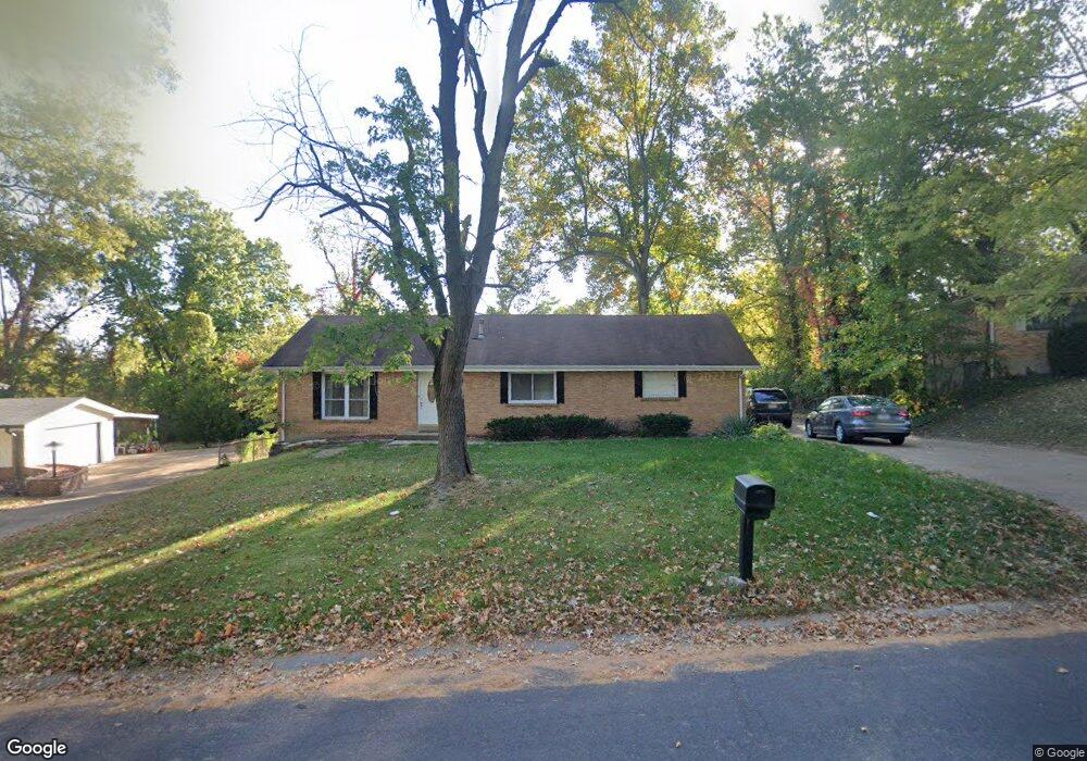
12320 Rocket Dr Florissant, MO 63033
Estimated Value: $204,000 - $254,000
4
Beds
2
Baths
1,740
Sq Ft
$136/Sq Ft
Est. Value
About This Home
This home is located at 12320 Rocket Dr, Florissant, MO 63033 and is currently estimated at $236,070, approximately $135 per square foot. 12320 Rocket Dr is a home located in St. Louis County with nearby schools including Townsend Elementary School, Central Middle School, and Hazelwood Central High School.
Ownership History
Date
Name
Owned For
Owner Type
Purchase Details
Closed on
Aug 24, 2006
Sold by
Steele Ronnie R
Bought by
Steele Ronnie R
Current Estimated Value
Home Financials for this Owner
Home Financials are based on the most recent Mortgage that was taken out on this home.
Original Mortgage
$140,600
Outstanding Balance
$94,228
Interest Rate
9.12%
Mortgage Type
Stand Alone Refi Refinance Of Original Loan
Estimated Equity
$141,842
Purchase Details
Closed on
Mar 31, 1998
Sold by
Wiesehan Frederick J and Wiesehan Joyce L
Bought by
Steele Ronnie R
Home Financials for this Owner
Home Financials are based on the most recent Mortgage that was taken out on this home.
Original Mortgage
$84,509
Interest Rate
7.04%
Mortgage Type
FHA
Create a Home Valuation Report for This Property
The Home Valuation Report is an in-depth analysis detailing your home's value as well as a comparison with similar homes in the area
Home Values in the Area
Average Home Value in this Area
Purchase History
| Date | Buyer | Sale Price | Title Company |
|---|---|---|---|
| Steele Ronnie R | -- | Integrity Land Title Co Inc | |
| Steele Ronnie R | -- | -- |
Source: Public Records
Mortgage History
| Date | Status | Borrower | Loan Amount |
|---|---|---|---|
| Open | Steele Ronnie R | $140,600 | |
| Closed | Steele Ronnie R | $84,509 |
Source: Public Records
Tax History Compared to Growth
Tax History
| Year | Tax Paid | Tax Assessment Tax Assessment Total Assessment is a certain percentage of the fair market value that is determined by local assessors to be the total taxable value of land and additions on the property. | Land | Improvement |
|---|---|---|---|---|
| 2025 | $3,008 | $40,510 | $3,950 | $36,560 |
| 2024 | $3,008 | $33,040 | $3,950 | $29,090 |
| 2023 | $3,008 | $33,040 | $3,950 | $29,090 |
| 2022 | $2,834 | $27,780 | $7,890 | $19,890 |
| 2021 | $2,682 | $27,780 | $7,890 | $19,890 |
| 2020 | $2,721 | $26,260 | $5,910 | $20,350 |
| 2019 | $2,678 | $26,260 | $5,910 | $20,350 |
| 2018 | $2,762 | $25,060 | $4,030 | $21,030 |
| 2017 | $2,759 | $25,060 | $4,030 | $21,030 |
| 2016 | $2,302 | $20,520 | $3,250 | $17,270 |
| 2015 | $2,249 | $20,520 | $3,250 | $17,270 |
| 2014 | $1,984 | $17,990 | $4,140 | $13,850 |
Source: Public Records
Map
Nearby Homes
- 12320 Missile Ln
- 6480 Hadden Bay Dr
- 6250 Pennyrich Ct
- 6320 Hadden Bay Dr
- 12136 La Padera Ln
- 6587 Dolphin Cir E Unit 110B
- 6595 Dolphin Cir E Unit 131A
- 12095 El Camara Dr
- 12065 El Camara Dr
- 12225 Tarpon Dr
- 6470 White Cap Ln Unit D
- 12292 Jerries Ln
- 12455 Jerries Ln
- 12750 Needle Point Ct
- 11760 Sheffield Dr
- 5432 Trailbend Dr
- 12705 Stubwood Dr
- 5348 Trailoaks Dr
- 12435 Sea Lane Dr Unit 5
- 12456 Sea Lane Dr Unit A
- 12340 Rocket Dr
- 12300 Rocket Dr
- 12015 Parker Estates Ct
- 12019 Parker Estates Ct
- 12011 Parker Estates Ct
- Lot 28 Hazelwood (Parent Lot 24) Dr
- 6290 Rocket Dr
- 12360 Rocket Dr
- 12305 Rocket Dr
- 12007 Parker Estates Ct
- 12345 Rocket Dr
- 12023 Parker Estates Ct
- 12025 Parker Estates Ct
- 12365 Rocket Dr
- 6270 Rocket Dr
- 12380 Rocket Dr
- 12003 Parker Estates Ct
- 6275 Rocket Dr
- 6325 Parker Rd
- 12027 Parker Estates Ct