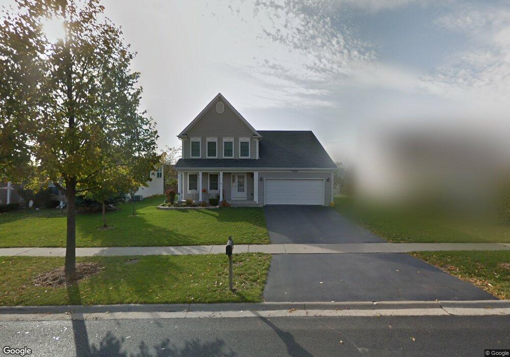
12340 Bob White Ln Plainfield, IL 60585
Estimated Value: $438,637 - $504,000
--
Bed
1
Bath
2,240
Sq Ft
$210/Sq Ft
Est. Value
About This Home
This home is located at 12340 Bob White Ln, Plainfield, IL 60585 and is currently estimated at $469,409, approximately $209 per square foot. 12340 Bob White Ln is a home located in Will County with nearby schools including Eagle Pointe Elementary School, Heritage Grove Middle School, and Plainfield North High School.
Ownership History
Date
Name
Owned For
Owner Type
Purchase Details
Closed on
Apr 1, 1998
Sold by
Beverly Trust Company
Bought by
Franken Martin and Franken Julie
Current Estimated Value
Home Financials for this Owner
Home Financials are based on the most recent Mortgage that was taken out on this home.
Original Mortgage
$165,200
Outstanding Balance
$31,634
Interest Rate
7.2%
Estimated Equity
$437,775
Create a Home Valuation Report for This Property
The Home Valuation Report is an in-depth analysis detailing your home's value as well as a comparison with similar homes in the area
Home Values in the Area
Average Home Value in this Area
Purchase History
| Date | Buyer | Sale Price | Title Company |
|---|---|---|---|
| Franken Martin | $174,000 | Chicago Title Insurance Co |
Source: Public Records
Mortgage History
| Date | Status | Borrower | Loan Amount |
|---|---|---|---|
| Open | Franken Martin | $165,200 |
Source: Public Records
Tax History Compared to Growth
Tax History
| Year | Tax Paid | Tax Assessment Tax Assessment Total Assessment is a certain percentage of the fair market value that is determined by local assessors to be the total taxable value of land and additions on the property. | Land | Improvement |
|---|---|---|---|---|
| 2024 | $8,807 | $129,007 | $32,376 | $96,631 |
| 2023 | $8,807 | $113,964 | $28,601 | $85,363 |
| 2022 | $7,631 | $101,222 | $27,055 | $74,167 |
| 2021 | $7,345 | $96,402 | $25,767 | $70,635 |
| 2020 | $7,337 | $94,875 | $25,359 | $69,516 |
| 2019 | $7,224 | $92,201 | $24,644 | $67,557 |
| 2018 | $6,663 | $83,913 | $22,302 | $61,611 |
| 2017 | $6,625 | $81,746 | $21,726 | $60,020 |
| 2016 | $6,637 | $79,986 | $21,258 | $58,728 |
| 2015 | $7,687 | $76,909 | $20,440 | $56,469 |
| 2014 | $7,687 | $87,331 | $20,440 | $66,891 |
| 2013 | $7,687 | $87,331 | $20,440 | $66,891 |
Source: Public Records
Map
Nearby Homes
- 24037 Pear Tree Cir Unit 170305
- 24043 Pear Tree Cir Unit 170302
- 12225 Shagbark Dr
- 12154 Pear Tree Way
- 24340 Hemlock Dr
- 24115 Pear Tree Cir Unit 170807
- 24135 Walnut Cir Unit 182504
- 12843 Bradford Ln Unit 2
- 24436 W Alexis Ln
- 24333 Leski Ln
- 24432 W Alexis Ln Unit 56401
- 24454 W Kroll Dr Unit 65397
- 24456 W Kroll Dr Unit 65396
- 24418 W Alexis Ln Unit 67416
- 24460 W Kroll Dr Unit 65394
- 24405 W Kroll Dr Unit 67416
- 24412 W Alexis Ln Unit 54429
- 24506 W Kroll Dr Unit 66391
- 24558 W Alexis Ln
- 2711 Lawlor Ln
- 12346 Bob White Ln
- 12330 Bob White Ln
- 12335 Heritage Meadow Dr
- 12335 Heritage Meadows Dr
- 12341 Heritage Meadow Dr
- 12331 Heritage Meadows Dr
- 12331 Heritage Meadow Dr
- 12351 Heritage Meadow Dr
- 12339 Bob White Ln
- 12343 Falcon Dr
- 12329 S Bobwhite Ln
- 12329 Bob White Ln
- 12360 S Bobwhite Ln
- 12360 Bob White Ln
- 12355 Heritage Meadow Dr
- 24116 Nightingale Ct
- 24112 Nightingale Ct
- 12345 Falcon Dr
- 24122 Nightingale Ct
- 12400 Bob White Ln