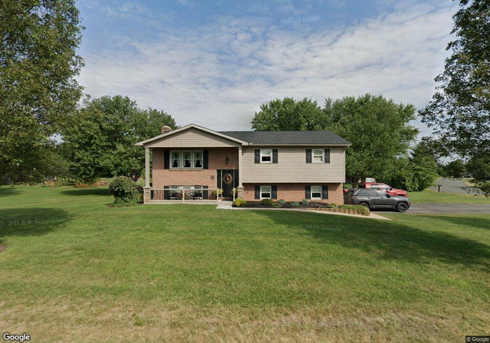
12356 Randy Dr Greencastle, PA 17225
Estimated Value: $309,000 - $415,057
--
Bed
1
Bath
1,702
Sq Ft
$204/Sq Ft
Est. Value
About This Home
This home is located at 12356 Randy Dr, Greencastle, PA 17225 and is currently estimated at $346,764, approximately $203 per square foot. 12356 Randy Dr is a home located in Franklin County with nearby schools including Greencastle-Antrim Primary School, Greencastle-Antrim Elementary School, and Greencastle-Antrim Middle School.
Ownership History
Date
Name
Owned For
Owner Type
Purchase Details
Closed on
Dec 15, 2006
Sold by
Akehurst Kevin W and Akehurst Nancy A
Bought by
Glessner Bradley J and Glessner Tara N
Current Estimated Value
Home Financials for this Owner
Home Financials are based on the most recent Mortgage that was taken out on this home.
Original Mortgage
$180,000
Outstanding Balance
$107,618
Interest Rate
6.31%
Mortgage Type
New Conventional
Estimated Equity
$239,146
Create a Home Valuation Report for This Property
The Home Valuation Report is an in-depth analysis detailing your home's value as well as a comparison with similar homes in the area
Home Values in the Area
Average Home Value in this Area
Purchase History
| Date | Buyer | Sale Price | Title Company |
|---|---|---|---|
| Glessner Bradley J | $225,000 | None Available |
Source: Public Records
Mortgage History
| Date | Status | Borrower | Loan Amount |
|---|---|---|---|
| Open | Glessner Bradley J | $180,000 |
Source: Public Records
Tax History Compared to Growth
Tax History
| Year | Tax Paid | Tax Assessment Tax Assessment Total Assessment is a certain percentage of the fair market value that is determined by local assessors to be the total taxable value of land and additions on the property. | Land | Improvement |
|---|---|---|---|---|
| 2025 | $3,831 | $22,900 | $1,930 | $20,970 |
| 2024 | $3,476 | $22,900 | $1,930 | $20,970 |
| 2023 | $3,435 | $22,900 | $1,930 | $20,970 |
| 2022 | $3,435 | $22,900 | $1,930 | $20,970 |
| 2021 | $3,368 | $22,900 | $1,930 | $20,970 |
| 2020 | $3,280 | $22,900 | $1,930 | $20,970 |
| 2019 | $3,206 | $22,900 | $1,930 | $20,970 |
| 2018 | $3,171 | $22,900 | $1,930 | $20,970 |
| 2017 | $3,091 | $22,900 | $1,930 | $20,970 |
| 2016 | $656 | $22,900 | $1,930 | $20,970 |
| 2015 | $600 | $22,480 | $1,930 | $20,550 |
| 2014 | $600 | $22,480 | $1,930 | $20,550 |
Source: Public Records
Map
Nearby Homes
- 10135 Jasper Dr
- 11765 Melrose Ave
- 12689 Williamsport Pike
- 20 Helens Dr
- 707 Shook Ct W
- 281 Toms Ln
- 10937 Grant Shook Rd
- 10925 Grant Shook Rd
- 12976 Daybreak Ln
- 763 Joy Dr
- 1223 E Pebblebrook Dr
- 11498 Nicole Dr
- 2428 Pikeside Dr
- 642 Milnor Rd
- 0 Molly Pitcher Hwy Unit PAFL178468
- 0 Molly Pitcher Hwy Unit PAFL2030380
- 270 Paradise View Dr
- 480 S Carlisle St
- 375 Carolle St
- 460 Paradise View Dr