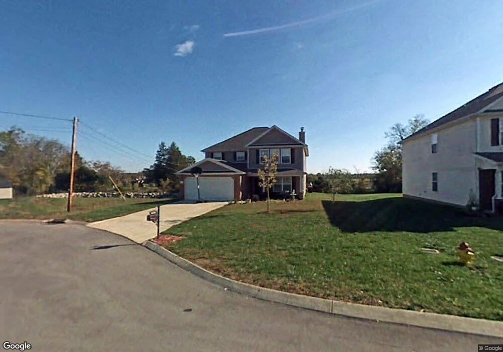
1238 Lasalle Dr Smyrna, TN 37167
Estimated Value: $418,106 - $468,000
--
Bed
3
Baths
2,740
Sq Ft
$162/Sq Ft
Est. Value
About This Home
This home is located at 1238 Lasalle Dr, Smyrna, TN 37167 and is currently estimated at $443,277, approximately $161 per square foot. 1238 Lasalle Dr is a home located in Rutherford County with nearby schools including Rocky Fork Elementary School, Stewarts Creek Middle School, and Stewarts Creek High School.
Ownership History
Date
Name
Owned For
Owner Type
Purchase Details
Closed on
Oct 13, 2009
Sold by
Adams Elizabeth
Bought by
Adams Randall
Current Estimated Value
Home Financials for this Owner
Home Financials are based on the most recent Mortgage that was taken out on this home.
Original Mortgage
$115,618
Interest Rate
5.04%
Purchase Details
Closed on
Jul 14, 2004
Sold by
Centex Homes
Bought by
Adams and Elizabeth
Home Financials for this Owner
Home Financials are based on the most recent Mortgage that was taken out on this home.
Original Mortgage
$95,250
Interest Rate
6.24%
Purchase Details
Closed on
Jul 8, 2004
Sold by
Centex Homes
Bought by
Adams and Elizabeth
Home Financials for this Owner
Home Financials are based on the most recent Mortgage that was taken out on this home.
Original Mortgage
$95,250
Interest Rate
6.24%
Create a Home Valuation Report for This Property
The Home Valuation Report is an in-depth analysis detailing your home's value as well as a comparison with similar homes in the area
Home Values in the Area
Average Home Value in this Area
Purchase History
| Date | Buyer | Sale Price | Title Company |
|---|---|---|---|
| Adams Randall | -- | -- | |
| Adams | $170,089 | -- | |
| Adams | $170,089 | -- |
Source: Public Records
Mortgage History
| Date | Status | Borrower | Loan Amount |
|---|---|---|---|
| Closed | Adams | $115,618 | |
| Previous Owner | Adams | $95,250 | |
| Previous Owner | Adams | $95,250 |
Source: Public Records
Tax History Compared to Growth
Tax History
| Year | Tax Paid | Tax Assessment Tax Assessment Total Assessment is a certain percentage of the fair market value that is determined by local assessors to be the total taxable value of land and additions on the property. | Land | Improvement |
|---|---|---|---|---|
| 2025 | $2,215 | $92,200 | $13,750 | $78,450 |
| 2024 | $2,215 | $92,200 | $13,750 | $78,450 |
| 2023 | $2,215 | $92,200 | $13,750 | $78,450 |
| 2022 | $1,975 | $92,200 | $13,750 | $78,450 |
| 2021 | $1,906 | $65,275 | $10,625 | $54,650 |
| 2020 | $1,906 | $65,275 | $10,625 | $54,650 |
| 2019 | $1,906 | $65,275 | $10,625 | $54,650 |
| 2018 | $1,827 | $65,275 | $0 | $0 |
| 2017 | $1,721 | $48,275 | $0 | $0 |
| 2016 | $1,721 | $48,275 | $0 | $0 |
| 2015 | $1,721 | $48,275 | $0 | $0 |
| 2014 | $1,200 | $48,275 | $0 | $0 |
| 2013 | -- | $48,700 | $0 | $0 |
Source: Public Records
Map
Nearby Homes
- 510 Lydia Ashley Ln
- 490 Lydia Ashley Ln
- 620 General Barksdale Dr
- 0 Gambill Ln
- 920 Sky Valley Trail
- 708 Rock Glen Trace
- 607 General Barksdale Dr
- 1011 Sky Valley Trail
- 753 Lipizanner Ln
- 165 Gallant Fox Dr
- 527 Hawk Cove
- 294 Sundale Dr
- 2028 Caladonia Way
- 4074 Utica St
- 2090 Caladonia Way
- 3057 Burnt Pine Dr
- 305 Wildwood Dr
- 838 Seven Oaks Blvd
- 3039 Burnt Pine Dr
- 1036 Harold Lee Dr
- 1236 Lasalle Dr
- 1234 Lasalle Dr
- 1242 Lasalle Dr
- 1233 Lasalle Dr
- 1232 Lasalle Dr
- 1244 Lasalle Dr
- 1331 Bundy Dr
- 1235 Lasalle Dr
- 1246 Lasalle Dr
- 1230 Lasalle Dr
- 1329 Bundy Dr
- 1237 Lasalle Dr
- 1248 Lasalle Dr
- 1228 Lasalle Dr
- 1327 Bundy Dr
- 1225 Lasalle Dr
- 1239 Lasalle Dr
- 1226 Lasalle Dr
- 1325 Bundy Dr
- 1322 Bundy Dr