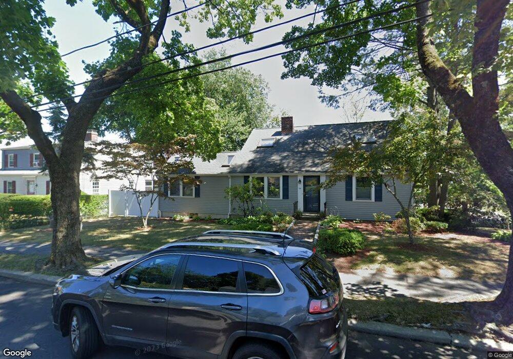
124 Fordham Rd West Newton, MA 02465
West Newton NeighborhoodEstimated Value: $1,258,000 - $1,517,361
4
Beds
2
Baths
2,259
Sq Ft
$612/Sq Ft
Est. Value
About This Home
This home is located at 124 Fordham Rd, West Newton, MA 02465 and is currently estimated at $1,383,340, approximately $612 per square foot. 124 Fordham Rd is a home located in Middlesex County with nearby schools including Franklin Elementary School, F.A. Day Middle School, and Newton North High School.
Ownership History
Date
Name
Owned For
Owner Type
Purchase Details
Closed on
Apr 15, 2025
Sold by
Labovitch Paul G and Labovitch Bela A
Bought by
124 Fordham Road Rt and Labovitch
Current Estimated Value
Purchase Details
Closed on
Jan 4, 1994
Sold by
Mayer Jerry C and Lehman-Mayer Pamela
Bought by
Labovitch Paul and Labovitch Bell A
Home Financials for this Owner
Home Financials are based on the most recent Mortgage that was taken out on this home.
Original Mortgage
$160,000
Interest Rate
7%
Mortgage Type
Purchase Money Mortgage
Purchase Details
Closed on
Jul 25, 1989
Sold by
Stuart Patricia A
Bought by
Meyer Jerry C
Create a Home Valuation Report for This Property
The Home Valuation Report is an in-depth analysis detailing your home's value as well as a comparison with similar homes in the area
Home Values in the Area
Average Home Value in this Area
Purchase History
| Date | Buyer | Sale Price | Title Company |
|---|---|---|---|
| 124 Fordham Road Rt | -- | None Available | |
| 124 Fordham Road Rt | -- | None Available | |
| Labovitch Paul | $230,000 | -- | |
| Labovitch Paul | $230,000 | -- | |
| Meyer Jerry C | $255,000 | -- | |
| Meyer Jerry C | $255,000 | -- |
Source: Public Records
Mortgage History
| Date | Status | Borrower | Loan Amount |
|---|---|---|---|
| Previous Owner | Meyer Jerry C | $160,000 | |
| Previous Owner | Meyer Jerry C | $25,000 |
Source: Public Records
Tax History Compared to Growth
Tax History
| Year | Tax Paid | Tax Assessment Tax Assessment Total Assessment is a certain percentage of the fair market value that is determined by local assessors to be the total taxable value of land and additions on the property. | Land | Improvement |
|---|---|---|---|---|
| 2025 | $11,980 | $1,222,400 | $829,800 | $392,600 |
| 2024 | $11,583 | $1,186,800 | $805,600 | $381,200 |
| 2023 | $10,900 | $1,070,700 | $615,000 | $455,700 |
| 2022 | $10,430 | $991,400 | $569,400 | $422,000 |
| 2021 | $10,064 | $935,300 | $537,200 | $398,100 |
| 2020 | $9,765 | $935,300 | $537,200 | $398,100 |
| 2019 | $9,490 | $908,100 | $521,600 | $386,500 |
| 2018 | $9,068 | $838,100 | $473,800 | $364,300 |
| 2017 | $8,793 | $790,700 | $447,000 | $343,700 |
| 2016 | $8,410 | $739,000 | $417,800 | $321,200 |
| 2015 | $8,019 | $690,700 | $390,500 | $300,200 |
Source: Public Records
Map
Nearby Homes
- 75 Cherry St
- 76 Taft Ave Unit 1
- 76 Taft Ave
- 76 Taft Ave Unit 2
- 76 Harding St
- 41 Kilburn Rd
- 287 Cherry St Unit 2
- 56 Dearborn St
- 44 Westland Ave
- 14 Cottage Place Unit 14
- 24 Tolman St Unit A
- 106 River St Unit 18
- 106 River St Unit 2
- 106 River St Unit 14
- 2 Elm St Unit 6
- 2 Elm St Unit 8
- 162 Myrtle St Unit 1
- 371 Cherry St
- 138 Myrtle St Unit 2
- 265-267 River St Unit 267
- 118 Fordham Rd
- 118 Fordham Rd Unit 1
- 118 Fordham Rd Unit 2
- 57 Pleasant St
- 66 Pleasant St
- 123 Fordham Rd
- 112 Fordham Rd
- 115 Fordham Rd
- 81 Fuller Terrace
- 56 Pleasant St
- 87 Pleasant St Unit 89
- 75 Fuller Terrace
- 85 Fuller Terrace
- 85 Fuller Terrace Unit 2
- 106 Fordham Rd
- 154 Cherry St
- 83 Pleasant St
- 45 Pleasant St
- 107 Fordham Rd
- 3 Rangeley Rd