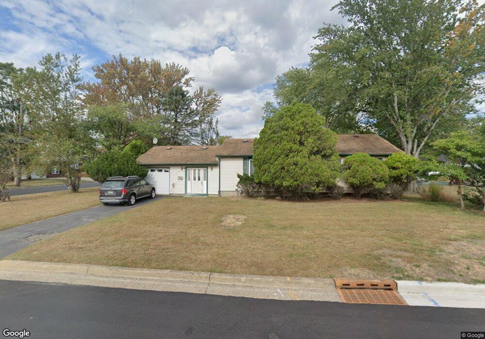
124 Norman St South Plainfield, NJ 07080
Estimated Value: $485,027 - $623,000
--
Bed
--
Bath
--
Sq Ft
10,019
Sq Ft Lot
About This Home
This home is located at 124 Norman St, South Plainfield, NJ 07080 and is currently estimated at $567,007. 124 Norman St is a home located in Middlesex County with nearby schools including South Plainfield High School, Holy Savior Academy, and The Wardlaw-Hartridge School.
Ownership History
Date
Name
Owned For
Owner Type
Purchase Details
Closed on
May 16, 2006
Current Estimated Value
Purchase Details
Closed on
Dec 9, 2000
Sold by
Molin Adolphe
Bought by
Hooks Tanya and Lashonda Pitt
Home Financials for this Owner
Home Financials are based on the most recent Mortgage that was taken out on this home.
Original Mortgage
$148,671
Interest Rate
7.69%
Mortgage Type
FHA
Create a Home Valuation Report for This Property
The Home Valuation Report is an in-depth analysis detailing your home's value as well as a comparison with similar homes in the area
Home Values in the Area
Average Home Value in this Area
Purchase History
| Date | Buyer | Sale Price | Title Company |
|---|---|---|---|
| -- | -- | -- | |
| Hooks Tanya | $149,900 | -- |
Source: Public Records
Mortgage History
| Date | Status | Borrower | Loan Amount |
|---|---|---|---|
| Previous Owner | Hooks Tanya | $148,671 |
Source: Public Records
Tax History Compared to Growth
Tax History
| Year | Tax Paid | Tax Assessment Tax Assessment Total Assessment is a certain percentage of the fair market value that is determined by local assessors to be the total taxable value of land and additions on the property. | Land | Improvement |
|---|---|---|---|---|
| 2025 | $8,427 | $120,700 | $35,500 | $85,200 |
| 2024 | $8,060 | $120,700 | $35,500 | $85,200 |
| 2023 | $8,060 | $120,700 | $35,500 | $85,200 |
| 2022 | $7,960 | $120,700 | $35,500 | $85,200 |
| 2021 | $7,773 | $120,700 | $35,500 | $85,200 |
| 2020 | $7,660 | $120,700 | $35,500 | $85,200 |
| 2019 | $7,349 | $120,700 | $35,500 | $85,200 |
| 2018 | $7,160 | $120,700 | $35,500 | $85,200 |
| 2017 | $7,068 | $120,700 | $35,500 | $85,200 |
| 2016 | $6,997 | $120,700 | $35,500 | $85,200 |
| 2015 | $6,876 | $120,700 | $35,500 | $85,200 |
| 2014 | $6,678 | $120,700 | $35,500 | $85,200 |
Source: Public Records
Map
Nearby Homes
- 533 Edgar Ave
- 102 Jerome Ave
- 6 Stacey Ct
- 1905 Park Ave
- 2415 Maple Ave
- 114 Whispering Hills Rd
- 2715 Maple Ave
- 117 Golf Ave E
- 1726 Kenyon Ave
- 1712 Kenyon Ave
- 149 Gubernat Dr
- 260 Merchants Ave
- 184 W Nassau Ave
- 127 Remington Ave Unit 31
- 117 E Elmwood Dr
- 1400 Kenyon Ave
- 106 Devon Ln
- 77 Parkside Rd Unit 89
- 1349 Park Ave Unit 53
- 1388 Belleview Ave Unit 90
- 127 Mildred St
- 120 Norman St
- 501 Carlisle St
- 123 Mildred St
- 400 Carlisle St
- 404 Carlisle St
- 123 Norman St
- 505 Carlisle St
- 118 Norman St
- 135 Mildred St
- 121 Mildred St
- 500 Carlisle St
- 119 Norman St
- 351 Carlisle St
- 128 Cedarbrook Ave
- 128 Mildred St
- 405 Walter St
- 114 Norman St
- 401 Walter St
- 202 Cedarbrook Ave