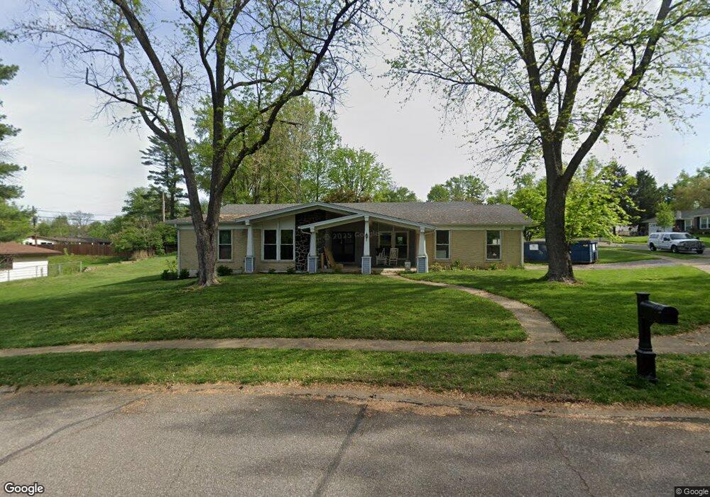
12411 Westport Dr Saint Louis, MO 63146
Estimated Value: $328,550 - $397,000
3
Beds
2
Baths
1,906
Sq Ft
$184/Sq Ft
Est. Value
About This Home
This home is located at 12411 Westport Dr, Saint Louis, MO 63146 and is currently estimated at $350,638, approximately $183 per square foot. 12411 Westport Dr is a home located in St. Louis County with nearby schools including Ross Elementary School, Parkway Northeast Middle School, and Parkway North High School.
Ownership History
Date
Name
Owned For
Owner Type
Purchase Details
Closed on
Oct 28, 2011
Sold by
The Ralph & Eleanor Ruth Koslow Living T
Bought by
Fowler Kimberly D and Fowler John C
Current Estimated Value
Home Financials for this Owner
Home Financials are based on the most recent Mortgage that was taken out on this home.
Original Mortgage
$141,075
Outstanding Balance
$96,404
Interest Rate
4.14%
Mortgage Type
New Conventional
Estimated Equity
$254,234
Purchase Details
Closed on
Sep 26, 2006
Sold by
Koslow Ralph and Koslow Eleanor Ruth
Bought by
Koslow Eleanor Ruth and Ralph & Eleanor Ruth Koslow Living Trust
Home Financials for this Owner
Home Financials are based on the most recent Mortgage that was taken out on this home.
Original Mortgage
$320,625
Interest Rate
6.47%
Mortgage Type
FHA
Create a Home Valuation Report for This Property
The Home Valuation Report is an in-depth analysis detailing your home's value as well as a comparison with similar homes in the area
Home Values in the Area
Average Home Value in this Area
Purchase History
| Date | Buyer | Sale Price | Title Company |
|---|---|---|---|
| Fowler Kimberly D | $148,500 | Integrity Land Title Co Inc | |
| Koslow Eleanor Ruth | -- | None Available |
Source: Public Records
Mortgage History
| Date | Status | Borrower | Loan Amount |
|---|---|---|---|
| Open | Fowler Kimberly D | $141,075 | |
| Previous Owner | Koslow Eleanor Ruth | $320,625 |
Source: Public Records
Tax History Compared to Growth
Tax History
| Year | Tax Paid | Tax Assessment Tax Assessment Total Assessment is a certain percentage of the fair market value that is determined by local assessors to be the total taxable value of land and additions on the property. | Land | Improvement |
|---|---|---|---|---|
| 2025 | $3,747 | $60,670 | $18,050 | $42,620 |
| 2024 | $3,747 | $57,240 | $13,030 | $44,210 |
| 2023 | $3,699 | $57,240 | $13,030 | $44,210 |
| 2022 | $3,428 | $48,340 | $16,040 | $32,300 |
| 2021 | $3,404 | $48,340 | $16,040 | $32,300 |
| 2020 | $3,361 | $45,580 | $15,540 | $30,040 |
| 2019 | $3,307 | $45,580 | $15,540 | $30,040 |
| 2018 | $2,863 | $36,380 | $12,860 | $23,520 |
| 2017 | $2,842 | $36,380 | $12,860 | $23,520 |
| 2016 | $2,861 | $34,840 | $9,800 | $25,040 |
| 2015 | $2,983 | $34,840 | $9,800 | $25,040 |
| 2014 | $2,739 | $34,160 | $9,160 | $25,000 |
Source: Public Records
Map
Nearby Homes
- 1529 Tryon Dr
- 12371 Sparrowhawk Ct
- 12167 Plainsman Dr
- 12558 Pepperwood Dr
- 12314 Rossridge Ct
- 11983 Villa Dorado Dr Unit 211
- 2021 Maryland Oaks Cir
- 2025 Maryland Oaks Cir
- 11921 Villa Dorado Dr Unit A
- 12516 Starspur Ln
- 1226 Hyannis Dr
- 12725 Westport Dr
- 12045 Bridal Shire Ct
- 11861 Spruce Orchard Dr
- 1201 Ross Ave
- 1425 Craig Rd
- 11825 Villa Dorado Dr
- 1072 King Carey Dr
- 1033 Mackinac Dr
- 12818 Willowyck Dr
- 1617 Redbluff Ct
- 12423 Westport Dr
- 1599 Westport Dr
- 1625 Redbluff Ct
- 12429 Westport Dr
- 1600 Redbluff Ct
- 1628 Red Gate Ln
- 1592 Eastham Dr
- 1622 Red Gate Ln
- 1606 Redbluff Ct
- 1632 Red Gate Ln
- 1593 Westport Dr
- 1616 Red Gate Ln
- 1612 Redbluff Ct
- 1633 Redbluff Ct
- 1590 Westport Dr
- 1600 Red Gate Ln
- 1618 Redbluff Ct
- 12389 Harundale Ct