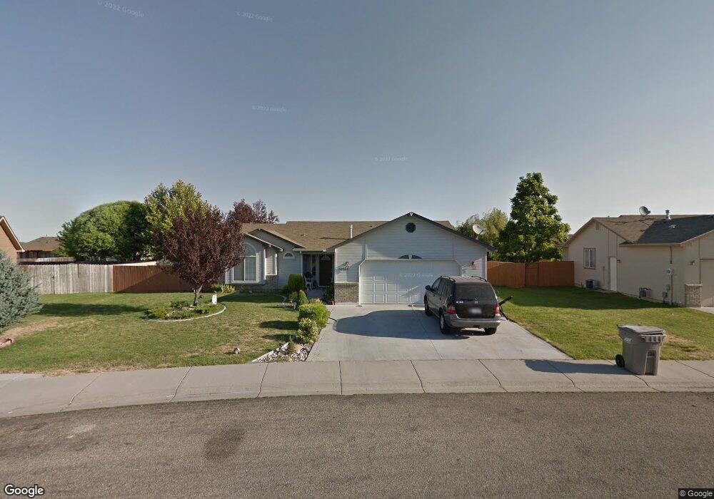
12426 W Camas Dr Boise, ID 83709
Southwest Boise NeighborhoodEstimated Value: $397,000 - $420,000
3
Beds
2
Baths
1,301
Sq Ft
$314/Sq Ft
Est. Value
About This Home
This home is located at 12426 W Camas Dr, Boise, ID 83709 and is currently estimated at $408,955, approximately $314 per square foot. 12426 W Camas Dr is a home located in Ada County with nearby schools including Pepper Ridge Elementary, Lewis & Clark Middle School, and Centennial High School.
Ownership History
Date
Name
Owned For
Owner Type
Purchase Details
Closed on
Nov 24, 1998
Sold by
Griffin David D and Griffin Diane H
Bought by
Hensley Sherrie A
Current Estimated Value
Home Financials for this Owner
Home Financials are based on the most recent Mortgage that was taken out on this home.
Original Mortgage
$108,794
Outstanding Balance
$24,270
Interest Rate
6.84%
Mortgage Type
FHA
Estimated Equity
$384,685
Purchase Details
Closed on
Aug 31, 1998
Sold by
Bilmar Inc
Bought by
Griffin David D and Griffin Diane M
Create a Home Valuation Report for This Property
The Home Valuation Report is an in-depth analysis detailing your home's value as well as a comparison with similar homes in the area
Home Values in the Area
Average Home Value in this Area
Purchase History
| Date | Buyer | Sale Price | Title Company |
|---|---|---|---|
| Hensley Sherrie A | -- | Alliance Title Company | |
| Griffin David D | -- | American Land |
Source: Public Records
Mortgage History
| Date | Status | Borrower | Loan Amount |
|---|---|---|---|
| Open | Hensley Sherrie A | $108,794 |
Source: Public Records
Tax History Compared to Growth
Tax History
| Year | Tax Paid | Tax Assessment Tax Assessment Total Assessment is a certain percentage of the fair market value that is determined by local assessors to be the total taxable value of land and additions on the property. | Land | Improvement |
|---|---|---|---|---|
| 2025 | $1,582 | $369,600 | -- | -- |
| 2024 | $1,496 | $363,200 | -- | -- |
| 2023 | $1,496 | $339,000 | $0 | $0 |
| 2022 | $1,996 | $419,700 | $0 | $0 |
| 2021 | $1,853 | $335,500 | $0 | $0 |
| 2020 | $1,403 | $238,600 | $0 | $0 |
| 2019 | $1,736 | $232,900 | $0 | $0 |
| 2018 | $1,434 | $194,500 | $0 | $0 |
| 2017 | $1,322 | $173,700 | $0 | $0 |
| 2016 | $1,287 | $164,900 | $0 | $0 |
| 2015 | $1,182 | $156,800 | $0 | $0 |
| 2012 | -- | $110,800 | $0 | $0 |
Source: Public Records
Map
Nearby Homes
- 12410 W Lewisburg Dr
- 12152 W Lewisburg Ct
- 11829 W Camas St
- 4216 Woodmurra St
- 4345 E Vacheron St
- 11683 W Aldershot St
- 4202 Woodmurra St
- 3970 E Overland Rd
- 12158 W Silverking Ct
- 330 S Winthrop Place
- 4187 E Blueberry St
- 1132 S Amaya Ave
- 1147 S Blanca St
- 3820 E Overland Rd
- 681 S Kiser Ave
- 1340 Jade Ave
- 11899 W Blueberry Ct
- 4132 E Silverking Ln
- 704 S Kiser Ave
- 1285 S Jade Ave
- 12412 W Camas Dr
- 00000 W Camas Dr
- 12450 W Camas Dr
- 12423 W Norristown St
- 12447 W Norristown St
- 12401 W Norristown St
- 12469 W Norristown St
- 12384 W Camas Dr
- 12407 W Camas Dr
- 12470 W Lewisburg Dr
- 12375 W Norristown St
- 12504 W Lewisburg Dr
- 12491 W Norristown St
- 12383 W Camas Dr
- 12532 W Lewisburg Dr
- 12424 W Norristown St
- 12556 W Lewisburg Dr
- 12369 W Camas Dr
- 975 S Pikesville Ave
- 12486 W Norristown St