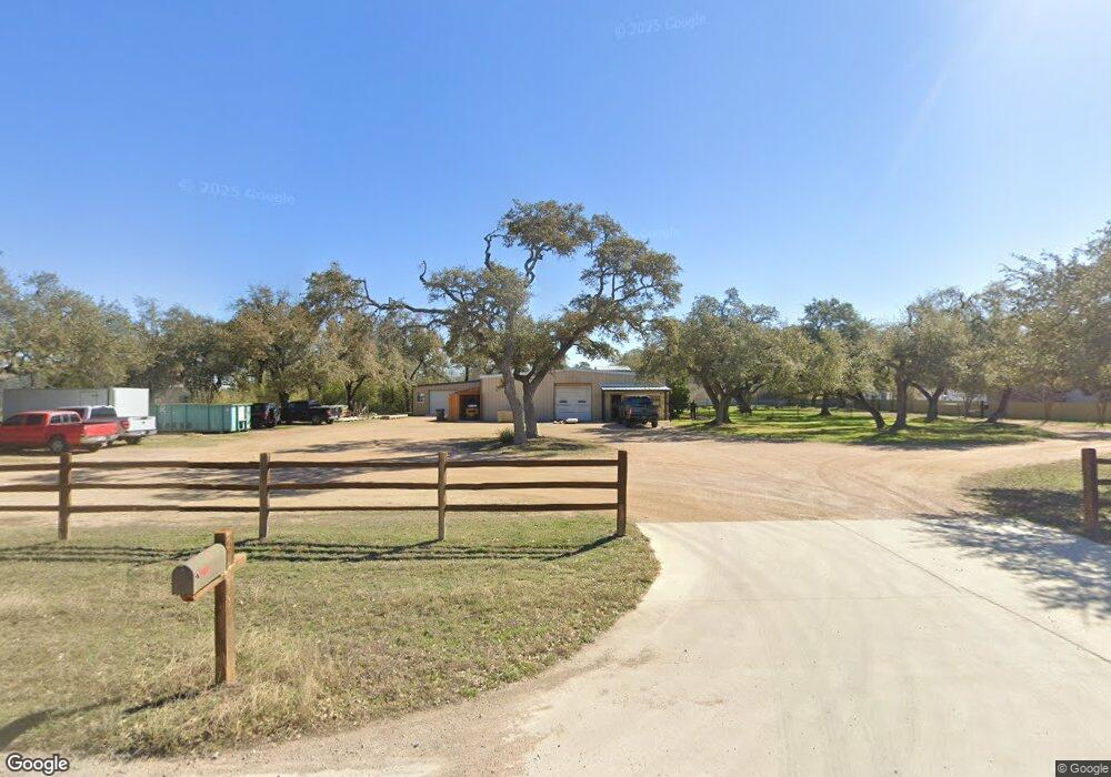
12427 Trail Driver Dripping Springs, TX 78620
Estimated Value: $830,000
--
Bed
--
Bath
6,136
Sq Ft
$135/Sq Ft
Est. Value
About This Home
This home is located at 12427 Trail Driver, Dripping Springs, TX 78620 and is currently priced at $830,000, approximately $135 per square foot. 12427 Trail Driver is a home with nearby schools including Dripping Springs Middle School and Dripping Springs High School.
Ownership History
Date
Name
Owned For
Owner Type
Purchase Details
Closed on
Oct 19, 2004
Sold by
Sloan James
Bought by
Sloan James T and Sloan Debra Kimmey
Current Estimated Value
Home Financials for this Owner
Home Financials are based on the most recent Mortgage that was taken out on this home.
Original Mortgage
$105,746
Interest Rate
5.82%
Mortgage Type
Commercial
Create a Home Valuation Report for This Property
The Home Valuation Report is an in-depth analysis detailing your home's value as well as a comparison with similar homes in the area
Home Values in the Area
Average Home Value in this Area
Purchase History
| Date | Buyer | Sale Price | Title Company |
|---|---|---|---|
| Sloan James T | -- | Gracy Title Co |
Source: Public Records
Mortgage History
| Date | Status | Borrower | Loan Amount |
|---|---|---|---|
| Closed | Sloan James T | $105,746 |
Source: Public Records
Tax History Compared to Growth
Tax History
| Year | Tax Paid | Tax Assessment Tax Assessment Total Assessment is a certain percentage of the fair market value that is determined by local assessors to be the total taxable value of land and additions on the property. | Land | Improvement |
|---|---|---|---|---|
| 2025 | $12,238 | $938,928 | -- | -- |
| 2024 | $12,238 | $782,440 | $503,850 | $278,590 |
| 2023 | $11,768 | $779,310 | $503,850 | $275,460 |
| 2022 | $10,353 | $607,010 | $341,590 | $265,420 |
| 2021 | $10,870 | $581,030 | $330,660 | $250,370 |
| 2020 | $8,874 | $474,340 | $247,040 | $227,300 |
| 2019 | $8,204 | $397,850 | $189,380 | $208,470 |
| 2018 | $7,459 | $359,690 | $164,660 | $195,030 |
| 2017 | $5,454 | $261,000 | $77,770 | $183,230 |
| 2016 | $5,338 | $255,490 | $77,770 | $177,720 |
| 2015 | $5,100 | $249,610 | $76,400 | $173,210 |
Source: Public Records
Map
Nearby Homes
- 190 Carol Ann Dr
- 12600 Trail Driver St
- 12609 Pauls Valley Rd
- 12904 Wells Fargo St
- 13005 D Fitzhugh Rd
- 14610 Fitzhugh Rd
- 12621 Fitzhugh Rd
- 13400 Paisano Trail
- TBD Fitzhugh Rd
- 5 Midnight Sky Dr
- 4 Midnight Sky Dr
- 13590 Paisano Trail
- 12605 Fitzhugh Rd
- 13601 Paisano Trail
- 10921 Long Branch Dr
- 12290 Trautwein Rd
- 13601 Paisano Cir
- 400 Sundown Ridge
- Tbd Fitzhugh Rd
- 16 Tall Oaks Trail
- 0 Trail Driver Unit 3257207
- 0 Trail Driver Unit 9785151
- 0 Trail Driver Unit 9219360
- 0 Trail Driver Unit ACT5541369
- 12475 Trail Driver Unit A
- 12475 Trail Driver Unit C200
- 12475 Trail Driver
- 13377 Fitzhugh Rd Unit C
- 13377 Fitzhugh Rd Unit A
- 13419 Trail Driver
- 13317 Fitzhugh Rd
- 13377 Fitzhugh Rd Unit C
- 12420 Trail Driver St
- 12409 Driver
- 13 Carol Ann Dr
- 12501 Trail Driver St
- 13408 Fitzhugh Rd
- 115 Carol Ann Dr
- 12505 Trail Driver St Unit A&B
- 12505 Trail Driver St