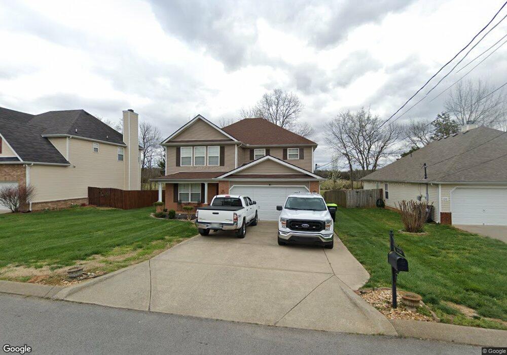
1248 Lasalle Dr Smyrna, TN 37167
Estimated Value: $416,849 - $473,000
--
Bed
3
Baths
2,740
Sq Ft
$161/Sq Ft
Est. Value
About This Home
This home is located at 1248 Lasalle Dr, Smyrna, TN 37167 and is currently estimated at $441,462, approximately $161 per square foot. 1248 Lasalle Dr is a home located in Rutherford County with nearby schools including Rocky Fork Elementary School, Stewarts Creek Middle School, and Stewarts Creek High School.
Ownership History
Date
Name
Owned For
Owner Type
Purchase Details
Closed on
May 18, 2007
Sold by
Yenney Tony C and Yenney Pamela A
Bought by
Harris Frank E and Harris Lavonda S
Current Estimated Value
Home Financials for this Owner
Home Financials are based on the most recent Mortgage that was taken out on this home.
Original Mortgage
$197,874
Outstanding Balance
$120,032
Interest Rate
6.12%
Estimated Equity
$321,430
Create a Home Valuation Report for This Property
The Home Valuation Report is an in-depth analysis detailing your home's value as well as a comparison with similar homes in the area
Home Values in the Area
Average Home Value in this Area
Purchase History
| Date | Buyer | Sale Price | Title Company |
|---|---|---|---|
| Harris Frank E | $201,000 | -- |
Source: Public Records
Mortgage History
| Date | Status | Borrower | Loan Amount |
|---|---|---|---|
| Open | Harris Frank E | $197,874 |
Source: Public Records
Tax History Compared to Growth
Tax History
| Year | Tax Paid | Tax Assessment Tax Assessment Total Assessment is a certain percentage of the fair market value that is determined by local assessors to be the total taxable value of land and additions on the property. | Land | Improvement |
|---|---|---|---|---|
| 2025 | $2,251 | $93,725 | $13,750 | $79,975 |
| 2024 | $2,251 | $93,725 | $13,750 | $79,975 |
| 2023 | $2,251 | $93,725 | $13,750 | $79,975 |
| 2022 | $2,008 | $93,725 | $13,750 | $79,975 |
| 2021 | $2,012 | $68,875 | $10,625 | $58,250 |
| 2020 | $2,012 | $68,875 | $10,625 | $58,250 |
| 2019 | $2,012 | $68,875 | $10,625 | $58,250 |
| 2018 | $1,929 | $68,875 | $0 | $0 |
| 2017 | $1,737 | $48,725 | $0 | $0 |
| 2016 | $1,737 | $48,725 | $0 | $0 |
| 2015 | $1,737 | $48,725 | $0 | $0 |
| 2014 | $1,212 | $48,725 | $0 | $0 |
| 2013 | -- | $49,125 | $0 | $0 |
Source: Public Records
Map
Nearby Homes
- 510 Lydia Ashley Ln
- 490 Lydia Ashley Ln
- 0 Gambill Ln
- 620 General Barksdale Dr
- 708 Rock Glen Trace
- 920 Sky Valley Trail
- 607 General Barksdale Dr
- 753 Lipizanner Ln
- 1011 Sky Valley Trail
- 165 Gallant Fox Dr
- 294 Sundale Dr
- 527 Hawk Cove
- 301 Greystone Lee Blvd
- 308 Gs Lee Blvd
- 305 Greystone Lee Blvd
- 309 Greystone Lee Blvd
- 313 Greystone Lee Blvd
- 317 Greystone Lee Blvd
- 109 Fletchers Way
- 321 Greystone Lee Blvd
- 1246 Lasalle Dr
- 1244 Lasalle Dr
- 1254 Lasalle Dr
- 1237 Lasalle Dr
- 1235 Lasalle Dr
- 1239 Lasalle Dr
- 1233 Lasalle Dr
- 1242 Lasalle Dr
- 1256 Lasalle Dr
- 1241 Lasalle Dr
- 1258 Lasalle Dr
- 1526 Clayton Dr
- 1327 Bundy Dr
- 1329 Bundy Dr
- 1238 Lasalle Dr
- 1325 Bundy Dr
- 1331 Bundy Dr
- 1243 Lasalle Dr
- 1236 Lasalle Dr
- 1260 Lasalle Dr