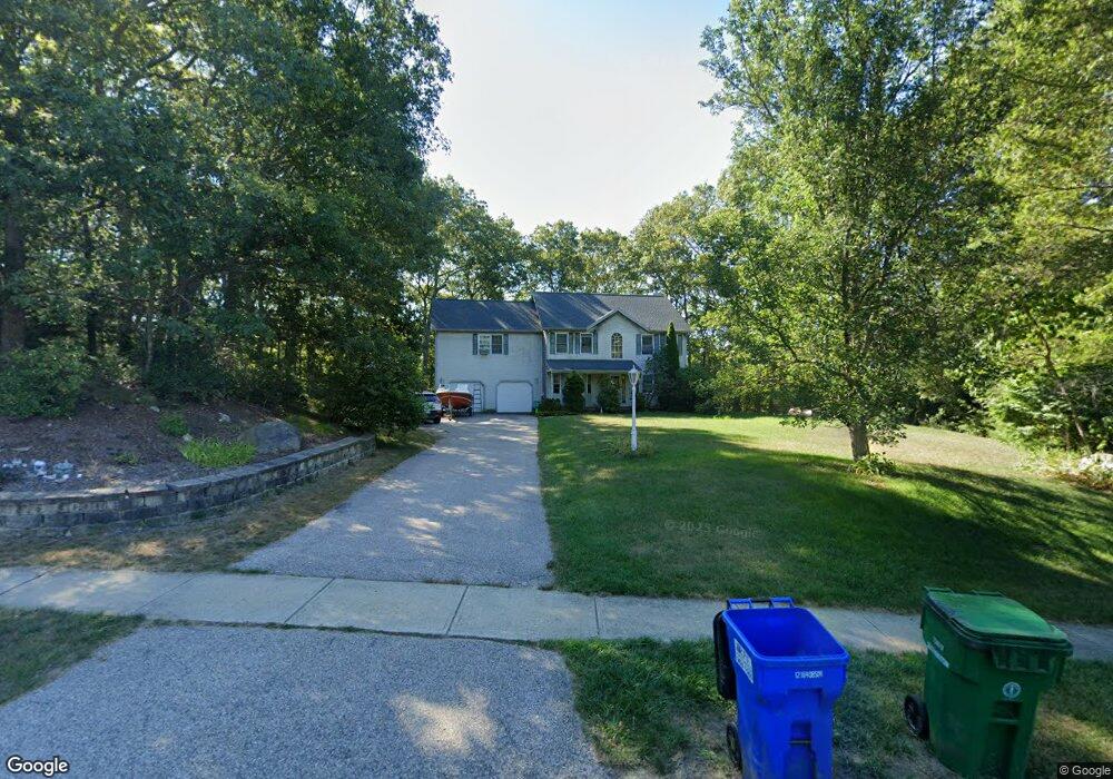
125 Sir Michael Cir West Kingston, RI 02892
Estimated Value: $748,707 - $904,000
4
Beds
3
Baths
2,542
Sq Ft
$331/Sq Ft
Est. Value
About This Home
This home is located at 125 Sir Michael Cir, West Kingston, RI 02892 and is currently estimated at $840,177, approximately $330 per square foot. 125 Sir Michael Cir is a home located in Washington County with nearby schools including South Kingstown High School and Meadowbrook Waldorf School.
Ownership History
Date
Name
Owned For
Owner Type
Purchase Details
Closed on
Feb 10, 2016
Sold by
Driggers Gregory C and Driggers Virginia M
Bought by
Driggers Gregory C and Driggers Virginia M
Current Estimated Value
Purchase Details
Closed on
Oct 8, 1998
Sold by
Odonnell Development
Bought by
Driggers Gregory C and Driggers Virginia M
Create a Home Valuation Report for This Property
The Home Valuation Report is an in-depth analysis detailing your home's value as well as a comparison with similar homes in the area
Home Values in the Area
Average Home Value in this Area
Purchase History
| Date | Buyer | Sale Price | Title Company |
|---|---|---|---|
| Driggers Gregory C | -- | -- | |
| Driggers Gregory C | $219,500 | -- |
Source: Public Records
Mortgage History
| Date | Status | Borrower | Loan Amount |
|---|---|---|---|
| Previous Owner | Driggers Gregory C | $124,800 | |
| Previous Owner | Driggers Gregory C | $175,000 | |
| Previous Owner | Driggers Gregory C | $150,000 |
Source: Public Records
Tax History Compared to Growth
Tax History
| Year | Tax Paid | Tax Assessment Tax Assessment Total Assessment is a certain percentage of the fair market value that is determined by local assessors to be the total taxable value of land and additions on the property. | Land | Improvement |
|---|---|---|---|---|
| 2025 | $5,775 | $646,000 | $209,600 | $436,400 |
| 2024 | $5,879 | $532,000 | $161,500 | $370,500 |
| 2023 | $5,879 | $532,000 | $161,500 | $370,500 |
| 2022 | $5,825 | $532,000 | $161,500 | $370,500 |
| 2021 | $6,240 | $431,800 | $140,300 | $291,500 |
| 2020 | $6,240 | $431,800 | $140,300 | $291,500 |
| 2019 | $6,240 | $431,800 | $140,300 | $291,500 |
| 2018 | $6,131 | $391,000 | $130,600 | $260,400 |
| 2017 | $5,986 | $391,000 | $130,600 | $260,400 |
| 2016 | $5,900 | $391,000 | $130,600 | $260,400 |
| 2015 | $5,867 | $378,000 | $127,400 | $250,600 |
| 2014 | $5,851 | $378,000 | $127,400 | $250,600 |
Source: Public Records
Map
Nearby Homes
- 804 Waites Corner Rd
- 58 Sand Turn Rd
- 18 Railroad Ave
- 0 Liberty Ln E Unit 1397022
- 400 Yawgoo Valley Rd
- 155 Beechwood Hill Trail
- 76 Laurel Ln
- 86 Laurel Ln
- 42 Ledgewood Rd
- 1035 Liberty Ln
- 91 Old Rd N
- 81 Old Rd N
- 7 Caitlin Ct
- 79 Linden Dr
- 470 Sylvan Ct
- 449 Sylvan Ct
- 150 Delta Dr
- 604 Stony Fort Rd
- 23 Conant Ln
- 3 Punchbowl Trail
- 134 Sir Michael Ct
- 134 Sir Michael Cir
- 135 Sir Michael Cir
- 99 Sir Michael Cir
- 143 Sir Michael Cir
- 100 Sir Michael Cir
- 188 Sir Michael Cir
- 188 Sir Michael Cir
- 31 Parsons Ln
- 157 Sir Michael Cir
- 149 Sir Michael Cir
- 15 Parsons Ln
- 80 Sir Michael Cir
- 75 Sir Michael Cir
- 210 Sir Michael Cir
- 210 Sir Michael Ct
- 0 Almarose Dr Unit 976853
- 0 Almarose Dr Unit 989190
- 16 Whisper Ln
- 175 Sir Michael Cir