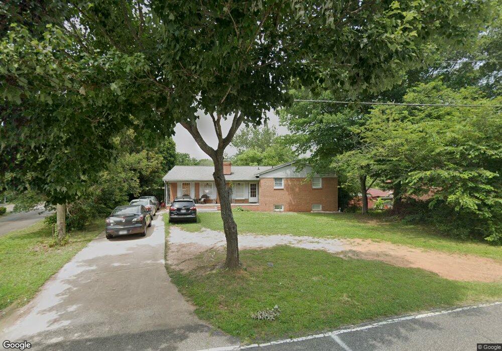
1250 Phifer Rd Kings Mountain, NC 28086
Estimated Value: $284,000 - $317,000
--
Bed
--
Bath
2,288
Sq Ft
$131/Sq Ft
Est. Value
About This Home
This home is located at 1250 Phifer Rd, Kings Mountain, NC 28086 and is currently estimated at $299,868, approximately $131 per square foot. 1250 Phifer Rd is a home located in Cleveland County with nearby schools including Bethware Elementary School, Kings Mountain Middle, and Kings Mountain Intermediate School.
Ownership History
Date
Name
Owned For
Owner Type
Purchase Details
Closed on
Mar 21, 2014
Sold by
Bank Of The Ozarks
Bought by
Ramos Marrero Jose Luis and Rodriguez Yanuaris Perez
Current Estimated Value
Home Financials for this Owner
Home Financials are based on the most recent Mortgage that was taken out on this home.
Original Mortgage
$83,460
Outstanding Balance
$63,332
Interest Rate
4.37%
Mortgage Type
FHA
Estimated Equity
$236,536
Purchase Details
Closed on
Mar 12, 2013
Sold by
Spalding Connie S and Spalding Arthur Eugene
Bought by
First National Bank
Purchase Details
Closed on
Mar 27, 2006
Sold by
Spalding Arthur E
Bought by
Spalding Connie
Create a Home Valuation Report for This Property
The Home Valuation Report is an in-depth analysis detailing your home's value as well as a comparison with similar homes in the area
Home Values in the Area
Average Home Value in this Area
Purchase History
| Date | Buyer | Sale Price | Title Company |
|---|---|---|---|
| Ramos Marrero Jose Luis | $85,000 | None Available | |
| First National Bank | $70,000 | None Available | |
| Spalding Connie | -- | None Available |
Source: Public Records
Mortgage History
| Date | Status | Borrower | Loan Amount |
|---|---|---|---|
| Open | Ramos Marrero Jose Luis | $83,460 |
Source: Public Records
Tax History Compared to Growth
Tax History
| Year | Tax Paid | Tax Assessment Tax Assessment Total Assessment is a certain percentage of the fair market value that is determined by local assessors to be the total taxable value of land and additions on the property. | Land | Improvement |
|---|---|---|---|---|
| 2025 | $1,472 | $239,353 | $17,280 | $222,073 |
| 2024 | $1,193 | $150,660 | $17,280 | $133,380 |
| 2023 | $1,187 | $150,660 | $17,280 | $133,380 |
| 2022 | $1,187 | $150,660 | $17,280 | $133,380 |
| 2021 | $1,193 | $150,660 | $17,280 | $133,380 |
| 2020 | $1,009 | $122,189 | $10,908 | $111,281 |
| 2019 | $1,009 | $122,189 | $10,908 | $111,281 |
| 2018 | $1,008 | $122,189 | $10,908 | $111,281 |
| 2017 | $1,002 | $122,189 | $10,908 | $111,281 |
| 2016 | $1,003 | $122,189 | $10,908 | $111,281 |
| 2015 | $883 | $106,625 | $8,100 | $98,525 |
| 2014 | $883 | $106,625 | $8,100 | $98,525 |
Source: Public Records
Map
Nearby Homes
- 106 Raintree Dr
- 163 Kipling Ln
- 180 Rosedale St
- 226 Caley St
- 107 Frank Burns Way
- 223 Frank Burns Way
- 262 Frank Burns Way
- 412 Brinkley Dr
- 419 Brinkley Dr
- 231 Brinkley Dr
- 143 Parker Claire Ln
- 137 Parker Claire Ln
- 157 Parker Claire Ln
- 104 Parker Claire Ln
- 207 Parker Claire Ln
- 219 Parker Claire Ln
- Belhaven Plan at Brinkley Ridge
- Freeport Plan at Brinkley Ridge
- Robie Plan at Brinkley Ridge
- Penwell Plan at Brinkley Ridge