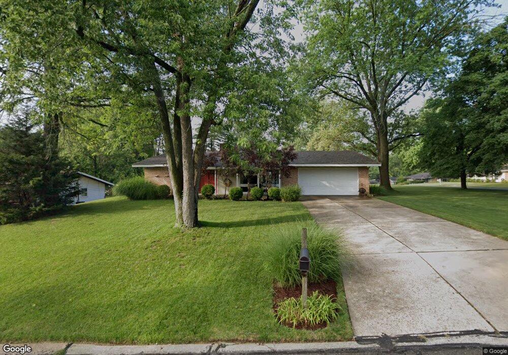
12514 Westport Dr Saint Louis, MO 63146
Estimated Value: $306,434 - $315,000
3
Beds
2
Baths
1,710
Sq Ft
$182/Sq Ft
Est. Value
About This Home
This home is located at 12514 Westport Dr, Saint Louis, MO 63146 and is currently estimated at $310,609, approximately $181 per square foot. 12514 Westport Dr is a home located in St. Louis County with nearby schools including Ross Elementary School, Parkway Northeast Middle School, and Parkway North High School.
Ownership History
Date
Name
Owned For
Owner Type
Purchase Details
Closed on
Oct 24, 1997
Sold by
Willis Robert E and Willis Mary C
Bought by
Cummins Elizabeth K
Current Estimated Value
Home Financials for this Owner
Home Financials are based on the most recent Mortgage that was taken out on this home.
Original Mortgage
$121,600
Outstanding Balance
$18,613
Interest Rate
7.33%
Estimated Equity
$291,996
Create a Home Valuation Report for This Property
The Home Valuation Report is an in-depth analysis detailing your home's value as well as a comparison with similar homes in the area
Home Values in the Area
Average Home Value in this Area
Purchase History
| Date | Buyer | Sale Price | Title Company |
|---|---|---|---|
| Cummins Elizabeth K | -- | -- |
Source: Public Records
Mortgage History
| Date | Status | Borrower | Loan Amount |
|---|---|---|---|
| Open | Cummins Elizabeth K | $121,600 |
Source: Public Records
Tax History Compared to Growth
Tax History
| Year | Tax Paid | Tax Assessment Tax Assessment Total Assessment is a certain percentage of the fair market value that is determined by local assessors to be the total taxable value of land and additions on the property. | Land | Improvement |
|---|---|---|---|---|
| 2025 | $3,471 | $52,290 | $17,120 | $35,170 |
| 2024 | $3,471 | $49,120 | $12,370 | $36,750 |
| 2023 | $3,471 | $49,120 | $12,370 | $36,750 |
| 2022 | $3,107 | $40,530 | $15,220 | $25,310 |
| 2021 | $3,087 | $40,530 | $15,220 | $25,310 |
| 2020 | $2,935 | $36,630 | $14,990 | $21,640 |
| 2019 | $2,893 | $36,630 | $14,990 | $21,640 |
| 2018 | $2,804 | $32,610 | $12,370 | $20,240 |
| 2017 | $2,786 | $32,610 | $12,370 | $20,240 |
| 2016 | $2,615 | $29,000 | $9,520 | $19,480 |
| 2015 | $2,717 | $29,000 | $9,520 | $19,480 |
| 2014 | $2,344 | $26,550 | $9,410 | $17,140 |
Source: Public Records
Map
Nearby Homes
- 12558 Pepperwood Dr
- 1529 Tryon Dr
- 12371 Sparrowhawk Ct
- 12725 Westport Dr
- 12314 Rossridge Ct
- 12516 Starspur Ln
- 12167 Plainsman Dr
- 12818 Willowyck Dr
- 1201 Ross Ave
- 2021 Maryland Oaks Cir
- 2025 Maryland Oaks Cir
- 1226 Hyannis Dr
- 1702 Pensacola Dr
- 1935 Marine Terrace Dr Unit D
- 1948 Marine Terrace Dr Unit A
- 1960 Marine Terrace Dr Unit H
- 1960 Marine Terrace Dr Unit K
- 1834 Chelmsford Ct
- 1072 King Carey Dr
- 1018 Tempo Dr
- 1564 Fontana Dr
- 12508 Westport Dr
- 1602 Fontana Dr
- 12522 Westport Dr
- 1558 Fontana Dr
- 12507 Westport Dr
- 1597 Ross Ave
- 1559 Fontana Dr
- 1591 Ross Ave
- 12523 Westport Dr
- 12501 Westport Dr
- 1552 Fontana Dr
- 12532 Westport Dr
- 1608 Fontana Dr
- 1585 Ross Ave
- 1553 Fontana Dr
- 1611 Ross Ave
- 1607 Fontana Dr
- 12529 Westport Dr
- 1546 Fontana Dr