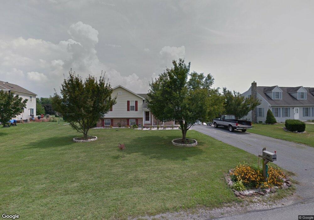
12518 Carol Ave Greencastle, PA 17225
Estimated Value: $282,000 - $408,024
3
Beds
2
Baths
--
Sq Ft
0.41
Acres
About This Home
This home is located at 12518 Carol Ave, Greencastle, PA 17225 and is currently estimated at $334,006. 12518 Carol Ave is a home located in Franklin County with nearby schools including Greencastle-Antrim Primary School, Greencastle-Antrim Elementary School, and Greencastle-Antrim Middle School.
Ownership History
Date
Name
Owned For
Owner Type
Purchase Details
Closed on
Jul 26, 2007
Sold by
Freeman Michael E and Freeman Annette K
Bought by
Deneen Ryan W and Deneen Karen M
Current Estimated Value
Home Financials for this Owner
Home Financials are based on the most recent Mortgage that was taken out on this home.
Original Mortgage
$226,800
Outstanding Balance
$144,111
Interest Rate
6.73%
Mortgage Type
New Conventional
Estimated Equity
$189,895
Create a Home Valuation Report for This Property
The Home Valuation Report is an in-depth analysis detailing your home's value as well as a comparison with similar homes in the area
Home Values in the Area
Average Home Value in this Area
Purchase History
| Date | Buyer | Sale Price | Title Company |
|---|---|---|---|
| Deneen Ryan W | $226,800 | First American Title Insuran |
Source: Public Records
Mortgage History
| Date | Status | Borrower | Loan Amount |
|---|---|---|---|
| Open | Deneen Ryan W | $226,800 |
Source: Public Records
Tax History Compared to Growth
Tax History
| Year | Tax Paid | Tax Assessment Tax Assessment Total Assessment is a certain percentage of the fair market value that is determined by local assessors to be the total taxable value of land and additions on the property. | Land | Improvement |
|---|---|---|---|---|
| 2025 | $3,299 | $19,720 | $1,250 | $18,470 |
| 2024 | $2,993 | $19,720 | $1,250 | $18,470 |
| 2023 | $2,958 | $19,720 | $1,250 | $18,470 |
| 2022 | $2,958 | $19,720 | $1,250 | $18,470 |
| 2021 | $2,900 | $19,720 | $1,250 | $18,470 |
| 2020 | $2,825 | $19,720 | $1,250 | $18,470 |
| 2019 | $2,761 | $19,720 | $1,250 | $18,470 |
| 2018 | $2,731 | $19,720 | $1,250 | $18,470 |
| 2017 | $2,662 | $19,720 | $1,250 | $18,470 |
| 2016 | $565 | $19,720 | $1,250 | $18,470 |
| 2015 | $497 | $18,600 | $1,250 | $17,350 |
| 2014 | $497 | $18,600 | $1,250 | $17,350 |
Source: Public Records
Map
Nearby Homes
- 20 Helens Dr
- 10135 Jasper Dr
- 11765 Melrose Ave
- 707 Shook Ct W
- 12689 Williamsport Pike
- 10937 Grant Shook Rd
- 10925 Grant Shook Rd
- 281 Toms Ln
- 12976 Daybreak Ln
- 763 Joy Dr
- 1223 E Pebblebrook Dr
- 11498 Nicole Dr
- 2428 Pikeside Dr
- 270 Paradise View Dr
- 642 Milnor Rd
- 0 Molly Pitcher Hwy Unit PAFL178468
- 0 Molly Pitcher Hwy Unit PAFL2030380
- 460 Paradise View Dr
- Lot # 6-36 Paradise View Dr
- 375 Carolle St
- 12540 Carol Ave
- 1378 Lisa Dr
- 12415 Randy Dr
- 12558 Carol Ave
- 12457 Carol Ave
- 1356 Lisa Dr
- 12523 Carol Ave
- 12525 Carol Ave
- 12501 Carol Ave
- 12572 Carol Ave
- 1375 Lisa Dr
- 12549 Carol Ave
- 12427 Randy Dr
- 12439 Randy Dr
- 12569 Carol Ave
- 12574 Carol Ave
- 12451 Randy Dr
- 12355 Randy Dr
- 12571 Carol Ave
- 12451 Carol Ave