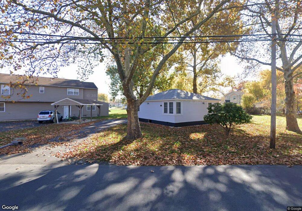
1253 Marie Lowe Dr Bristol, PA 19007
Estimated Value: $220,000 - $313,000
--
Bed
1
Bath
775
Sq Ft
$334/Sq Ft
Est. Value
About This Home
This home is located at 1253 Marie Lowe Dr, Bristol, PA 19007 and is currently estimated at $258,528, approximately $333 per square foot. 1253 Marie Lowe Dr is a home located in Bucks County with nearby schools including Truman Senior High School, St. Mark Elementary School, and Isabet Academy.
Ownership History
Date
Name
Owned For
Owner Type
Purchase Details
Closed on
Dec 29, 2022
Sold by
Natt Real Estates Llc
Bought by
Lezi Sabedin and Lezi Mervete
Current Estimated Value
Purchase Details
Closed on
Apr 26, 2019
Sold by
Redevelopment Autthority Of Cnty Of Buck
Bought by
Natt Real Estates Llc
Purchase Details
Closed on
Jul 2, 1979
Sold by
Fetzer Donald E and Fetzer Lillian M
Bought by
Williams Bernard and Williams Betty R
Create a Home Valuation Report for This Property
The Home Valuation Report is an in-depth analysis detailing your home's value as well as a comparison with similar homes in the area
Home Values in the Area
Average Home Value in this Area
Purchase History
| Date | Buyer | Sale Price | Title Company |
|---|---|---|---|
| Lezi Sabedin | $232,500 | American Legal Abstract | |
| Natt Real Estates Llc | $16,750 | None Available | |
| Williams Bernard | $13,500 | -- |
Source: Public Records
Tax History Compared to Growth
Tax History
| Year | Tax Paid | Tax Assessment Tax Assessment Total Assessment is a certain percentage of the fair market value that is determined by local assessors to be the total taxable value of land and additions on the property. | Land | Improvement |
|---|---|---|---|---|
| 2025 | $2,173 | $8,000 | $2,200 | $5,800 |
| 2024 | $2,173 | $8,000 | $2,200 | $5,800 |
| 2023 | $2,157 | $8,000 | $2,200 | $5,800 |
| 2022 | $2,157 | $8,000 | $2,200 | $5,800 |
| 2021 | $2,157 | $8,000 | $2,200 | $5,800 |
| 2020 | $2,157 | $8,000 | $2,200 | $5,800 |
| 2019 | $2,114 | $0 | $0 | $0 |
| 2018 | $2,114 | $8,000 | $2,200 | $5,800 |
| 2017 | $2,082 | $8,000 | $2,200 | $5,800 |
| 2016 | $2,082 | $8,000 | $2,200 | $5,800 |
| 2015 | $1,341 | $8,000 | $2,200 | $5,800 |
| 2014 | $1,341 | $8,000 | $2,200 | $5,800 |
Source: Public Records
Map
Nearby Homes
- 5617 Beaver Dam Rd
- 5605 Toga St
- 5517 Schumacher Dr
- 1515 Lakeland Ave
- 5 Green Ln
- 1201 Pacific Ave
- 5604 Fleetwing Dr
- 2205 Liberator St
- 5711 Mustang St
- 314 Railroad Ave
- 61 Green Ln
- 905 Garden St
- 221 Cleveland St
- 243 Monroe St
- 6419 Radcliffe St
- 903 New Chestnut St
- 194 Delhaas Cir
- 192 Delhaas Cir
- 186 Delhaas Cir
- 190 Delhaas Cir
- 5506 Beaver Dam Rd
- 1237 Schumacher Dr
- 5502 Beaver Dam Rd
- 1245 Marie Lowe Dr
- 5601 Turtle St
- 1241 Marie Lowe Dr
- 1252 Marie Lowe Dr
- 5603 Beaver Dam Rd
- 5603 Turtle St
- 1237 Marie Lowe Dr
- 5603 Turner St
- 5603 Turner St
- 1212 Schumacher Dr
- 1247 Marie Lowe Dr
- 1247 Marie Lowe Dr
- 1247 Marie Lowe Dr
- 5605 Turtle St
- 5615 Beaver Dam Rd
- 5605 Turner St
- 1210 Schumacher Dr