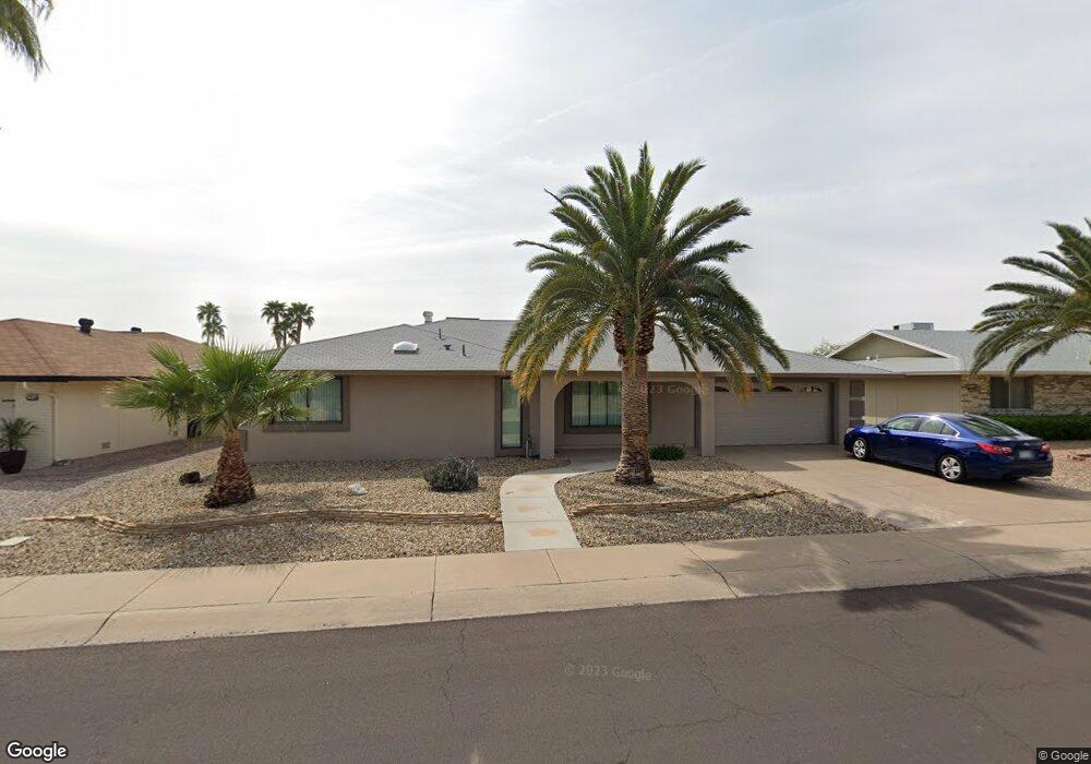
12547 W Skyview Dr Unit 10 Sun City West, AZ 85375
Estimated Value: $305,184 - $480,000
--
Bed
2
Baths
1,888
Sq Ft
$199/Sq Ft
Est. Value
About This Home
This home is located at 12547 W Skyview Dr Unit 10, Sun City West, AZ 85375 and is currently estimated at $375,046, approximately $198 per square foot. 12547 W Skyview Dr Unit 10 is a home located in Maricopa County with nearby schools including Arizona Charter Academy and FourteenSix Christian Academy.
Ownership History
Date
Name
Owned For
Owner Type
Purchase Details
Closed on
Dec 10, 2020
Sold by
Dixon Curtis R
Bought by
Dixon Family Trust and Dixon
Current Estimated Value
Purchase Details
Closed on
Nov 15, 2011
Sold by
Olson Orland C
Bought by
Dixon Curtis R and Dixon June A
Home Financials for this Owner
Home Financials are based on the most recent Mortgage that was taken out on this home.
Original Mortgage
$108,000
Interest Rate
2.87%
Mortgage Type
New Conventional
Purchase Details
Closed on
Sep 30, 2010
Sold by
Olson Phyllis J
Bought by
Olson Orland C
Purchase Details
Closed on
Feb 24, 2005
Sold by
Gurnsey Floyd L and Gurnsey Velma A
Bought by
Gurnsey Floyd L and Gurnsey Velma A
Create a Home Valuation Report for This Property
The Home Valuation Report is an in-depth analysis detailing your home's value as well as a comparison with similar homes in the area
Home Values in the Area
Average Home Value in this Area
Purchase History
| Date | Buyer | Sale Price | Title Company |
|---|---|---|---|
| Dixon Family Trust | -- | None Listed On Document | |
| Dixon Curtis R | $160,000 | First American Title Ins Co | |
| Olson Orland C | -- | First American Title Ins Co | |
| Olson Orland C | $90,000 | First American Title Ins Co | |
| Gurnsey Floyd L | -- | -- |
Source: Public Records
Mortgage History
| Date | Status | Borrower | Loan Amount |
|---|---|---|---|
| Previous Owner | Dixon Curtis R | $108,000 |
Source: Public Records
Tax History Compared to Growth
Tax History
| Year | Tax Paid | Tax Assessment Tax Assessment Total Assessment is a certain percentage of the fair market value that is determined by local assessors to be the total taxable value of land and additions on the property. | Land | Improvement |
|---|---|---|---|---|
| 2025 | $1,252 | $15,564 | -- | -- |
| 2024 | $1,138 | $14,823 | -- | -- |
| 2023 | $1,138 | $26,310 | $5,260 | $21,050 |
| 2022 | $1,071 | $21,280 | $4,250 | $17,030 |
| 2021 | $1,104 | $19,400 | $3,880 | $15,520 |
| 2020 | $1,078 | $17,870 | $3,570 | $14,300 |
| 2019 | $1,056 | $15,530 | $3,100 | $12,430 |
| 2018 | $1,019 | $14,350 | $2,870 | $11,480 |
| 2017 | $982 | $13,250 | $2,650 | $10,600 |
| 2016 | $616 | $12,270 | $2,450 | $9,820 |
| 2015 | $900 | $11,110 | $2,220 | $8,890 |
Source: Public Records
Map
Nearby Homes
- 12514 W Butterfield Dr
- 12618 W Butterfield Dr
- 12646 W Butterfield Dr
- 17610 N Buntline Dr
- 17807 N 125th Dr
- 17602 N Desert Glen Dr
- 17818 N Buntline Dr
- 12515 W Rampart Dr
- 12526 W Rampart Dr
- 17415 N 130th Ave
- 17409 N Conquistador Dr
- 17405 N Conquistador Dr
- 12514 W Seneca Dr Unit 11
- 18007 N 129th Ave
- 17406 N 130th Ave
- 12546 W Seneca Dr
- 12910 W Rampart Dr
- 12535 W Brandywine Dr
- 12510 W Brandywine Dr Unit 11
- 12407 W Coronet Dr
- 12603 W Skyview Dr Unit 10
- 12543 W Skyview Dr
- 12522 W Butterfield Dr
- 12518 W Butterfield Dr
- 12548 W Pinetop Dr
- 12526 W Butterfield Dr
- 12611 W Skyview Dr
- 12539 W Skyview Dr
- 17803 N 126th Dr
- 12602 W Butterfield Dr
- 12530 W Skyview Dr Unit 10
- 12546 W Pinetop Dr
- 12619 W Skyview Dr
- 12535 W Skyview Dr
- 12610 W Butterfield Dr
- 12519 W Butterfield Dr
- 12523 W Butterfield Dr
- 12510 W Butterfield Dr
- 12544 W Pinetop Dr
- 12627 W Skyview Dr