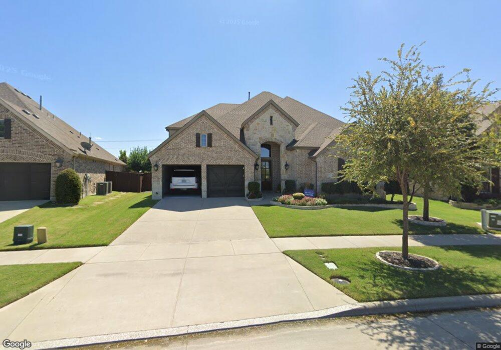
12563 Burnt Prairie Ln Frisco, TX 75035
East Frisco NeighborhoodEstimated Value: $832,000 - $919,000
5
Beds
6
Baths
4,266
Sq Ft
$209/Sq Ft
Est. Value
About This Home
This home is located at 12563 Burnt Prairie Ln, Frisco, TX 75035 and is currently estimated at $891,326, approximately $208 per square foot. 12563 Burnt Prairie Ln is a home located in Collin County with nearby schools including Jim Spradley Elementary, Bill Hays Middle School, and Rock Hill High School.
Ownership History
Date
Name
Owned For
Owner Type
Purchase Details
Closed on
Sep 1, 2017
Sold by
American Legen Homes Llc
Bought by
Barnes Sean and Barnes Prema
Current Estimated Value
Home Financials for this Owner
Home Financials are based on the most recent Mortgage that was taken out on this home.
Original Mortgage
$424,100
Outstanding Balance
$354,344
Interest Rate
3.92%
Mortgage Type
New Conventional
Estimated Equity
$536,982
Purchase Details
Closed on
Sep 9, 2016
Sold by
Prairie View Partners Ltd
Bought by
American Legend Homes Llc
Home Financials for this Owner
Home Financials are based on the most recent Mortgage that was taken out on this home.
Original Mortgage
$15,000,000
Interest Rate
3.45%
Mortgage Type
Purchase Money Mortgage
Create a Home Valuation Report for This Property
The Home Valuation Report is an in-depth analysis detailing your home's value as well as a comparison with similar homes in the area
Home Values in the Area
Average Home Value in this Area
Purchase History
| Date | Buyer | Sale Price | Title Company |
|---|---|---|---|
| Barnes Sean | -- | Lawyers Title | |
| American Legend Homes Llc | -- | Rtt |
Source: Public Records
Mortgage History
| Date | Status | Borrower | Loan Amount |
|---|---|---|---|
| Open | Barnes Sean | $424,100 | |
| Previous Owner | American Legend Homes Llc | $15,000,000 |
Source: Public Records
Tax History Compared to Growth
Tax History
| Year | Tax Paid | Tax Assessment Tax Assessment Total Assessment is a certain percentage of the fair market value that is determined by local assessors to be the total taxable value of land and additions on the property. | Land | Improvement |
|---|---|---|---|---|
| 2025 | $12,252 | $822,891 | $192,500 | $728,039 |
| 2024 | $12,252 | $748,083 | $192,500 | $711,086 |
| 2023 | $12,252 | $680,075 | $192,500 | $676,545 |
| 2022 | $13,126 | $618,250 | $143,000 | $579,200 |
| 2021 | $12,119 | $562,045 | $110,000 | $452,045 |
| 2020 | $12,014 | $529,000 | $110,000 | $419,000 |
| 2019 | $12,369 | $520,000 | $110,000 | $410,000 |
| 2018 | $11,585 | $485,000 | $110,000 | $375,000 |
| 2017 | $6,800 | $284,662 | $99,000 | $185,662 |
| 2016 | $1,527 | $63,360 | $63,360 | $0 |
Source: Public Records
Map
Nearby Homes
- 13264 Cool Meadow Dr
- 12092 Burnt Prairie Ln
- 14005 Falcon Ranch Dr
- 2209 Willard Dr
- 13305 Wimberley Dr
- 13557 Carmenita Dr
- 14224 Wheatfield Ln
- 10721 Leesa Dr
- 14120 Esplanada Dr
- 14026 Gutierrez St
- 12073 Tyler Dr
- 10800 Sexton Dr
- 10520 Love Ct
- 10425 Matador Dr
- 11565 Gatesville Dr
- 11422 Teresa Ln
- 10416 Cochron Dr
- 10600 Sedalia Dr
- 12443 Dove Chase Ln
- Stonebriar 2FSW (w/Media) Plan at Collinsbrook Farm
- 12581 Burnt Prairie Ln
- 12545 Burnt Prairie Ln
- 12527 Burnt Prairie Ln
- 12509 Burnt Prairie Ln
- 12601 Burnt Prairie Ln
- 12615 Burnt Prairie Ln
- 12530 Belmeade Dr
- 12554 Belmeade Dr
- 12506 Belmeade Dr
- 3105 Autumn Sage
- 12629 Burnt Prairie Ln
- 12578 Belmeade Dr
- 12482 Belmeade Dr
- 12458 Belmeade Dr
- 12485 Burnt Prairie Ln
- 12643 Burnt Prairie Ln
- 13607 Fieldcrest Rd
- 12592 Belmeade Dr
- 13651 Fieldcrest Rd
- 13629 Fieldcrest Rd