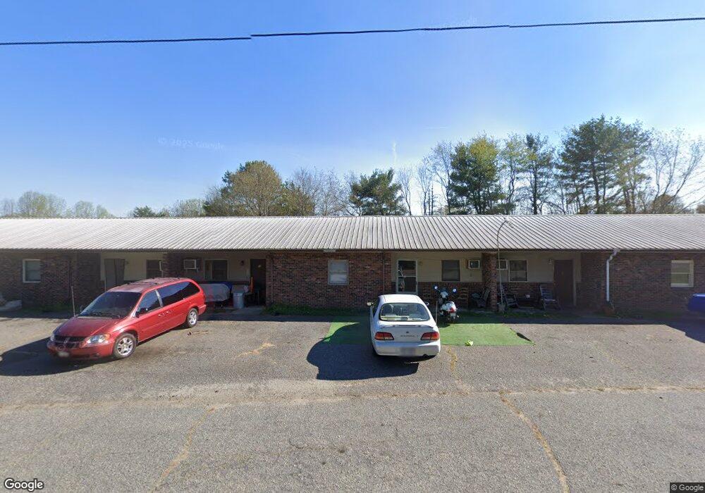
126 Farmside Dr Forest City, NC 28043
Estimated Value: $371,000 - $1,327,000
6
Beds
6
Baths
3,942
Sq Ft
$170/Sq Ft
Est. Value
About This Home
This home is located at 126 Farmside Dr, Forest City, NC 28043 and is currently estimated at $670,415, approximately $170 per square foot. 126 Farmside Dr is a home with nearby schools including Spindale Elementary School, R.S. Middle School, and R-S Central High School.
Ownership History
Date
Name
Owned For
Owner Type
Purchase Details
Closed on
Aug 29, 2022
Sold by
Tg Properties Llc
Bought by
American Of Nc Llc
Current Estimated Value
Home Financials for this Owner
Home Financials are based on the most recent Mortgage that was taken out on this home.
Original Mortgage
$520,000
Outstanding Balance
$497,304
Interest Rate
5.55%
Estimated Equity
$173,111
Purchase Details
Closed on
Mar 29, 2019
Sold by
Curtis Wolf Robert W and Curtis Wreston
Bought by
Morgan Family Real Properties Llc
Purchase Details
Closed on
Jun 24, 2014
Sold by
Thompson James R and Thompson Imogene W
Bought by
John Jason Abrams Enterprises Llc
Home Financials for this Owner
Home Financials are based on the most recent Mortgage that was taken out on this home.
Original Mortgage
$345,000
Interest Rate
4.23%
Mortgage Type
New Conventional
Create a Home Valuation Report for This Property
The Home Valuation Report is an in-depth analysis detailing your home's value as well as a comparison with similar homes in the area
Home Values in the Area
Average Home Value in this Area
Purchase History
| Date | Buyer | Sale Price | Title Company |
|---|---|---|---|
| American Of Nc Llc | $920,000 | Lane Peter E | |
| Morgan Family Real Properties Llc | -- | None Available | |
| John Jason Abrams Enterprises Llc | $350,000 | Chicago Title Insurance Co |
Source: Public Records
Mortgage History
| Date | Status | Borrower | Loan Amount |
|---|---|---|---|
| Open | American Of Nc Llc | $520,000 | |
| Previous Owner | John Jason Abrams Enterprises Llc | $345,000 |
Source: Public Records
Tax History Compared to Growth
Tax History
| Year | Tax Paid | Tax Assessment Tax Assessment Total Assessment is a certain percentage of the fair market value that is determined by local assessors to be the total taxable value of land and additions on the property. | Land | Improvement |
|---|---|---|---|---|
| 2025 | -- | $170,200 | $21,400 | $148,800 |
| 2024 | $986 | $170,200 | $21,400 | $148,800 |
| 2023 | $799 | $170,200 | $21,400 | $148,800 |
| 2022 | $799 | $110,900 | $21,400 | $89,500 |
| 2021 | $793 | $110,900 | $21,400 | $89,500 |
| 2020 | $782 | $110,900 | $21,400 | $89,500 |
| 2019 | $733 | $110,900 | $21,400 | $89,500 |
| 2018 | $1,024 | $155,200 | $21,600 | $133,600 |
| 2016 | $1,040 | $155,200 | $21,600 | $133,600 |
| 2013 | -- | $155,200 | $21,600 | $133,600 |
Source: Public Records
Map
Nearby Homes
- 0 Carver Ln
- 847 Crowe Dairy Rd
- 732 Crowe Dairy Rd
- 188 Debby Ln
- 0 Oakland Heights Rd
- 1349 Us 221 Hwy S
- 151 Debby Ln
- 0 Joshua Dr
- 1260 US 221 Hwy S
- 549 Piney Ridge Rd
- Lot 34 Line Dr
- Lot 32 Line Dr
- Lot 31 Line Dr
- Lot 20 Line Dr
- Lot 19 Line Dr
- 387 Oak Street Extension
- Lot 11 Mcdade Rd
- Lot 12 Mcdade Rd
- Lot 10 Mcdade Rd
- 122 Overbrook Dr
- 114 Farmside Dr
- 114, 111, 126 Farmside Dr
- 111 Farmside Dr
- 111 Farmside Dr
- 111 Farmside Dr
- 357 Crowe Dairy Rd
- 161 Farmside Dr
- 172 Hunter Carver Ln
- 173 Hunter Carver Ln
- 293 Crowe Dairy Rd
- 178 Farmside Dr
- 340 Crowe Dairy Rd Unit 344
- 162 Hunter Carver Ln
- 163 Hunter Carver Rd
- 163 Hunter Carver Ln
- 130 Jersey St
- 285 Crowe Dairy Rd
- 296 Crowe Dairy Rd
- 370 Crowe Dairy Rd
- 154 Hunter Carver Ln