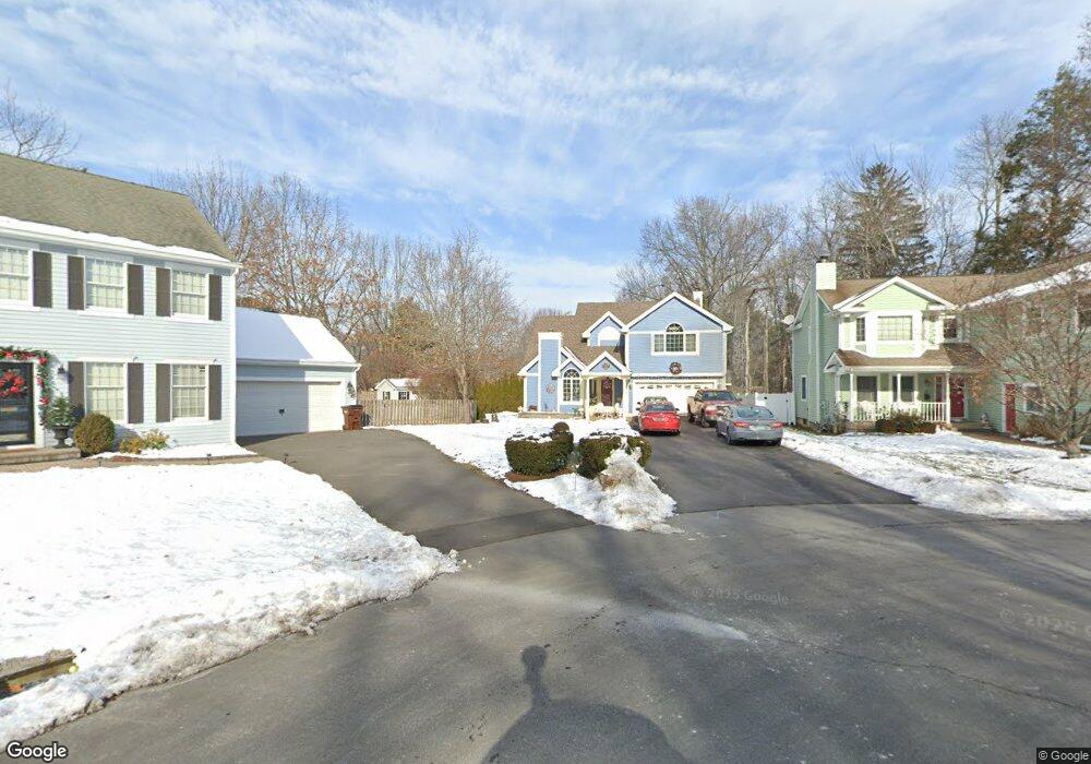
126 Middlebrook Rd West Hartford, CT 06119
Estimated Value: $615,000 - $792,000
4
Beds
5
Baths
2,587
Sq Ft
$281/Sq Ft
Est. Value
About This Home
This home is located at 126 Middlebrook Rd, West Hartford, CT 06119 and is currently estimated at $727,067, approximately $281 per square foot. 126 Middlebrook Rd is a home located in Hartford County with nearby schools including Morley School, King Philip Middle School, and Hall High School.
Ownership History
Date
Name
Owned For
Owner Type
Purchase Details
Closed on
Oct 9, 1990
Sold by
Kenlin Homes Inc
Bought by
Remicio Arturo
Current Estimated Value
Home Financials for this Owner
Home Financials are based on the most recent Mortgage that was taken out on this home.
Original Mortgage
$215,000
Interest Rate
10.21%
Create a Home Valuation Report for This Property
The Home Valuation Report is an in-depth analysis detailing your home's value as well as a comparison with similar homes in the area
Home Values in the Area
Average Home Value in this Area
Purchase History
| Date | Buyer | Sale Price | Title Company |
|---|---|---|---|
| Remicio Arturo | $239,000 | -- |
Source: Public Records
Mortgage History
| Date | Status | Borrower | Loan Amount |
|---|---|---|---|
| Open | Remicio Arturo | $100,000 | |
| Closed | Remicio Arturo | $180,000 | |
| Closed | Remicio Arturo | $215,000 |
Source: Public Records
Tax History Compared to Growth
Tax History
| Year | Tax Paid | Tax Assessment Tax Assessment Total Assessment is a certain percentage of the fair market value that is determined by local assessors to be the total taxable value of land and additions on the property. | Land | Improvement |
|---|---|---|---|---|
| 2025 | $14,704 | $328,370 | $103,740 | $224,630 |
| 2024 | $13,906 | $328,370 | $103,740 | $224,630 |
| 2023 | $13,437 | $328,370 | $103,740 | $224,630 |
| 2022 | $13,358 | $328,370 | $103,740 | $224,630 |
| 2021 | $13,166 | $310,380 | $108,080 | $202,300 |
| 2020 | $12,500 | $299,040 | $101,150 | $197,890 |
| 2019 | $12,500 | $299,040 | $101,150 | $197,890 |
| 2018 | $12,261 | $299,040 | $101,150 | $197,890 |
| 2017 | $12,273 | $299,040 | $101,150 | $197,890 |
| 2016 | $11,140 | $281,960 | $88,690 | $193,270 |
| 2015 | $10,802 | $281,960 | $88,690 | $193,270 |
| 2014 | $10,537 | $281,960 | $88,690 | $193,270 |
Source: Public Records
Map
Nearby Homes
- 129 Middlebrook Rd
- 1272 Trout Brook Dr
- 1268 Trout Brook Dr
- 1294 Trout Brook Dr
- 1196 Trout Brook Dr
- 11 Lawler Rd
- 132 N Main St
- 3 Trumbull Ln
- 105 Ardmore Rd
- 1110 Trout Brook Dr
- 3 Pilgrim Rd
- 183 Loomis Dr Unit 109
- 54 Robin Rd Unit B2
- 237 Fern St Unit 314
- 62 Blue Ridge Ln
- 48 Walkley Rd
- 1006A Trout Brook Dr Unit 1006A
- 1993 Albany Ave
- 16 Lilley Rd
- 320 N Steele Rd
- 122 Middlebrook Rd
- 130 Middlebrook Rd
- 215 Ballard Dr
- 203 Ballard Dr
- 125 Middlebrook Rd
- 1288 Trout Brook Dr
- 193 Ballard Dr
- 225 Ballard Dr
- 1292 Trout Brook Dr
- 189 Ballard Dr
- 231 Ballard Dr
- 235 Ballard Dr
- 185 Ballard Dr
- 210 Ballard Dr
- 216 Ballard Dr
- 110 Middlebrook Rd
- 1287 Trout Brook Dr
- 220 Ballard Dr
- 3 Duffield Dr
- 1266 Trout Brook Dr