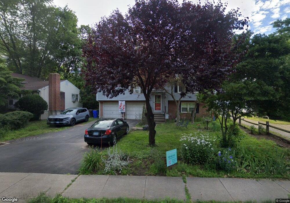
1260 Trout Brook Dr West Hartford, CT 06119
Estimated Value: $406,913 - $441,000
3
Beds
2
Baths
1,344
Sq Ft
$317/Sq Ft
Est. Value
About This Home
This home is located at 1260 Trout Brook Dr, West Hartford, CT 06119 and is currently estimated at $425,728, approximately $316 per square foot. 1260 Trout Brook Dr is a home located in Hartford County with nearby schools including Morley School, King Philip Middle School, and Hall High School.
Ownership History
Date
Name
Owned For
Owner Type
Purchase Details
Closed on
Mar 18, 2025
Sold by
Gineo Christopher
Bought by
Randall Blanche A
Current Estimated Value
Purchase Details
Closed on
Apr 24, 2023
Sold by
Randall Blanche A
Bought by
Gineo Christopher and Randall Blanche A
Purchase Details
Closed on
Sep 1, 1988
Sold by
Kujawski M
Bought by
Randall R E
Purchase Details
Closed on
Feb 23, 1987
Sold by
Francolini Mary B
Bought by
Kujawski Josephine
Create a Home Valuation Report for This Property
The Home Valuation Report is an in-depth analysis detailing your home's value as well as a comparison with similar homes in the area
Home Values in the Area
Average Home Value in this Area
Purchase History
| Date | Buyer | Sale Price | Title Company |
|---|---|---|---|
| Randall Blanche A | -- | None Available | |
| Randall Blanche A | -- | None Available | |
| Gineo Christopher | -- | None Available | |
| Gineo Christopher | -- | None Available | |
| Randall R E | $195,000 | -- | |
| Kujawski Josephine | $150,000 | -- |
Source: Public Records
Mortgage History
| Date | Status | Borrower | Loan Amount |
|---|---|---|---|
| Previous Owner | Kujawski Josephine | $270,750 | |
| Previous Owner | Kujawski Josephine | $175,000 | |
| Previous Owner | Kujawski Josephine | $120,000 |
Source: Public Records
Tax History Compared to Growth
Tax History
| Year | Tax Paid | Tax Assessment Tax Assessment Total Assessment is a certain percentage of the fair market value that is determined by local assessors to be the total taxable value of land and additions on the property. | Land | Improvement |
|---|---|---|---|---|
| 2025 | $8,226 | $183,690 | $58,600 | $125,090 |
| 2024 | $7,779 | $183,690 | $58,600 | $125,090 |
| 2023 | $7,517 | $183,690 | $58,600 | $125,090 |
| 2022 | $7,473 | $183,690 | $58,600 | $125,090 |
| 2021 | $6,331 | $149,240 | $61,000 | $88,240 |
| 2020 | $6,238 | $149,240 | $57,200 | $92,040 |
| 2019 | $6,238 | $149,240 | $57,190 | $92,050 |
| 2018 | $6,119 | $149,240 | $57,190 | $92,050 |
| 2017 | $6,125 | $149,240 | $57,190 | $92,050 |
| 2016 | $6,165 | $156,030 | $51,380 | $104,650 |
| 2015 | $5,978 | $156,030 | $51,380 | $104,650 |
| 2014 | $5,831 | $156,030 | $51,380 | $104,650 |
Source: Public Records
Map
Nearby Homes
- 1268 Trout Brook Dr
- 1272 Trout Brook Dr
- 129 Middlebrook Rd
- 1294 Trout Brook Dr
- 1196 Trout Brook Dr
- 132 N Main St
- 105 Ardmore Rd
- 1110 Trout Brook Dr
- 11 Lawler Rd
- 3 Trumbull Ln
- 183 Loomis Dr Unit 109
- 54 Robin Rd Unit B2
- 237 Fern St Unit 314
- 1006A Trout Brook Dr Unit 1006A
- 48 Walkley Rd
- 16 Lilley Rd
- 869 Farmington Ave Unit 305
- 30 Outlook Ave Unit 205
- 3 Pilgrim Rd
- 62 Blue Ridge Ln
- 1258 Trout Brook Dr
- 1262 Trout Brook Dr
- 1256 Trout Brook Dr
- 1266 Trout Brook Dr
- 169 Ballard Dr
- 175 Ballard Dr
- 165 Ballard Dr
- 1254 Trout Brook Dr
- 181 Ballard Dr
- 161 Ballard Dr
- 185 Ballard Dr
- 155 Ballard Dr
- 1252 Trout Brook Dr
- 151 Ballard Dr
- 189 Ballard Dr
- 125 Middlebrook Rd
- 1250 Trout Brook Dr
- 145 Ballard Dr
- 193 Ballard Dr
- 170 Ballard Dr