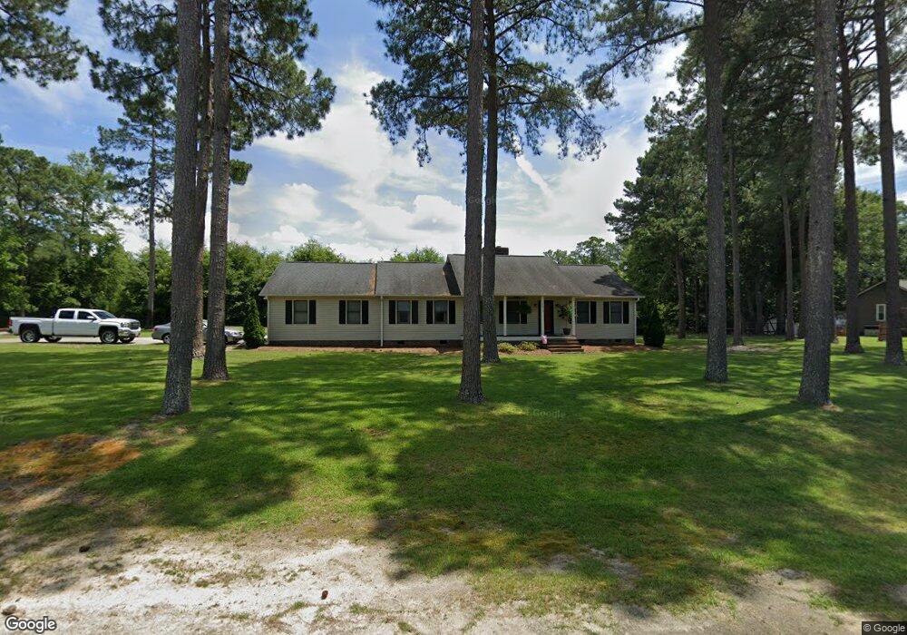
12640 Cotton Dr Laurinburg, NC 28352
Estimated Value: $218,000 - $350,000
3
Beds
2
Baths
1,702
Sq Ft
$153/Sq Ft
Est. Value
About This Home
This home is located at 12640 Cotton Dr, Laurinburg, NC 28352 and is currently estimated at $261,187, approximately $153 per square foot. 12640 Cotton Dr is a home located in Scotland County with nearby schools including South Scotland Elementary, Scotland High School, and Christ the Cornerstone Academy.
Ownership History
Date
Name
Owned For
Owner Type
Purchase Details
Closed on
May 24, 2010
Sold by
Williams Danny C and Williams Brenda G
Bought by
Cooper Jeffery G and Cooper Denise S
Current Estimated Value
Home Financials for this Owner
Home Financials are based on the most recent Mortgage that was taken out on this home.
Original Mortgage
$145,000
Outstanding Balance
$95,748
Interest Rate
4.75%
Mortgage Type
New Conventional
Estimated Equity
$165,439
Purchase Details
Closed on
Jul 11, 2008
Sold by
Krienke Hoyles Todd Dennis and Krienke Hoyles Darla Jo
Bought by
Williams Danny C and Williams Brenda G
Home Financials for this Owner
Home Financials are based on the most recent Mortgage that was taken out on this home.
Original Mortgage
$100,000
Interest Rate
5.59%
Mortgage Type
Purchase Money Mortgage
Create a Home Valuation Report for This Property
The Home Valuation Report is an in-depth analysis detailing your home's value as well as a comparison with similar homes in the area
Home Values in the Area
Average Home Value in this Area
Purchase History
| Date | Buyer | Sale Price | Title Company |
|---|---|---|---|
| Cooper Jeffery G | $145,000 | None Available | |
| Williams Danny C | $149,000 | None Available |
Source: Public Records
Mortgage History
| Date | Status | Borrower | Loan Amount |
|---|---|---|---|
| Open | Cooper Jeffery G | $145,000 | |
| Previous Owner | Williams Danny C | $100,000 |
Source: Public Records
Tax History Compared to Growth
Tax History
| Year | Tax Paid | Tax Assessment Tax Assessment Total Assessment is a certain percentage of the fair market value that is determined by local assessors to be the total taxable value of land and additions on the property. | Land | Improvement |
|---|---|---|---|---|
| 2025 | $1,535 | $149,530 | $13,200 | $136,330 |
| 2024 | $1,521 | $149,530 | $13,200 | $136,330 |
| 2023 | $1,535 | $149,530 | $13,200 | $136,330 |
| 2022 | $1,535 | $149,530 | $13,200 | $136,330 |
| 2021 | $1,550 | $149,530 | $13,200 | $136,330 |
| 2020 | $1,535 | $149,530 | $13,200 | $136,330 |
| 2019 | $1,550 | $149,530 | $13,200 | $136,330 |
| 2018 | $1,628 | $157,320 | $15,400 | $141,920 |
| 2017 | $1,644 | $157,320 | $15,400 | $141,920 |
| 2016 | $1,660 | $157,320 | $15,400 | $141,920 |
| 2015 | $1,560 | $146,150 | $15,400 | $130,750 |
| 2014 | $1,505 | $0 | $0 | $0 |
Source: Public Records
Map
Nearby Homes
- 9260 Mcleod Rd
- 9361 Mcleod Rd
- 9681 Deerfield Cir
- 0 Muirfield Dr
- 12480 Muirfield Dr
- 11400 Barnes Bridge Rd
- 8200 Scotch Meadows Dr
- 9881 McColl Rd
- 11140 Barnes Bridge Rd
- 10981 Academy Rd
- 8061 Green Acres Rd
- 8181 Carnostie Dr
- 9141 Hasty Rd
- 9167 Hasty Rd
- 0 Holly
- 11561 Purcell Rd
- 10481 Bostic Rd
- 11621 Purcell Rd
- 53 Barnes Bridge
- Tr #2 Mcqueen
- 12620 Cotton Dr
- 9300 Oat Dr
- 12660 Cotton Dr
- 12600 Cotton Dr
- 12621 Cotton Dr
- 12661 Cotton Dr
- 9320 Oat Dr
- 0000 Oat
- 12601 Cotton Dr
- 12681 Cotton Dr
- 12680 Cotton Dr
- 12580 Cotton Dr
- 9301 Oat Dr
- 12581 Cotton Dr
- 9340 Oat Dr
- 12640 Longleaf Dr
- 12620 Longleaf Dr
- 9280 Mcleod Rd
- 9240 Mcleod Rd
- 12660 Longleaf Dr