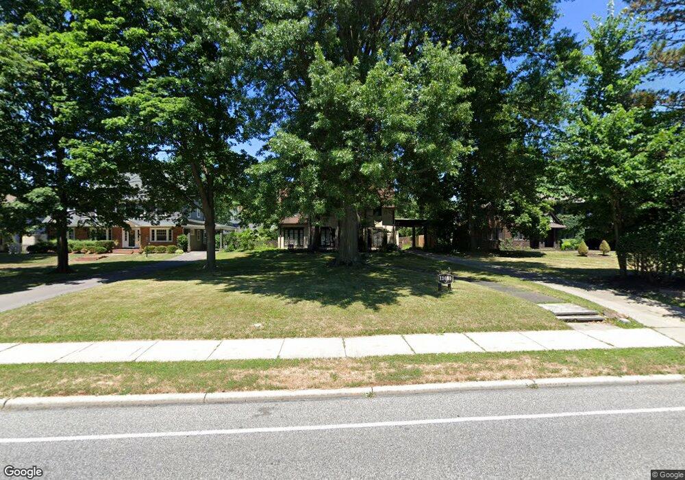
12689 Cedar Rd Cleveland, OH 44106
Cedar-Fairmount NeighborhoodEstimated Value: $368,000 - $447,000
4
Beds
4
Baths
2,531
Sq Ft
$164/Sq Ft
Est. Value
About This Home
This home is located at 12689 Cedar Rd, Cleveland, OH 44106 and is currently estimated at $414,812, approximately $163 per square foot. 12689 Cedar Rd is a home located in Cuyahoga County with nearby schools including Roxboro Elementary School, Roxboro Middle School, and Cleveland Heights High School.
Ownership History
Date
Name
Owned For
Owner Type
Purchase Details
Closed on
Apr 19, 1991
Sold by
Dinga Lynn M
Bought by
Rosenbaum Robert G
Current Estimated Value
Purchase Details
Closed on
Nov 23, 1988
Sold by
Dinga Marc J and Dinga Lynn M
Bought by
Dinga Lynn M
Purchase Details
Closed on
Jun 10, 1983
Sold by
Johnson Peter C
Bought by
Dinga Marc J and Dinga Lynn M
Purchase Details
Closed on
Mar 18, 1977
Sold by
Demmy Nicholas and Demmy Olean W
Bought by
Johnson Peter C
Purchase Details
Closed on
Jan 1, 1975
Bought by
Demmy Nicholas and Demmy Olean W
Create a Home Valuation Report for This Property
The Home Valuation Report is an in-depth analysis detailing your home's value as well as a comparison with similar homes in the area
Home Values in the Area
Average Home Value in this Area
Purchase History
| Date | Buyer | Sale Price | Title Company |
|---|---|---|---|
| Rosenbaum Robert G | $116,000 | -- | |
| Dinga Lynn M | -- | -- | |
| Dinga Marc J | $103,000 | -- | |
| Johnson Peter C | $63,000 | -- | |
| Demmy Nicholas | -- | -- |
Source: Public Records
Tax History Compared to Growth
Tax History
| Year | Tax Paid | Tax Assessment Tax Assessment Total Assessment is a certain percentage of the fair market value that is determined by local assessors to be the total taxable value of land and additions on the property. | Land | Improvement |
|---|---|---|---|---|
| 2024 | $11,005 | $130,095 | $24,290 | $105,805 |
| 2023 | $8,924 | $82,180 | $22,470 | $59,710 |
| 2022 | $8,879 | $82,180 | $22,470 | $59,710 |
| 2021 | $8,699 | $82,180 | $22,470 | $59,710 |
| 2020 | $9,328 | $79,770 | $21,810 | $57,960 |
| 2019 | $8,811 | $227,900 | $62,300 | $165,600 |
| 2018 | $8,398 | $79,770 | $21,810 | $57,960 |
| 2017 | $8,433 | $70,910 | $17,780 | $53,130 |
| 2016 | $8,416 | $70,910 | $17,780 | $53,130 |
| 2015 | $7,572 | $70,910 | $17,780 | $53,130 |
| 2014 | $7,572 | $67,270 | $16,450 | $50,820 |
Source: Public Records
Map
Nearby Homes
- 2763 Derbyshire Rd
- 12783 Cedar Rd
- 2135 Coventry Rd
- 2819 E Derbyshire Rd
- 2843 E Derbyshire Rd
- 2312 N Saint James Pkwy
- 2568 Euclid Heights Blvd
- 2646 Fairmount Blvd
- 2696 Fairmount Blvd
- 2357 Demington Dr
- 1935 Coventry Rd
- 2463 Derbyshire Rd
- 2707 Lancashire Rd Unit 18
- 2206 Westminster Rd
- 2334 Roxboro Rd
- 2609 Hampshire Rd
- 2640 Mayfield Rd
- 2230 Grandview Ave
- 2189 Bellfield Ave
- 2967 Meadowbrook Blvd
- 12699 Cedar Rd
- 12685 Cedar Rd
- 12705 Cedar Rd
- 12675 Cedar Rd
- 2684 Derbyshire Rd
- 2700 Derbyshire Rd
- 2678 Derbyshire Rd
- 2704 Derbyshire Rd
- 2150 Chatfield Dr
- 12711 Cedar Rd
- 12667 Cedar Rd
- 12700 Cedar Rd
- 2153 Chatfield Dr
- 2672 Derbyshire Rd
- 2710 Derbyshire Rd
- 12717 Cedar Rd
- 2160 Chatfield Dr
- 2666 Derbyshire Rd
- 2155 Demington Dr
- 2159 Chatfield Dr
