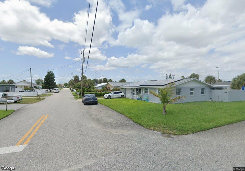
127 Dottie Ave Daytona Beach, FL 32118
Estimated Value: $292,000 - $329,000
2
Beds
1
Bath
1,084
Sq Ft
$294/Sq Ft
Est. Value
About This Home
This home is located at 127 Dottie Ave, Daytona Beach, FL 32118 and is currently estimated at $318,647, approximately $293 per square foot. 127 Dottie Ave is a home located in Volusia County with nearby schools including R.J. Longstreet Elementary School, Atlantic High School, and Silver Sands Middle School.
Ownership History
Date
Name
Owned For
Owner Type
Purchase Details
Closed on
Feb 11, 2008
Sold by
Mullins Susie Gordon and Mullins John Michael
Bought by
Vaughan Theodore B and Vaughan Nicolette A
Current Estimated Value
Home Financials for this Owner
Home Financials are based on the most recent Mortgage that was taken out on this home.
Original Mortgage
$166,500
Interest Rate
6.06%
Mortgage Type
Purchase Money Mortgage
Purchase Details
Closed on
Dec 2, 2002
Sold by
Rousseau Christopher Charles
Bought by
Gordon Susie and Gordon Susan
Home Financials for this Owner
Home Financials are based on the most recent Mortgage that was taken out on this home.
Original Mortgage
$82,800
Interest Rate
6.08%
Mortgage Type
Purchase Money Mortgage
Purchase Details
Closed on
Jul 15, 1985
Bought by
Vaughan Theodore B
Purchase Details
Closed on
Dec 15, 1971
Bought by
Vaughan Theodore B
Create a Home Valuation Report for This Property
The Home Valuation Report is an in-depth analysis detailing your home's value as well as a comparison with similar homes in the area
Home Values in the Area
Average Home Value in this Area
Purchase History
| Date | Buyer | Sale Price | Title Company |
|---|---|---|---|
| Vaughan Theodore B | $185,000 | Adams Cameron Title Svcs Inc | |
| Gordon Susie | $46,000 | -- | |
| Gordon Susie | $46,000 | -- | |
| Vaughan Theodore B | $100 | -- | |
| Vaughan Theodore B | $22,900 | -- |
Source: Public Records
Mortgage History
| Date | Status | Borrower | Loan Amount |
|---|---|---|---|
| Closed | Vaughan Theodore B | $166,500 | |
| Previous Owner | Gordon Susie | $82,800 |
Source: Public Records
Tax History Compared to Growth
Tax History
| Year | Tax Paid | Tax Assessment Tax Assessment Total Assessment is a certain percentage of the fair market value that is determined by local assessors to be the total taxable value of land and additions on the property. | Land | Improvement |
|---|---|---|---|---|
| 2025 | $4,961 | $315,878 | $161,000 | $154,878 |
| 2024 | $4,961 | $319,317 | $161,000 | $158,317 |
| 2023 | $4,961 | $298,323 | $140,392 | $157,931 |
| 2022 | $4,543 | $258,684 | $101,430 | $157,254 |
| 2021 | $4,240 | $204,023 | $85,008 | $119,015 |
| 2020 | $3,901 | $189,069 | $84,364 | $104,705 |
| 2019 | $3,717 | $185,894 | $83,447 | $102,447 |
| 2018 | $3,394 | $161,197 | $57,330 | $103,867 |
| 2017 | $3,240 | $155,511 | $57,378 | $98,133 |
| 2016 | $3,021 | $137,744 | $0 | $0 |
| 2015 | $2,886 | $128,441 | $0 | $0 |
| 2014 | $2,623 | $116,741 | $0 | $0 |
Source: Public Records
Map
Nearby Homes
- 0 S Peninsula Dr Unit MFRV4942972
- 0 S Peninsula Dr Unit 1219405
- 0 S Peninsula Dr
- 0 S Peninsula Dr Unit 1213918
- 100 Talo Cir
- 3244 S Peninsula Dr
- 3315 S Atlantic Ave Unit 1605
- 3315 S Atlantic Ave Unit 1406
- 3315 S Atlantic Ave Unit 1005
- 3315 S Atlantic Ave Unit 806
- 3315 S Atlantic Ave Unit 1707
- 3315 S Atlantic Ave Unit 408
- 3315 S Atlantic Ave Unit 1108
- 3315 S Atlantic Ave Unit 1106
- 2 Talo Cir
- 3255 S Atlantic Ave Unit 207
- 3255 S Atlantic Ave Unit 106
- 3245 S Atlantic Ave Unit 208
- 3311 S Atlantic Ave Unit 1504
- 3311 S Atlantic Ave Unit 602
- 119 Dottie Ave
- 131 Dottie Ave
- 114 Simpson Ave
- 116 Simpson Ave
- 117 Dottie Ave
- 124 Dottie Ave
- 128 Dottie Ave
- 112 Simpson Ave
- 120 Dottie Ave
- 132 Dottie Ave
- 116 Dottie Ave
- 115 Dottie Ave
- 110 Simpson Ave
- 3302 S Atlantic Ave
- 3304 S Atlantic Ave
- 3306 S Atlantic Ave
- 117 Ogden Blvd
- 119 Ogden Blvd
- 112 Dottie Ave
- 115 Ogden Blvd