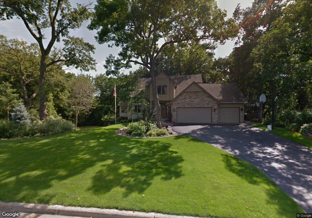
12720 Sable Dr Burnsville, MN 55337
Estimated Value: $566,000 - $616,000
4
Beds
4
Baths
2,587
Sq Ft
$228/Sq Ft
Est. Value
About This Home
This home is located at 12720 Sable Dr, Burnsville, MN 55337 and is currently estimated at $590,305, approximately $228 per square foot. 12720 Sable Dr is a home located in Dakota County with nearby schools including William Byrne Elementary School, Burnsville High School, and Gateway STEM Academy.
Ownership History
Date
Name
Owned For
Owner Type
Purchase Details
Closed on
Jul 1, 2020
Sold by
Lotfy Hazem and Lofty Hazem
Bought by
Lotfy Ahmed and Lotfy Riham Mahmoud
Current Estimated Value
Home Financials for this Owner
Home Financials are based on the most recent Mortgage that was taken out on this home.
Original Mortgage
$326,000
Outstanding Balance
$230,843
Interest Rate
3.2%
Mortgage Type
New Conventional
Estimated Equity
$359,462
Purchase Details
Closed on
May 20, 2019
Sold by
Hartsough Allan R and Hartsough Janice R
Bought by
Lofty Ahmed and Lofty Hazem
Home Financials for this Owner
Home Financials are based on the most recent Mortgage that was taken out on this home.
Original Mortgage
$360,000
Interest Rate
4.1%
Mortgage Type
New Conventional
Purchase Details
Closed on
Feb 28, 1997
Sold by
Lamb Lawrence J and Lamb Elizabeth J
Bought by
Hartsough Allan R and Hartsough Janice R
Create a Home Valuation Report for This Property
The Home Valuation Report is an in-depth analysis detailing your home's value as well as a comparison with similar homes in the area
Home Values in the Area
Average Home Value in this Area
Purchase History
| Date | Buyer | Sale Price | Title Company |
|---|---|---|---|
| Lotfy Ahmed | -- | Titlesmart Inc | |
| Lofty Ahmed | $450,000 | Results Title | |
| Hartsough Allan R | $292,500 | -- |
Source: Public Records
Mortgage History
| Date | Status | Borrower | Loan Amount |
|---|---|---|---|
| Open | Lotfy Ahmed | $326,000 | |
| Closed | Lofty Ahmed | $360,000 |
Source: Public Records
Tax History Compared to Growth
Tax History
| Year | Tax Paid | Tax Assessment Tax Assessment Total Assessment is a certain percentage of the fair market value that is determined by local assessors to be the total taxable value of land and additions on the property. | Land | Improvement |
|---|---|---|---|---|
| 2024 | $5,900 | $560,000 | $156,800 | $403,200 |
| 2023 | $5,900 | $550,800 | $157,000 | $393,800 |
| 2022 | $5,124 | $542,200 | $156,600 | $385,600 |
| 2021 | $5,000 | $475,800 | $136,500 | $339,300 |
| 2020 | $5,224 | $439,700 | $130,000 | $309,700 |
| 2019 | $5,225 | $442,500 | $123,800 | $318,700 |
| 2018 | $5,376 | $420,200 | $117,900 | $302,300 |
| 2017 | $4,994 | $419,400 | $112,300 | $307,100 |
| 2016 | $5,281 | $384,100 | $107,000 | $277,100 |
| 2015 | $4,984 | $386,879 | $103,208 | $283,671 |
| 2014 | -- | $381,647 | $101,197 | $280,450 |
| 2013 | -- | $354,724 | $92,035 | $262,689 |
Source: Public Records
Map
Nearby Homes
- 3017 Rainier Ct
- 12640 Tiffany Ct
- 12625 Sable Dr
- 108 Hidden Meadow Rd
- 101 Hidden Meadow Ct
- 109 Cimarron Ct
- 2708 Lassen Ct
- 188 River Woods Ln
- 146 River Woods Ln
- 145 River Woods Ln
- 55 River Woods Ln
- 247 River Woods Ln
- 221 River Woods Ln
- 72 River Woods Ln
- 319 River Woods Ln
- 2400 E 125th St
- 12867 Pennock Ave
- 12068 Gantry Ln
- 2300 Villaburne Ct W
- 13101 Heritage Way
- 12721 Diamond Dr
- 12717 Diamond Dr
- 12724 Sable Dr
- 12725 Diamond Dr
- 12721 Sable Dr
- 12725 Sable Dr
- 12729 Sable Dr
- 12729 Diamond Dr
- 12709 Diamond Dr
- 12728 Sable Dr
- 12720 Diamond Dr
- 12705 Diamond Dr
- 12716 Diamond Dr
- 12724 Diamond Dr
- 3405 Garnet Ct
- 12712 Diamond Dr
- 12728 Diamond Dr
- 3401 Garnet Ct
- 12708 Diamond Dr
- 12732 Diamond Dr