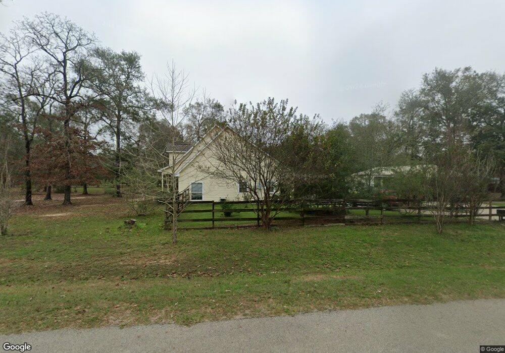
12794 Willis Waukegan Rd Conroe, TX 77303
Estimated Value: $443,000 - $497,000
4
Beds
3
Baths
2,299
Sq Ft
$207/Sq Ft
Est. Value
About This Home
This home is located at 12794 Willis Waukegan Rd, Conroe, TX 77303 and is currently estimated at $475,491, approximately $206 per square foot. 12794 Willis Waukegan Rd is a home located in Montgomery County with nearby schools including Patterson Elementary School, Bozman Intermediate School, and Stockton Junior High School.
Ownership History
Date
Name
Owned For
Owner Type
Purchase Details
Closed on
May 10, 2013
Sold by
West Charles L and West Deborah J
Bought by
Foster John J and Foster Mandy L
Current Estimated Value
Home Financials for this Owner
Home Financials are based on the most recent Mortgage that was taken out on this home.
Original Mortgage
$192,000
Outstanding Balance
$135,869
Interest Rate
3.45%
Mortgage Type
New Conventional
Estimated Equity
$339,622
Purchase Details
Closed on
Sep 28, 2006
Sold by
Corley Duane T
Bought by
West Charles L and West Deborah J
Create a Home Valuation Report for This Property
The Home Valuation Report is an in-depth analysis detailing your home's value as well as a comparison with similar homes in the area
Home Values in the Area
Average Home Value in this Area
Purchase History
| Date | Buyer | Sale Price | Title Company |
|---|---|---|---|
| Foster John J | -- | Stewart Title Of Montgomery | |
| West Charles L | -- | Old Republic Title |
Source: Public Records
Mortgage History
| Date | Status | Borrower | Loan Amount |
|---|---|---|---|
| Open | Foster John J | $192,000 |
Source: Public Records
Tax History Compared to Growth
Tax History
| Year | Tax Paid | Tax Assessment Tax Assessment Total Assessment is a certain percentage of the fair market value that is determined by local assessors to be the total taxable value of land and additions on the property. | Land | Improvement |
|---|---|---|---|---|
| 2025 | $5,696 | $490,123 | -- | -- |
| 2024 | $5,094 | $445,566 | -- | -- |
| 2023 | $5,094 | $405,060 | $117,870 | $354,090 |
| 2022 | $6,415 | $368,240 | $117,870 | $331,650 |
| 2021 | $6,189 | $334,760 | $100,750 | $234,010 |
| 2020 | $6,322 | $325,150 | $30,750 | $294,400 |
| 2019 | $6,100 | $302,830 | $30,750 | $272,080 |
| 2018 | $5,245 | $291,790 | $30,750 | $261,040 |
| 2017 | $5,897 | $291,790 | $30,750 | $261,040 |
| 2016 | $5,577 | $275,960 | $30,750 | $245,210 |
| 2015 | $4,903 | $275,400 | $30,750 | $293,920 |
| 2014 | $4,903 | $250,360 | $30,750 | $219,610 |
Source: Public Records
Map
Nearby Homes
- Discovery Plan at Stonebrooke
- Voyager Plan at Stonebrooke
- Athena Plan at Stonebrooke
- Magellan Plan at Stonebrooke
- Odyssey Plan at Stonebrooke
- Atlantis Plan at Stonebrooke
- Plan 2025 at Stonebrooke
- Plan 1700 at Stonebrooke
- Plan 1602-1 at Stonebrooke
- Plan 1434 at Stonebrooke
- Plan 1503 at Stonebrooke
- 9132 Stonebrooke Chase Dr
- 9313 Hard Rock Rd
- 9340 Hard Rock Rd
- 9344 Hard Rock Rd
- 9233 Boulder Blvd
- 12859 Lime Stone Ln
- 12855 Lime Stone Ln
- 12851 Lime Stone Ln
- 12847 Lime Stone Ln
- 12806 Willis Waukegan Rd
- 9178 Black Buck Ln
- 12760 Willis Waukegan Rd
- 12797 Willis Waukegan Rd
- 12807 Willis Waukegan Rd
- 9172 Black Buck Ln
- 12827 Willis Waukegan Rd
- 9273 Boulder Blvd
- 3236 Boulder Blvd
- 9217 Boulder Blvd
- 9209 Boulder Blvd
- 9179 Black Buck Ln
- 12746 Willis Waukegan Rd
- 9173 Black Buck Ln
- 12845 Willis Waukegan Rd
- 12761 Willis Waukegan Rd
- 12745 Willis Waukegan Rd
- 9166 Black Buck Ln
- 9123 Bush Buck Ln
- 9127 Bush Buck Ln