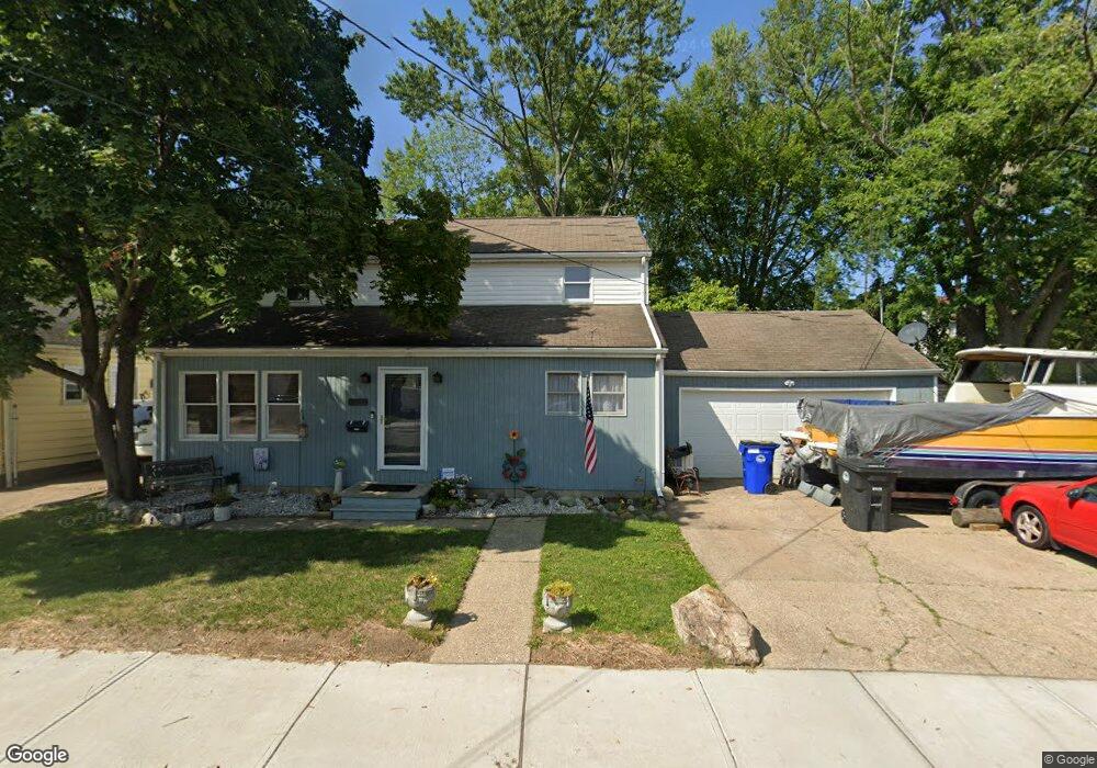
12802 Milligan Ave Cleveland, OH 44135
Bellaire-Puritas NeighborhoodEstimated Value: $157,000 - $206,000
3
Beds
2
Baths
1,750
Sq Ft
$99/Sq Ft
Est. Value
About This Home
This home is located at 12802 Milligan Ave, Cleveland, OH 44135 and is currently estimated at $172,521, approximately $98 per square foot. 12802 Milligan Ave is a home located in Cuyahoga County with nearby schools including Artemus Ward School, Almira Academy, and Benjamin Franklin.
Ownership History
Date
Name
Owned For
Owner Type
Purchase Details
Closed on
Sep 7, 1990
Bought by
Vura Michael William
Current Estimated Value
Purchase Details
Closed on
Oct 13, 1989
Sold by
Baker Mc Kinley
Bought by
Sec Of Veterans Affairs
Purchase Details
Closed on
Mar 26, 1982
Sold by
Bush William W and Bush Janice M
Bought by
Baker Mc Kinley
Purchase Details
Closed on
Jul 18, 1979
Sold by
Mckelvey David T and Mckelvey Blossom L
Bought by
David T Mckelvey
Purchase Details
Closed on
Jan 1, 1975
Bought by
Mckelvey David T and Mckelvey Blossom L
Create a Home Valuation Report for This Property
The Home Valuation Report is an in-depth analysis detailing your home's value as well as a comparison with similar homes in the area
Home Values in the Area
Average Home Value in this Area
Purchase History
| Date | Buyer | Sale Price | Title Company |
|---|---|---|---|
| Vura Michael William | -- | -- | |
| Sec Of Veterans Affairs | -- | -- | |
| Baker Mc Kinley | $34,000 | -- | |
| Bush William W | -- | -- | |
| Blossom L Mc Kelvey | -- | -- | |
| David T Mckelvey | $100 | -- | |
| Mckelvey David T | -- | -- |
Source: Public Records
Tax History Compared to Growth
Tax History
| Year | Tax Paid | Tax Assessment Tax Assessment Total Assessment is a certain percentage of the fair market value that is determined by local assessors to be the total taxable value of land and additions on the property. | Land | Improvement |
|---|---|---|---|---|
| 2024 | $3,126 | $47,670 | $8,085 | $39,585 |
| 2023 | $2,106 | $27,760 | $4,730 | $23,030 |
| 2022 | $2,093 | $27,755 | $4,725 | $23,030 |
| 2021 | $2,072 | $27,760 | $4,730 | $23,030 |
| 2020 | $1,859 | $21,530 | $3,680 | $17,850 |
| 2019 | $1,719 | $61,500 | $10,500 | $51,000 |
| 2018 | $1,721 | $21,530 | $3,680 | $17,850 |
| 2017 | $1,744 | $21,150 | $3,680 | $17,470 |
| 2016 | $1,731 | $21,150 | $3,680 | $17,470 |
| 2015 | $1,889 | $21,150 | $3,680 | $17,470 |
| 2014 | $1,889 | $23,000 | $3,990 | $19,010 |
Source: Public Records
Map
Nearby Homes
- 12701 Milligan Ave
- 12613 Milligan Ave
- 12518 Erwin Ave
- 13104 Wainfleet Ave
- 12519 Carrington Ave
- 12010 Longmead Ave
- 13401 Puritas Ave
- 12009 Mcgowan Ave
- 12301 Carrington Ave
- 13410 Wainfleet Ave
- 4349 W 132nd St
- 12804 Astor Ave
- 4329 W 131st St
- 13104 Astor Ave
- 13410 Gilmore Ave
- 12507 Astor Ave
- 13514 Bennington Ave
- 13622 Carrington Ave
- 12620 Grimsby Ave
- 12510 Grimsby Ave
- 12806 Milligan Ave
- 12810 Milligan Ave
- 12814 Milligan Ave
- 0 Milligan Ave
- 12818 Milligan Ave
- 12803 Longmead Ave
- 12807 Longmead Ave
- 12737 Longmead Ave
- 12801 Milligan Ave
- 12805 Milligan Ave
- 12721 Milligan Ave
- 12813 Longmead Ave
- 12717 Milligan Ave
- 12809 Milligan Ave
- 12817 Longmead Ave
- 12813 Milligan Ave
- 12713 Milligan Ave
- 12826 Milligan Ave
- 12709 Milligan Ave
- 12821 Longmead Ave