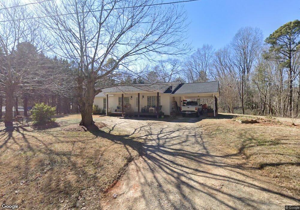
1283 West Ave Dallas, GA 30157
Estimated Value: $210,000 - $269,000
4
Beds
2
Baths
1,848
Sq Ft
$127/Sq Ft
Est. Value
About This Home
This home is located at 1283 West Ave, Dallas, GA 30157 and is currently estimated at $234,429, approximately $126 per square foot. 1283 West Ave is a home located in Paulding County with nearby schools including Lillian C. Poole Elementary School, South Paulding Middle School, and Paulding County High School.
Ownership History
Date
Name
Owned For
Owner Type
Purchase Details
Closed on
Oct 8, 2025
Sold by
Blalock Wayne Morris
Bought by
Mcmichen Kenneth Trust and Mcmichen Connie J Tr
Current Estimated Value
Purchase Details
Closed on
Jan 23, 2015
Sold by
Blalock Grace Wynell
Bought by
Blalock Wayne Morris
Purchase Details
Closed on
Jun 30, 2011
Sold by
Blalock Grace Wynell
Create a Home Valuation Report for This Property
The Home Valuation Report is an in-depth analysis detailing your home's value as well as a comparison with similar homes in the area
Home Values in the Area
Average Home Value in this Area
Purchase History
| Date | Buyer | Sale Price | Title Company |
|---|---|---|---|
| Mcmichen Kenneth Trust | -- | -- | |
| Mcmichen Kenneth Trust | $500 | -- | |
| Blalock Wayne Morris | -- | -- | |
| -- | -- | -- |
Source: Public Records
Tax History Compared to Growth
Tax History
| Year | Tax Paid | Tax Assessment Tax Assessment Total Assessment is a certain percentage of the fair market value that is determined by local assessors to be the total taxable value of land and additions on the property. | Land | Improvement |
|---|---|---|---|---|
| 2024 | $2,262 | $90,936 | $11,280 | $79,656 |
| 2023 | $2,286 | $87,696 | $10,920 | $76,776 |
| 2022 | $1,931 | $74,056 | $9,440 | $64,616 |
| 2021 | $1,438 | $49,480 | $7,680 | $41,800 |
| 2020 | $1,341 | $45,160 | $7,960 | $37,200 |
| 2019 | $1,273 | $42,240 | $8,160 | $34,080 |
| 2018 | $920 | $30,520 | $8,120 | $22,400 |
| 2017 | $901 | $29,480 | $8,120 | $21,360 |
| 2016 | $709 | $23,440 | $7,720 | $15,720 |
| 2015 | $510 | $16,560 | $6,880 | $9,680 |
| 2014 | $474 | $15,000 | $6,560 | $8,440 |
| 2013 | -- | $13,840 | $7,320 | $6,520 |
Source: Public Records
Map
Nearby Homes
- 298 Buchanan Hwy
- 60 Westside Cir
- 380 Buchanan Hwy
- 0 Cole Lake Rd Unit 10607141
- 0 Cole Lake Rd Unit 7651259
- +/-1.0 Cole Lake Rd
- 107 Salem Place
- 47 Whitley Ct
- 105 Ashford Dr
- 1119 W Memorial Dr
- 120 Remington Place Blvd
- 102 Natalie Ct
- 212 Remington Place Blvd
- 1136 Cole Lake Rd
- 305 Remington Place Blvd
- 1160 W Memorial Dr
- 205 Arbor Creek Dr
- 216 McMichen Rd
- 196 Pope Place
- 1297 West Ave
- 1255 West Ave
- 1325 West Ave
- 1259 West Ave
- 1253 West Ave
- 1257 West Ave
- 1290 West Ave
- 56 Lawrence Rd
- 204 Westridge
- 1205 West Ave
- 264 Buchanan Hwy
- 110 Westside Cir
- 25 Westside Cir
- 78 Lawrence Rd
- 59 Lawrence Rd
- 1190 West Ave
- 106 Laurel Farms Ln
- 368 Buchanan St
- 61 Lawrence Rd
- 0 Lawrence Rd Unit 7496734