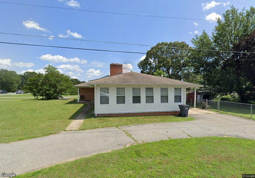
12846 Simpson Dr Waldorf, MD 20602
Estimated Value: $400,844 - $494,000
--
Bed
2
Baths
2,431
Sq Ft
$183/Sq Ft
Est. Value
About This Home
This home is located at 12846 Simpson Dr, Waldorf, MD 20602 and is currently estimated at $445,211, approximately $183 per square foot. 12846 Simpson Dr is a home located in Charles County with nearby schools including J.P. Ryon Elementary School, Milton M. Somers Middle School, and St. Charles High School.
Ownership History
Date
Name
Owned For
Owner Type
Purchase Details
Closed on
May 5, 2010
Sold by
Briscoe Agnes M
Bought by
Briscoe Agnes M and Bush Karlen Y
Current Estimated Value
Purchase Details
Closed on
Sep 26, 2003
Sold by
Briscoe Agnes M and Briscoe Troy A
Bought by
Briscoe Agnes M
Purchase Details
Closed on
Sep 30, 1996
Sold by
Briscoe Agnes M and Briscoe Troy A
Bought by
Briscoe Agnes M and Briscoe Troy A
Purchase Details
Closed on
Jul 24, 1996
Sold by
Hawkins Carroll L Rose A M
Bought by
Briscoe Agnes M and Briscoe Troy A
Create a Home Valuation Report for This Property
The Home Valuation Report is an in-depth analysis detailing your home's value as well as a comparison with similar homes in the area
Home Values in the Area
Average Home Value in this Area
Purchase History
| Date | Buyer | Sale Price | Title Company |
|---|---|---|---|
| Briscoe Agnes M | -- | -- | |
| Briscoe Agnes M | -- | -- | |
| Briscoe Agnes M | -- | -- | |
| Briscoe Agnes M | $135,000 | -- |
Source: Public Records
Mortgage History
| Date | Status | Borrower | Loan Amount |
|---|---|---|---|
| Closed | Briscoe Agnes M | -- |
Source: Public Records
Tax History Compared to Growth
Tax History
| Year | Tax Paid | Tax Assessment Tax Assessment Total Assessment is a certain percentage of the fair market value that is determined by local assessors to be the total taxable value of land and additions on the property. | Land | Improvement |
|---|---|---|---|---|
| 2025 | $10,095 | $341,733 | -- | -- |
| 2024 | $4,378 | $321,467 | $0 | $0 |
| 2023 | $4,304 | $301,200 | $115,100 | $186,100 |
| 2022 | $3,808 | $278,800 | $0 | $0 |
| 2021 | $3,305 | $256,400 | $0 | $0 |
| 2020 | $3,305 | $234,000 | $108,100 | $125,900 |
| 2019 | $3,192 | $226,700 | $0 | $0 |
| 2018 | $3,056 | $219,400 | $0 | $0 |
| 2017 | $2,953 | $212,100 | $0 | $0 |
| 2016 | -- | $212,100 | $0 | $0 |
| 2015 | $3,188 | $212,100 | $0 | $0 |
| 2014 | $3,188 | $226,500 | $0 | $0 |
Source: Public Records
Map
Nearby Homes
- 12822 Simpson Dr
- 12816 Thompson Dr
- 4285 Marion Ln
- 4499 Leonardtown Rd
- 3691 Red Bud Ct
- 13 King James Place
- 1 King James Place
- 3539 Smokethorn Ct
- 2278 Ingleside Ct
- 2523 Robinson Place
- 2584 Sussex Ct
- 2509 Robinson Place
- 13185 Jessies Place
- 2337 Vale Ct
- 3442 Tulip Tree Ct
- 4460 Red Rome Ct
- 4071 Powell Ct
- 3465 Marigold Place
- 12473 Turtle Dove Place
- 3844 Lakewood Place
- 4985 Leonardtown Rd
- 12845 Simpson Dr
- 12842 Simpson Dr
- 12835 Thompson Dr
- 12831 Thompson Dr
- 12838 Simpson Dr
- 5005 Leonardtown Rd
- 12827 Thompson Dr
- 12827A Thompson Dr
- 12827 Thompson Dr Unit A
- 12837 Simpson Dr
- 4508 Ladybug Place
- 12834 Simpson Dr
- 4984 Leonardtown Rd
- 12866 Owens Dr
- 12823 Thompson Dr
- 12832 Thompson Dr
- 12862 Owens Dr
- 12833 Simpson Dr
- 4504 Ladybug Place