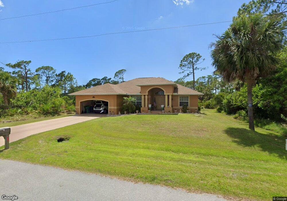
1291 Sanford St Port Charlotte, FL 33953
Northwest Port Charlotte NeighborhoodEstimated Value: $307,713 - $479,000
3
Beds
2
Baths
1,780
Sq Ft
$212/Sq Ft
Est. Value
About This Home
This home is located at 1291 Sanford St, Port Charlotte, FL 33953 and is currently estimated at $378,178, approximately $212 per square foot. 1291 Sanford St is a home located in Charlotte County with nearby schools including Liberty Elementary School, Murdock Middle School, and Port Charlotte High School.
Ownership History
Date
Name
Owned For
Owner Type
Purchase Details
Closed on
Jul 9, 2010
Sold by
Stephan Charles P and Fulton Henry
Bought by
Dorf Robert
Current Estimated Value
Home Financials for this Owner
Home Financials are based on the most recent Mortgage that was taken out on this home.
Original Mortgage
$122,735
Outstanding Balance
$81,844
Interest Rate
4.79%
Mortgage Type
FHA
Estimated Equity
$296,334
Purchase Details
Closed on
Oct 27, 2009
Sold by
Fifth Third Mortgage Company
Bought by
Stephan Charles P and Fulton Henry
Purchase Details
Closed on
May 4, 2009
Sold by
Vervuurt Norman and Vervuurt Linda
Bought by
Fifth Third Mortgage Company
Purchase Details
Closed on
Sep 14, 2004
Sold by
Handlon Vinita
Bought by
Vervuurt Norman and Vervuurt Linda
Create a Home Valuation Report for This Property
The Home Valuation Report is an in-depth analysis detailing your home's value as well as a comparison with similar homes in the area
Home Values in the Area
Average Home Value in this Area
Purchase History
| Date | Buyer | Sale Price | Title Company |
|---|---|---|---|
| Dorf Robert | $125,000 | Gold Crest Title Services | |
| Stephan Charles P | $69,000 | Stewart Title Company | |
| Fifth Third Mortgage Company | $77,100 | None Available | |
| Vervuurt Norman | $19,000 | -- |
Source: Public Records
Mortgage History
| Date | Status | Borrower | Loan Amount |
|---|---|---|---|
| Open | Dorf Robert | $122,735 |
Source: Public Records
Tax History Compared to Growth
Tax History
| Year | Tax Paid | Tax Assessment Tax Assessment Total Assessment is a certain percentage of the fair market value that is determined by local assessors to be the total taxable value of land and additions on the property. | Land | Improvement |
|---|---|---|---|---|
| 2024 | $1,855 | $111,097 | -- | -- |
| 2023 | $1,855 | $107,861 | $0 | $0 |
| 2022 | $1,772 | $104,719 | $0 | $0 |
| 2021 | $1,754 | $101,669 | $0 | $0 |
| 2020 | $1,707 | $100,265 | $0 | $0 |
| 2019 | $1,621 | $98,011 | $0 | $0 |
| 2018 | $1,484 | $96,184 | $0 | $0 |
| 2017 | $1,464 | $94,206 | $0 | $0 |
| 2016 | $1,449 | $92,268 | $0 | $0 |
| 2015 | $1,434 | $91,627 | $0 | $0 |
| 2014 | $1,316 | $90,900 | $0 | $0 |
Source: Public Records
Map
Nearby Homes
- 1307 Sanford St
- 1232 Sanford St
- 13006 Devereaux Ave
- 1315 Ramsey St
- 1300 Quantico St
- 1307 Quantico St
- 1315 Quantico St
- 1267 Quantico St
- 1322 Ramsey St
- 13048 Devereaux Ave
- 1267 Patton St
- 13057 Batlin Ave
- 1332 Patton St
- 1150 or 1160 Delmore St
- 13125 Irwin Dr
- 1336 Forrestal St
- 1264 Forrestal St
- 1130 Forrestal St
- 1160 Shell St
- 13062 Armitage Ave
- 1262 Sanford St
- 1222 Sanford St
- 1323 Sanford St
- 1288 Ramsey St
- 1288 1306 Ramsey St
- 1275 Sanford St
- 1315 Sanford St
- 1264 Ramsey St
- 1256 Ramsey St
- 1331 Ramsey St
- 1284 Quantico St
- 1248 Ramsey St
- 13156 Dodds Ct
- 1241 Sanford St
- 1240 Ramsey St
- 1323 Quantico St
- 1251 Quantico St
- 1299 Quantico St
- 13149 Eisenhower Dr
- 1332 Quantico St