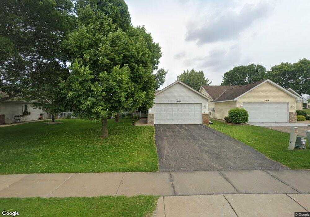
12924 Brookside Ln N Rogers, MN 55374
Estimated Value: $331,000 - $348,000
2
Beds
2
Baths
1,451
Sq Ft
$232/Sq Ft
Est. Value
About This Home
This home is located at 12924 Brookside Ln N, Rogers, MN 55374 and is currently estimated at $336,197, approximately $231 per square foot. 12924 Brookside Ln N is a home located in Hennepin County with nearby schools including Rogers Elementary School, Rogers Middle School, and Rogers Senior High School.
Ownership History
Date
Name
Owned For
Owner Type
Purchase Details
Closed on
Jun 20, 2019
Sold by
Steinkraus Pamela A
Bought by
Rlt Steinkraus Pamela A and Rlt Pamela A Steinkraus
Current Estimated Value
Purchase Details
Closed on
Feb 22, 2018
Sold by
Grave Blen V and Grave Barbara L
Bought by
Steinkraus Pamela
Home Financials for this Owner
Home Financials are based on the most recent Mortgage that was taken out on this home.
Original Mortgage
$223,250
Interest Rate
3.99%
Mortgage Type
New Conventional
Purchase Details
Closed on
Jun 28, 2001
Sold by
Chartwell Construction Inc
Bought by
Grave Glen and Grave Barbara L
Purchase Details
Closed on
Aug 17, 2000
Sold by
Brook Park Realty Inc
Bought by
Chartwell Construction Inc
Create a Home Valuation Report for This Property
The Home Valuation Report is an in-depth analysis detailing your home's value as well as a comparison with similar homes in the area
Home Values in the Area
Average Home Value in this Area
Purchase History
| Date | Buyer | Sale Price | Title Company |
|---|---|---|---|
| Rlt Steinkraus Pamela A | $500 | None Available | |
| Steinkraus Pamela | $235,000 | Minnetonka Title Inc | |
| Grave Glen | $162,900 | -- | |
| Chartwell Construction Inc | $28,900 | -- |
Source: Public Records
Mortgage History
| Date | Status | Borrower | Loan Amount |
|---|---|---|---|
| Previous Owner | Steinkraus Pamela | $223,250 |
Source: Public Records
Tax History Compared to Growth
Tax History
| Year | Tax Paid | Tax Assessment Tax Assessment Total Assessment is a certain percentage of the fair market value that is determined by local assessors to be the total taxable value of land and additions on the property. | Land | Improvement |
|---|---|---|---|---|
| 2024 | $4,072 | $321,100 | $43,000 | $278,100 |
| 2023 | $3,922 | $317,900 | $45,000 | $272,900 |
| 2022 | $3,358 | $289,000 | $27,000 | $262,000 |
| 2021 | $3,051 | $252,000 | $27,000 | $225,000 |
| 2020 | $3,166 | $230,000 | $10,000 | $220,000 |
| 2019 | $2,789 | $227,000 | $10,000 | $217,000 |
| 2018 | $2,316 | $218,000 | $10,000 | $208,000 |
| 2017 | $2,167 | $167,000 | $10,000 | $157,000 |
| 2016 | $2,089 | $159,000 | $20,000 | $139,000 |
| 2015 | $2,333 | $168,000 | $30,000 | $138,000 |
| 2014 | -- | $147,000 | $30,000 | $117,000 |
Source: Public Records
Map
Nearby Homes
- 12984 Brookside Ln N
- 12842 Sawyer Ln
- 12836 Sawyer Ln
- Aspire Plan at Aster Mill - Inspiration
- Oakdale Plan at Aster Mill - Inspiration
- Newberry Plan at Aster Mill - Expressions
- Linwood Plan at Aster Mill - Expressions
- Crisfield Plan at Aster Mill - Inspiration
- Mercer Plan at Aster Mill - Expressions
- Bowman Plan at Aster Mill - Freedom
- Mitchell Plan at Aster Mill - Inspiration
- Hampton Plan at Aster Mill - Inspiration
- Waverly Plan at Aster Mill - Expressions
- Continental Plan at Aster Mill - Expressions
- Duncan Plan at Aster Mill - Freedom
- Ashton Plan at Aster Mill - Freedom
- 12833 Sawyer Ln
- 13046 Brookside Ln N
- 12905 Brenly Way
- 13070 Brookside Ln N
- 12938 Brookside Ln N
- 12910 Brookside Ln N
- 12946 Brookside Ln N
- 12952 Brookside Ln N
- 12921 Brookside Ln N
- 12909 Brookside Ln N
- 12988 Brookside Ln N
- 21900 129th Ave N
- 12981 Brookside Ln N
- 12992 Brookside Ln N
- 22010 Brenly Way
- 22020 Brenly Way
- 22000 Brenly Way
- 12986 Brookside Ln N
- 22030 Brenly Way
- 12990 Brookside Ln N
- 12854 Sawyer Ln
- 12996 Brookside Ln N
- 21992 Harvest Ave
- 12994 Brookside Ln N