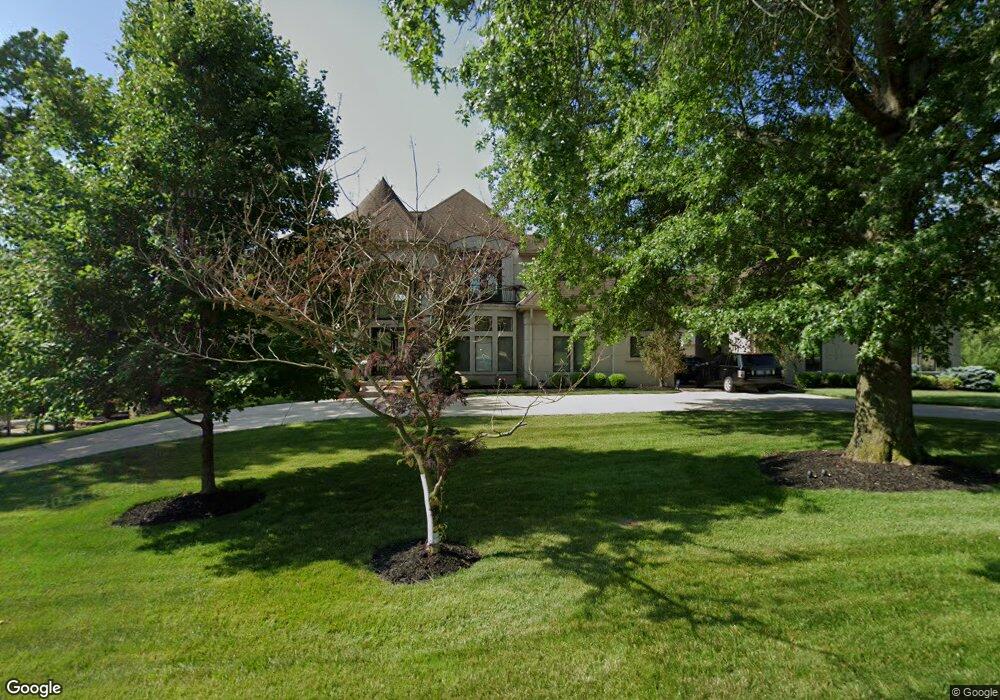
12950 Woodlark Ln Saint Louis, MO 63131
Estimated Value: $2,210,904 - $3,423,000
5
Beds
7
Baths
8,351
Sq Ft
$333/Sq Ft
Est. Value
About This Home
This home is located at 12950 Woodlark Ln, Saint Louis, MO 63131 and is currently estimated at $2,776,976, approximately $332 per square foot. 12950 Woodlark Ln is a home located in St. Louis County with nearby schools including Mason Ridge Elementary School, Parkway West Middle School, and Parkway West High School.
Ownership History
Date
Name
Owned For
Owner Type
Purchase Details
Closed on
Apr 4, 2007
Sold by
Frank Lawrence A
Bought by
Zafar Sajid and Sajid Sumera
Current Estimated Value
Purchase Details
Closed on
May 16, 2005
Sold by
Crp General Pa
Bought by
Frank Lawrence A
Purchase Details
Closed on
Jul 14, 2000
Sold by
Deane Vickroy Mary and Deane Mary
Bought by
Vickroy Stephen Young and Vickroy Debra Ann
Home Financials for this Owner
Home Financials are based on the most recent Mortgage that was taken out on this home.
Original Mortgage
$250,000
Interest Rate
8.15%
Mortgage Type
Seller Take Back
Create a Home Valuation Report for This Property
The Home Valuation Report is an in-depth analysis detailing your home's value as well as a comparison with similar homes in the area
Home Values in the Area
Average Home Value in this Area
Purchase History
| Date | Buyer | Sale Price | Title Company |
|---|---|---|---|
| Zafar Sajid | $530,000 | Clt | |
| Frank Lawrence A | $525,000 | Ort | |
| Crp General Pa | $463,000 | Ort | |
| Vickroy Stephen Young | $250,000 | -- |
Source: Public Records
Mortgage History
| Date | Status | Borrower | Loan Amount |
|---|---|---|---|
| Previous Owner | Vickroy Stephen Young | $250,000 |
Source: Public Records
Tax History Compared to Growth
Tax History
| Year | Tax Paid | Tax Assessment Tax Assessment Total Assessment is a certain percentage of the fair market value that is determined by local assessors to be the total taxable value of land and additions on the property. | Land | Improvement |
|---|---|---|---|---|
| 2025 | $24,555 | $493,980 | $85,630 | $408,350 |
| 2024 | $24,555 | $422,100 | $76,110 | $345,990 |
| 2023 | $24,555 | $422,100 | $76,110 | $345,990 |
| 2022 | $24,284 | $400,840 | $85,630 | $315,210 |
| 2021 | $24,083 | $408,160 | $85,630 | $322,530 |
| 2020 | $24,892 | $396,150 | $85,580 | $310,570 |
| 2019 | $24,541 | $396,150 | $85,580 | $310,570 |
| 2018 | $21,474 | $320,440 | $76,080 | $244,360 |
| 2017 | $21,182 | $320,440 | $76,080 | $244,360 |
| 2016 | $24,460 | $351,750 | $66,580 | $285,170 |
| 2015 | $25,782 | $351,750 | $66,580 | $285,170 |
| 2014 | $21,858 | $323,940 | $27,460 | $296,480 |
Source: Public Records
Map
Nearby Homes
- 1515 Topping Rd
- 1652 Mason Knoll Rd
- 1824 Topping Rd
- 12841 Thornhill Ct
- 1473 Mason Valley Rd
- 13354 Thornhill Dr
- 29a Chapel Hill Estates Dr
- 1536 S Mason Rd
- 1826 S Mason Rd
- 12439 Springdale Ln Unit TBB
- 2211 Viewroyal Dr
- 1359 S Mason Rd
- 11 Roclare Ln
- 13527 Royal Glen Dr
- 831 Minarca Dr
- 2056 N Ballas Rd
- 2062 N Ballas Rd
- The Hawthorne Plan at Ballas Ridge
- The Roclare II Plan at Ballas Ridge
- The Westchester IV Plan at Ballas Ridge
- 12970 Woodlark Ln
- 12940 Woodlark Ln
- 12951 Woodlark Ln
- 12963 Woodlark Ln
- 12943 Woodlark Ln
- 12959 Woodlark Ln
- 12973 Woodlark Ln
- 12933 Woodlark Ln
- 12942 Huntbridge Forest Dr
- 9 Brookwood Rd
- 12928 Huntbridge Forest Dr
- 12920 Woodlark Ln
- 12921 Woodlark Ln
- 1 Old Colony Ln
- 12950 Huntbridge Forest Dr
- 1610 Kriste Ct
- 10 Brookwood Rd
- 12915 Woodlark Ln
- 12926 Huntbridge Forest Dr
- 12945 Huntbridge Forest Dr