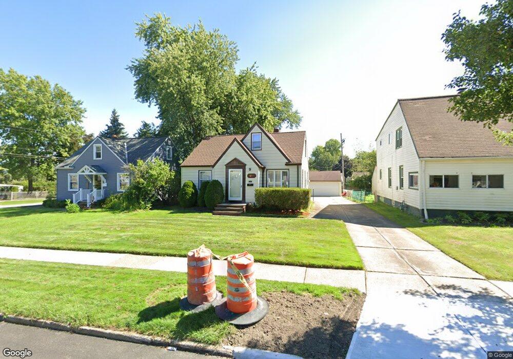
1297 Iroquois Ave Cleveland, OH 44124
Estimated Value: $190,000 - $221,000
3
Beds
1
Bath
1,258
Sq Ft
$166/Sq Ft
Est. Value
About This Home
This home is located at 1297 Iroquois Ave, Cleveland, OH 44124 and is currently estimated at $209,295, approximately $166 per square foot. 1297 Iroquois Ave is a home located in Cuyahoga County with nearby schools including Mayfield High School, Corpus Christi Academy, and Hawken Lower-Middle School.
Ownership History
Date
Name
Owned For
Owner Type
Purchase Details
Closed on
Aug 25, 1993
Sold by
Hun Donna M
Bought by
Tonderski Juliann
Current Estimated Value
Purchase Details
Closed on
Aug 13, 1993
Sold by
Wittreich Edward F
Bought by
Hun Donna M
Purchase Details
Closed on
Apr 12, 1993
Sold by
Wittreich Edward F and Wittreich Mary H
Bought by
Wittreich Edward F
Purchase Details
Closed on
Jan 1, 1975
Bought by
Wittreich Edward F and Wittreich Mary H
Create a Home Valuation Report for This Property
The Home Valuation Report is an in-depth analysis detailing your home's value as well as a comparison with similar homes in the area
Home Values in the Area
Average Home Value in this Area
Purchase History
| Date | Buyer | Sale Price | Title Company |
|---|---|---|---|
| Tonderski Juliann | -- | -- | |
| Hun Donna M | -- | -- | |
| Wittreich Edward F | -- | -- | |
| Wittreich Edward F | -- | -- |
Source: Public Records
Tax History Compared to Growth
Tax History
| Year | Tax Paid | Tax Assessment Tax Assessment Total Assessment is a certain percentage of the fair market value that is determined by local assessors to be the total taxable value of land and additions on the property. | Land | Improvement |
|---|---|---|---|---|
| 2024 | $3,391 | $61,250 | $12,040 | $49,210 |
| 2023 | $2,800 | $48,550 | $10,990 | $37,560 |
| 2022 | $2,937 | $48,550 | $10,990 | $37,560 |
| 2021 | $2,907 | $48,550 | $10,990 | $37,560 |
| 2020 | $3,282 | $41,480 | $9,380 | $32,100 |
| 2019 | $3,180 | $118,500 | $26,800 | $91,700 |
| 2018 | $2,993 | $41,480 | $9,380 | $32,100 |
| 2017 | $3,100 | $38,010 | $8,260 | $29,750 |
| 2016 | $3,077 | $38,010 | $8,260 | $29,750 |
| 2015 | $2,844 | $38,010 | $8,260 | $29,750 |
| 2014 | $2,844 | $38,010 | $8,260 | $29,750 |
Source: Public Records
Map
Nearby Homes
- 1391 Iroquois Ave
- 1213 Eastwood Ave
- 1218 Summit Dr
- 1233 Summit Dr
- 1194 Croyden Rd
- 1307 Ford Rd
- 1201 Summit Dr
- 1151 Croyden Rd
- 1146 Iroquois Ave
- 1151 Brainard Rd
- 1291 Haverston Rd
- 1363 Ranchland Dr
- 1120 Croyden Rd
- 1284 Haverston Rd
- 1430 Belrose Rd
- 1328 Elmwood Rd
- 1193 Mayfield Ridge Rd
- 1337 Elmwood Rd
- 1192 Blanchester Rd
- 1574 Hawthorne Dr
- 1291 Iroquois Ave
- 1301 Iroquois Ave
- 1307 Iroquois Ave
- 1298 Eastwood Ave
- 1290 Eastwood Ave
- 1281 Iroquois Ave
- 1311 Iroquois Ave
- 1302 Eastwood Ave
- 1306 Eastwood Ave
- 1296 Iroquois Ave
- 1300 Iroquois Ave
- 1277 Iroquois Ave
- 1317 Iroquois Ave
- 1294 Iroquois Ave
- 1312 Eastwood Ave
- 1280 Eastwood Ave
- 1306 Iroquois Ave
- 1280 Iroquois Ave
- 1310 Iroquois Ave
- 1271 Iroquois Ave