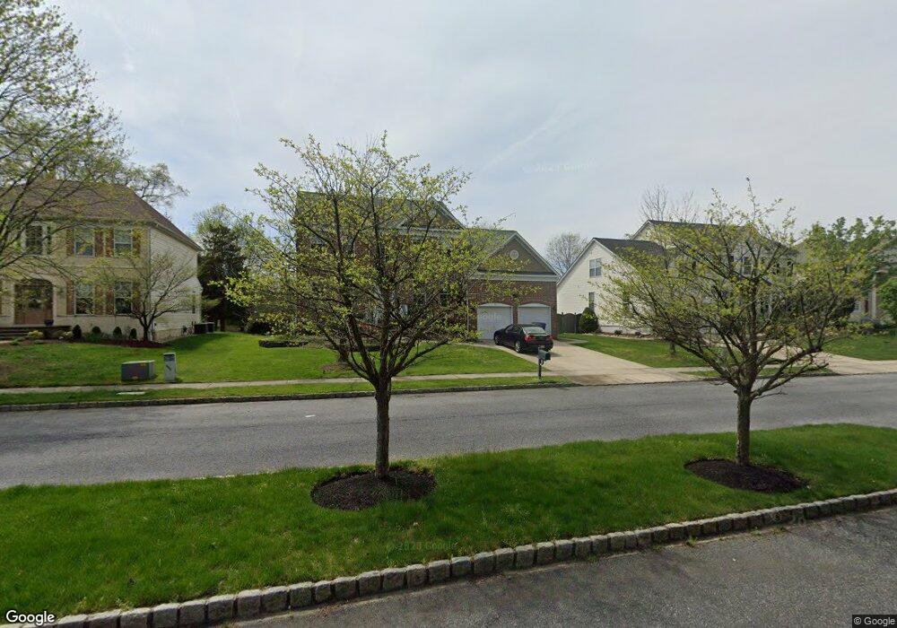
13 Brittany Blvd Marlton, NJ 08053
Estimated Value: $790,000 - $858,000
4
Beds
4
Baths
2,897
Sq Ft
$284/Sq Ft
Est. Value
About This Home
This home is located at 13 Brittany Blvd, Marlton, NJ 08053 and is currently estimated at $821,792, approximately $283 per square foot. 13 Brittany Blvd is a home located in Burlington County with nearby schools including H.L. Beeler Elementary School, Frances Demasi Middle School, and Lenape High School.
Ownership History
Date
Name
Owned For
Owner Type
Purchase Details
Closed on
Nov 29, 2021
Sold by
Schwarz and Kathleen
Bought by
Schwarz Matthew
Current Estimated Value
Purchase Details
Closed on
Apr 22, 2010
Sold by
Ilagan Dennis P and Ilagan Kimberly A
Bought by
Schwarz Matthew and Schwarz Kathleen
Home Financials for this Owner
Home Financials are based on the most recent Mortgage that was taken out on this home.
Original Mortgage
$255,000
Interest Rate
5.03%
Mortgage Type
New Conventional
Purchase Details
Closed on
Jul 2, 1998
Sold by
The Ryland Group Inc
Bought by
Ilagan Dennis P and Ilagan Kimberly A
Home Financials for this Owner
Home Financials are based on the most recent Mortgage that was taken out on this home.
Original Mortgage
$204,550
Interest Rate
6.92%
Create a Home Valuation Report for This Property
The Home Valuation Report is an in-depth analysis detailing your home's value as well as a comparison with similar homes in the area
Home Values in the Area
Average Home Value in this Area
Purchase History
| Date | Buyer | Sale Price | Title Company |
|---|---|---|---|
| Schwarz Matthew | -- | Boudwin Ross Roy Leodori Pc | |
| Schwarz Matthew | $465,000 | None Available | |
| Ilagan Dennis P | $259,383 | Cornerstone Title Co |
Source: Public Records
Mortgage History
| Date | Status | Borrower | Loan Amount |
|---|---|---|---|
| Previous Owner | Schwarz Matthew | $255,000 | |
| Previous Owner | Ilagan Dennis P | $204,550 |
Source: Public Records
Tax History Compared to Growth
Tax History
| Year | Tax Paid | Tax Assessment Tax Assessment Total Assessment is a certain percentage of the fair market value that is determined by local assessors to be the total taxable value of land and additions on the property. | Land | Improvement |
|---|---|---|---|---|
| 2025 | $15,299 | $448,000 | $140,000 | $308,000 |
| 2024 | $14,394 | $448,000 | $140,000 | $308,000 |
| 2023 | $14,394 | $448,000 | $140,000 | $308,000 |
| 2022 | $13,749 | $448,000 | $140,000 | $308,000 |
| 2021 | $13,427 | $448,000 | $140,000 | $308,000 |
| 2020 | $13,252 | $448,000 | $140,000 | $308,000 |
| 2019 | $13,144 | $448,000 | $140,000 | $308,000 |
| 2018 | $12,961 | $448,000 | $140,000 | $308,000 |
| 2017 | $12,808 | $448,000 | $140,000 | $308,000 |
| 2016 | $12,495 | $448,000 | $140,000 | $308,000 |
| 2015 | $12,275 | $448,000 | $140,000 | $308,000 |
| 2014 | $11,926 | $448,000 | $140,000 | $308,000 |
Source: Public Records
Map
Nearby Homes
- 48 Keegan Ct
- 125 Crown Prince Dr
- 223 Crown Prince Dr
- 8 Jonquil Place
- 174 Greenbrook Dr
- 21 Woodthrush Ct
- 46 Morning Glory Dr
- 3 Tuscany Way
- 6 Bluff Ct
- 59 Eddy Way
- 108 Meadowview Cir
- 109 Meadowview Cir
- 3 United States Cir
- 53 Lowell Dr
- 108 Weaver Dr
- 29 Longhurst Rd
- 24 Carter Ln
- 6205 Baltimore Dr Unit 6205
- 3 Abington Rd
- 123 Wyndmere Rd