Estimated Value: $963,000 - $1,298,000
4
Beds
3
Baths
2,402
Sq Ft
$481/Sq Ft
Est. Value
About This Home
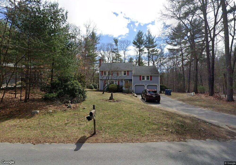
This home is located at 13 Oakwood Rd Unit R, Acton, MA 01720 and is currently estimated at $1,155,868, approximately $481 per square foot. 13 Oakwood Rd Unit R is a home located in Middlesex County with nearby schools including Acton-Boxborough Regional High School, Maynard Knowledge Beginnings, and The Imago School.
Ownership History
Date
Name
Owned For
Owner Type
Purchase Details
Closed on
Oct 2, 2002
Sold by
Swanson Eric A and Swanson Lynne W
Bought by
Jones Stuart H and Jones Lisa G
Current Estimated Value
Home Financials for this Owner
Home Financials are based on the most recent Mortgage that was taken out on this home.
Original Mortgage
$397,000
Outstanding Balance
$167,776
Interest Rate
6.27%
Mortgage Type
Purchase Money Mortgage
Estimated Equity
$988,092
Create a Home Valuation Report for This Property
The Home Valuation Report is an in-depth analysis detailing your home's value as well as a comparison with similar homes in the area
Home Values in the Area
Average Home Value in this Area
Purchase History
| Date | Buyer | Sale Price | Title Company |
|---|---|---|---|
| Jones Stuart H | $577,000 | -- |
Source: Public Records
Mortgage History
| Date | Status | Borrower | Loan Amount |
|---|---|---|---|
| Open | Jones Stuart H | $397,000 |
Source: Public Records
Tax History Compared to Growth
Tax History
| Year | Tax Paid | Tax Assessment Tax Assessment Total Assessment is a certain percentage of the fair market value that is determined by local assessors to be the total taxable value of land and additions on the property. | Land | Improvement |
|---|---|---|---|---|
| 2025 | $16,159 | $942,200 | $381,100 | $561,100 |
| 2024 | $15,110 | $906,400 | $381,100 | $525,300 |
| 2023 | $14,994 | $853,900 | $346,900 | $507,000 |
| 2022 | $13,973 | $718,400 | $304,500 | $413,900 |
| 2021 | $13,669 | $675,700 | $283,700 | $392,000 |
| 2020 | $12,895 | $670,200 | $283,700 | $386,500 |
| 2019 | $12,666 | $653,900 | $283,700 | $370,200 |
| 2018 | $12,446 | $642,200 | $283,700 | $358,500 |
| 2017 | $12,130 | $636,400 | $283,700 | $352,700 |
| 2016 | $11,901 | $618,900 | $283,700 | $335,200 |
| 2015 | $11,830 | $621,000 | $283,700 | $337,300 |
| 2014 | $11,440 | $588,200 | $283,700 | $304,500 |
Source: Public Records
Map
Nearby Homes
- 5 Oakwood Rd
- 8 Laurel Ct
- 70 River St
- 86 School St
- 2 Clover Hill Rd
- 128 Audubon Dr
- 118 Parker St Unit 16
- 12 Brewster Ln
- 40 High St
- 169 Main St
- 129 Main St Unit 129
- 129 Main St
- 131 Main St
- 128 Parker St Unit 3B
- 132 Parker St Unit G5
- 19 Railroad St Unit C2
- 23 John Swift Rd
- 11 Horseshoe Dr
- 491 Main St
- 65 Summit St