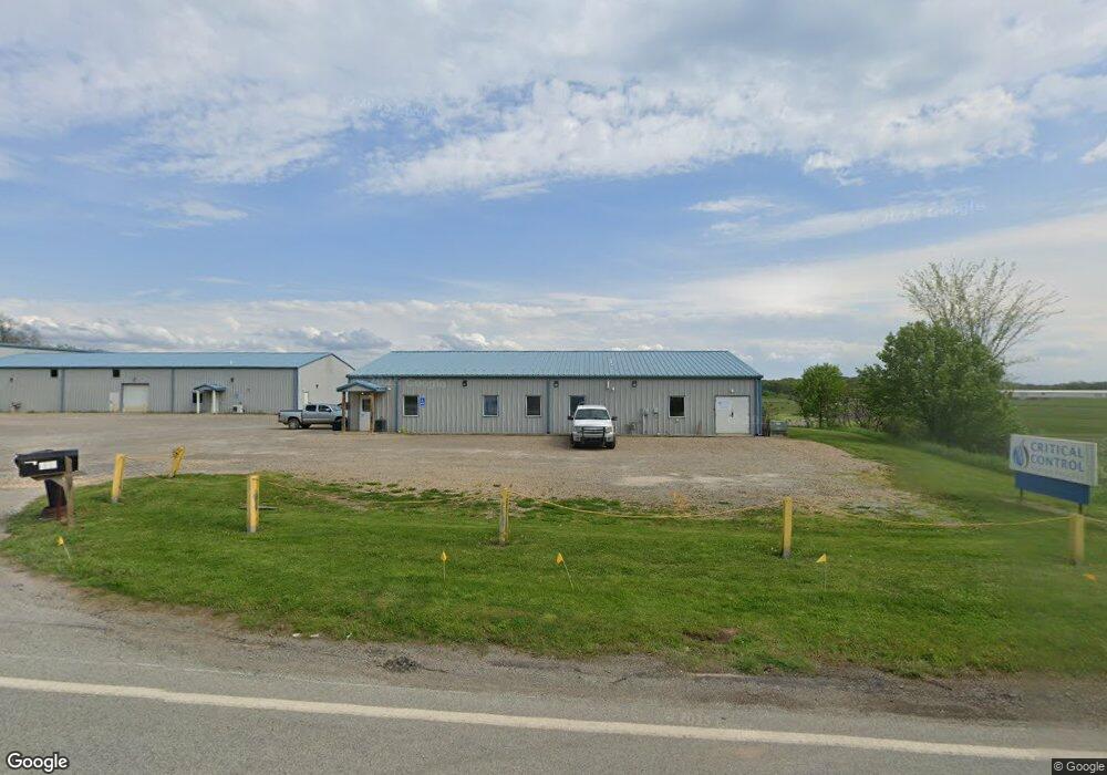
130 Airport Rd Indiana, PA 15701
Estimated Value: $1,000,794
--
Bed
--
Bath
4,000
Sq Ft
$250/Sq Ft
Est. Value
About This Home
This home is located at 130 Airport Rd, Indiana, PA 15701 and is currently estimated at $1,000,794, approximately $250 per square foot. 130 Airport Rd is a home located in Indiana County with nearby schools including Indiana Area Junior High School, Indiana Area Senior High School, and Seeds of Faith Christian Academy.
Ownership History
Date
Name
Owned For
Owner Type
Purchase Details
Closed on
Dec 27, 2021
Sold by
M & A Properties
Bought by
Cccb Real Estate Llc
Current Estimated Value
Home Financials for this Owner
Home Financials are based on the most recent Mortgage that was taken out on this home.
Original Mortgage
$660,000
Outstanding Balance
$608,272
Interest Rate
3.11%
Mortgage Type
Purchase Money Mortgage
Estimated Equity
$392,522
Create a Home Valuation Report for This Property
The Home Valuation Report is an in-depth analysis detailing your home's value as well as a comparison with similar homes in the area
Home Values in the Area
Average Home Value in this Area
Purchase History
| Date | Buyer | Sale Price | Title Company |
|---|---|---|---|
| Cccb Real Estate Llc | $825,000 | None Available |
Source: Public Records
Mortgage History
| Date | Status | Borrower | Loan Amount |
|---|---|---|---|
| Open | Cccb Real Estate Llc | $660,000 |
Source: Public Records
Tax History Compared to Growth
Tax History
| Year | Tax Paid | Tax Assessment Tax Assessment Total Assessment is a certain percentage of the fair market value that is determined by local assessors to be the total taxable value of land and additions on the property. | Land | Improvement |
|---|---|---|---|---|
| 2025 | $16,603 | $733,500 | $177,700 | $555,800 |
| 2024 | $15,679 | $733,500 | $177,700 | $555,800 |
| 2023 | $14,864 | $733,500 | $177,700 | $555,800 |
| 2022 | $14,864 | $733,500 | $177,700 | $555,800 |
| 2021 | $14,864 | $733,500 | $177,700 | $555,800 |
| 2020 | $14,527 | $733,500 | $177,700 | $555,800 |
| 2018 | $14,527 | $733,500 | $177,700 | $555,800 |
| 2017 | $15,163 | $733,500 | $177,700 | $555,800 |
| 2016 | -- | $733,500 | $177,700 | $555,800 |
| 2015 | -- | $106,030 | $22,960 | $83,070 |
| 2014 | -- | $106,030 | $22,960 | $83,070 |
Source: Public Records
Map
Nearby Homes
- 145 Hood School Rd
- 2688 Route 286 Hwy E
- 2 Deerfield Ln
- 2831 Route 286 Hwy E
- 000 Coolspring Rd
- 0 Hamill Rd
- 967 Josephine Ave
- 860 N 5th Ave
- 246 Anderson Ave
- 116 Philadelphia St
- 107 N Second St
- 270 Charles St
- 132 Church St
- 110 Lammert Rd
- 729 Fairview Ave
- 90 Grandview Ave Extension
- 0 Sunset Dr Unit 1697645
- 0 Sunset Dr Unit 1699295
- 332 Walnut St
- 0 Route 286 & Florence Ave Unit 1685866
- 220 Airport Rd
- 227 Airport Rd
- 227 Airport Rd
- 159 Airport Rd
- 113 Airport Rd
- 235 Airport Rd
- 239 Airport Rd
- 109 Airport Rd
- 120 Raymond Dr
- 2 Geesey Rd
- 110 Raymond Dr
- 243 Airport Rd
- 262 Airport Rd
- 101 Airport Rd
- 255 Airport Rd
- 488 Geesey Rd
- 31 Hood School Rd
- 31 Hood School Rd
- 301 Airport Rd
- 123 Hood School Rd