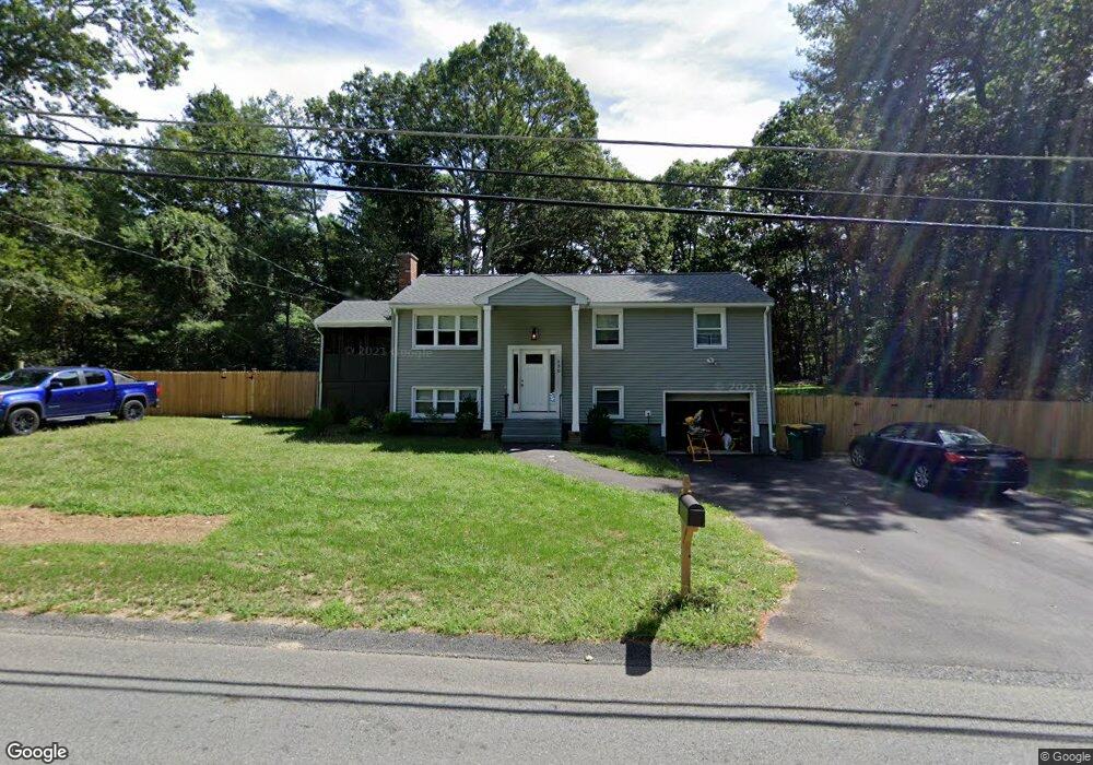
130 Otis St Mansfield, MA 02048
Estimated Value: $576,000 - $623,000
4
Beds
2
Baths
1,750
Sq Ft
$343/Sq Ft
Est. Value
About This Home
This home is located at 130 Otis St, Mansfield, MA 02048 and is currently estimated at $599,554, approximately $342 per square foot. 130 Otis St is a home located in Bristol County with nearby schools including Everett W. Robinson Elementary School, Jordan/Jackson Elementary School, and Harold L. Qualters Middle School.
Ownership History
Date
Name
Owned For
Owner Type
Purchase Details
Closed on
Jan 13, 2023
Sold by
Sokolinski Richard B
Bought by
Richard B Sokolinski Ft
Current Estimated Value
Purchase Details
Closed on
Oct 9, 1984
Bought by
Sokolinski Richard B and Sokolinski Rose C
Create a Home Valuation Report for This Property
The Home Valuation Report is an in-depth analysis detailing your home's value as well as a comparison with similar homes in the area
Home Values in the Area
Average Home Value in this Area
Purchase History
| Date | Buyer | Sale Price | Title Company |
|---|---|---|---|
| Richard B Sokolinski Ft | -- | None Available | |
| Sokolinski Richard B | $76,000 | -- |
Source: Public Records
Mortgage History
| Date | Status | Borrower | Loan Amount |
|---|---|---|---|
| Previous Owner | Sokolinski Richard B | $33,100 |
Source: Public Records
Tax History Compared to Growth
Tax History
| Year | Tax Paid | Tax Assessment Tax Assessment Total Assessment is a certain percentage of the fair market value that is determined by local assessors to be the total taxable value of land and additions on the property. | Land | Improvement |
|---|---|---|---|---|
| 2025 | $6,161 | $467,800 | $221,600 | $246,200 |
| 2024 | $5,823 | $431,300 | $221,600 | $209,700 |
| 2023 | $5,697 | $404,300 | $221,600 | $182,700 |
| 2022 | $5,519 | $363,800 | $205,100 | $158,700 |
| 2021 | $5,143 | $334,800 | $179,500 | $155,300 |
| 2020 | $5,075 | $330,400 | $171,000 | $159,400 |
| 2019 | $4,593 | $301,800 | $142,400 | $159,400 |
| 2018 | $4,406 | $283,000 | $135,900 | $147,100 |
| 2017 | $4,233 | $281,800 | $132,000 | $149,800 |
| 2016 | $4,269 | $277,000 | $125,600 | $151,400 |
| 2015 | $3,962 | $255,600 | $125,600 | $130,000 |
Source: Public Records
Map
Nearby Homes
- 176 Elm St
- 2 Oak St Unit 2D
- 2 Oak St Unit 2A
- 2 Oak St Unit 2C
- 2 Oak St Unit 2B
- 150 Gilbert St
- 451R Gilbert St
- 37 Oakleaf Dr
- 4 Buckskin Dr
- 255 Mckeon Dr
- 14 Country Club Way
- 24 Maverick Dr
- 250 Mansfield Ave Unit 66
- 196 Donald Tennant Cir
- 15 Reservoir St Unit 44
- 231 Spring St
- 115 Westfield Dr
- 4 Village Way Unit F
- 11 Buckthorn Ln
- 157 Mansfield Ave Unit 14